
Unmanned aerial vehicle path planning method for reconstructing Voronoi diagram in real time

A path planning, unmanned aerial vehicle technology, applied in the direction of vehicle position/route/height control, non-electric variable control, instruments, etc.

Inactive Publication Date: 2020-10-09
NO 54 INST OF CHINA ELECTRONICS SCI & TECH GRP
View PDF5 Cites 10 Cited by
  • Summary
  • Abstract
  • Description
  • Claims
  • Application Information

AI Technical Summary

Problems solved by technology

[0007] In short, there is still a lack of an efficient and real-time 3D path planning method through real-time Voronoi diagram segmentation in the prior art

Method used


Image

  • Unmanned aerial vehicle path planning method for reconstructing Voronoi diagram in real time
  • Unmanned aerial vehicle path planning method for reconstructing Voronoi diagram in real time
  • Unmanned aerial vehicle path planning method for reconstructing Voronoi diagram in real time

Examples


Embodiment Construction

[0031] The technical solutions of the present invention will be further described below in conjunction with the accompanying drawings and specific embodiments.

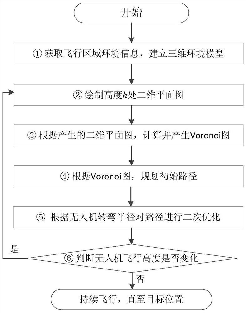
[0032] Such as figure 1 As shown, a real-time reconstructed Voronoi diagram UAV path planning method, which includes the following steps:

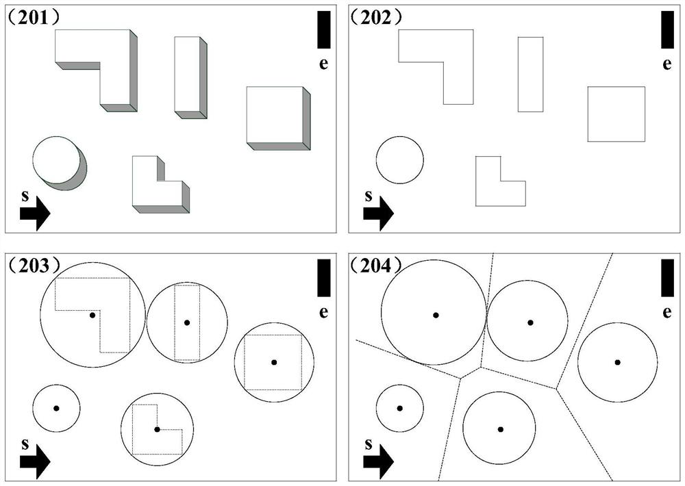
[0033] S1, obtain the environmental information of the UAV flight area, and establish a three-dimensional environmental threat model;

[0034] S2, determine the flying height of the UAV, and draw a two-dimensional plane threat map at the height;

[0035] S3, according to the two-dimensional plane threat map generated in step S2, and using the vector method to generate a Voronoi diagram;

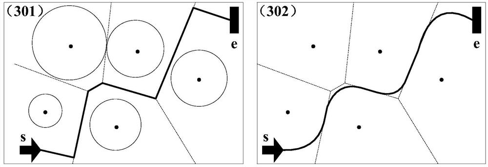
[0036] S4, planning and generating an initial path according to the Voronoi diagram generated in step S3;

[0037] S5, to the initial path that step S4 generates, carry out secondary optimization according to unmanned aerial vehicle performance parameter, generate flight path;

[0038] S6. Du...


PUM


Abstract

The invention discloses an unmanned aerial vehicle path planning method for reconstructing a Voronoi diagram in real time, belonging to the technical field of autonomous navigation of unmanned aerialvehicles. According to the method, path planning is carried out on a plane where an unmanned aerial vehicle is located in real time by taking the current spatial position of the unmanned aerial vehicle as a starting point according to the shape and size of obstacles and the real-time flight height of the unmanned aerial vehicle in a known obstacle environment. According to the method, a two-dimensional Voronoi graph segmentation method is expanded to three dimensions, and the flight path of the unmanned aerial vehicle in the three-dimensional space is planned, so the effectiveness of a plannedpath is improved.

Description

technical field [0001] The invention belongs to the technical field of autonomous navigation of unmanned aerial vehicles, and in particular refers to a path planning method for unmanned aerial vehicles that reconstructs Voronoi diagrams in real time, which can be used for real-time path planning of unmanned aerial vehicles when space environment information is known. [0002] technical background [0003] With the development of flight control technology and navigation technology, UAV systems have been developing towards autonomous flight. As an important part of autonomous navigation, autonomous path planning has become one of the research hotspots in the field of UAV measurement and control. The main task of path planning is to avoid environmental threats and find a safe flight path from the current position to the target position according to the task requirements when the environment is known or partially known. Among them, the Voronoi diagram segmentation method is a ty...

Claims


Application Information

Patent Timeline
IPC IPC(8): G01C21/20G05D1/10
CPCG01C21/20G05D1/101
Inventor 柴兴华陈勇陈彦桥关俊志彭会湘陈韬亦耿虎军高峰孙士勇
Owner NO 54 INST OF CHINA ELECTRONICS SCI & TECH GRP
Learn More