
Land area acquisition method and device and storage medium

A technology of land area and acquisition method, applied in the field of map data, can solve the problems of large land area errors and changes in the deduction relationship of land types, and achieve the effect of improving accuracy

Pending Publication Date: 2020-10-30
广东省土地调查规划院 +1
View PDF0 Cites 1 Cited by
  • Summary
  • Abstract
  • Description
  • Claims
  • Application Information

AI Technical Summary

Problems solved by technology

[0002] The spatial analysis of land survey data and various business result data is widely used in land management-related businesses. However, the graphic segmentation caused by spatial analysis will lead to the area of ​​map patches and linear terrain in the land survey data after spatial analysis. The deduction relationship between the land types between the property areas has changed. If the existing deduction relationship is still used for calculation, the obtained land area and the actual area have a large error

Method used


Image

  • Land area acquisition method and device and storage medium
  • Land area acquisition method and device and storage medium
  • Land area acquisition method and device and storage medium

Examples


Embodiment Construction

[0039] In order to make the purposes, technical solutions and advantages of the embodiments of the present application clearer, the technical solutions in the embodiments of the present application will be clearly and completely described below in conjunction with the drawings in the embodiments of the present application. Obviously, the described embodiments It is a part of the embodiments of this application, not all of them. The components of the embodiments of the application generally described and illustrated in the figures herein may be arranged and designed in a variety of different configurations.

[0040] Accordingly, the following detailed description of the embodiments of the present application provided in the accompanying drawings is not intended to limit the scope of the claimed application, but merely represents selected embodiments of the present application. Based on the embodiments in this application, all other embodiments obtained by persons of ordinary sk...


PUM


Abstract

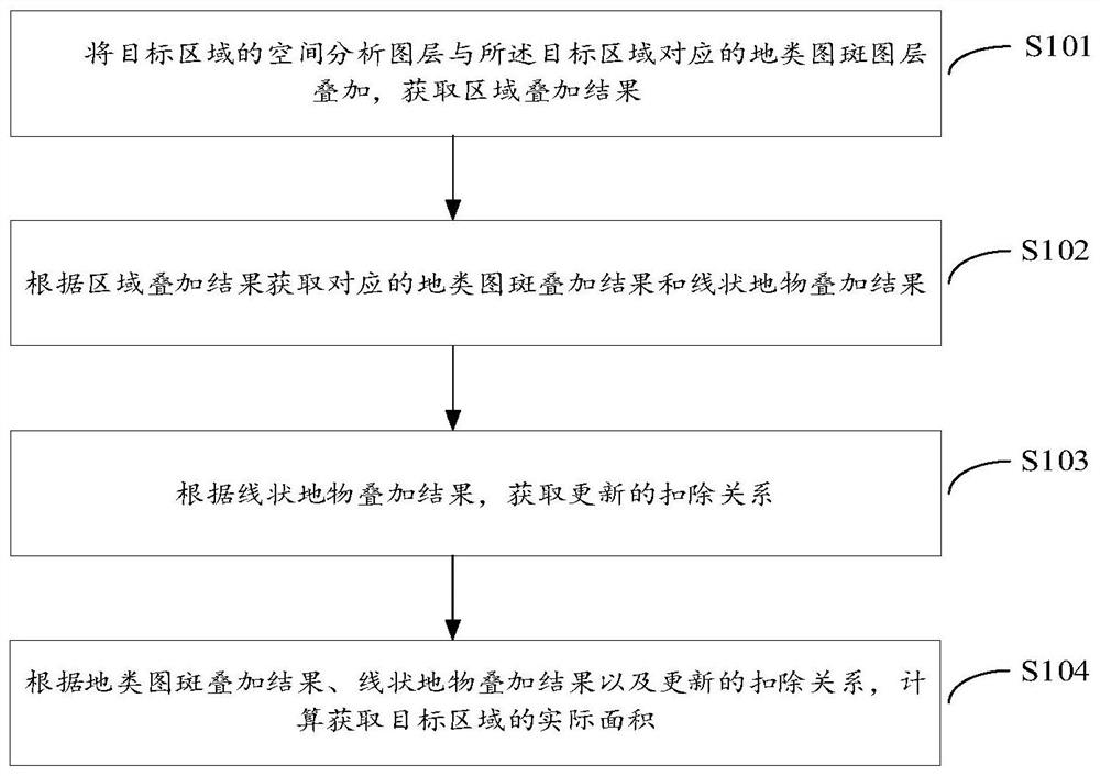
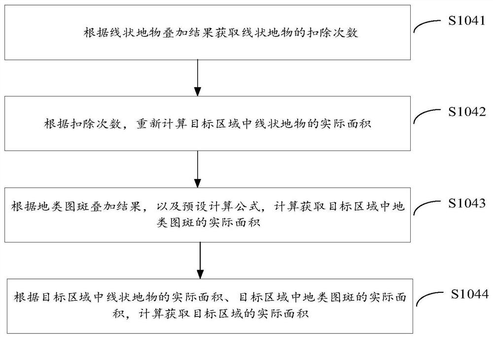
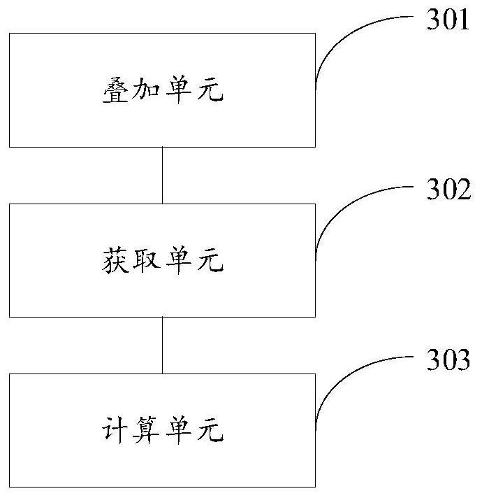
The embodiment of the invention provides a land area acquisition method and device and a storage medium, and relates to the technical field of map data; the method includes superposing the spatial analysis layer of the target area with the land type pattern spot layer corresponding to the target area to obtain an area superposing result; obtaining a corresponding ground class pattern spot superposition result and a linear ground object superposition result according to the region superposition result; obtaining an updated deduction relationship according to the linear ground object superposition result; and calculating and obtaining the actual area of the target area according to the ground class pattern spot superposition result, the linear ground object superposition result and the updated deduction relationship. According to the invention, the actual range of the linear ground features and the actual area of the ground pattern spots can be restored on the graph surface through the overlapping operation between the graph layers and the mode of updating the linear ground feature deduction relation, and the accuracy of area analysis is improved.

Description

technical field [0001] The present invention relates to the technical field of map data, in particular to a land area acquisition method, device and storage medium. Background technique [0002] The spatial analysis of land survey data and various business result data is widely used in land management-related businesses. However, the graphic segmentation caused by spatial analysis will lead to the area of ​​map patches and linear terrain in the land survey data after spatial analysis. If the deduction relationship between land types changes, if the existing deduction relationship is still used for calculation, there will be a large error between the obtained land area and the actual area. Contents of the invention [0003] In order to solve the problems existing in the prior art, this application provides a land area acquisition method, device and storage medium, which can restore the actual range of linear features, the actual area of ​​land-type map spots and the actua...

Claims


Application Information

Patent Timeline
IPC IPC(8): G06F16/29
CPCG06F16/29
Inventor 王刚武周常萍赖荣贵梁雄师刘茂国黄润兴何晓阳李光灿张临炜梁哲恒王丹丹
Owner 广东省土地调查规划院
Learn More