Landslide disaster emergency monitoring method based on ground-based radar

A ground-based radar and disaster technology, which is applied to measurement devices, electromagnetic measurement devices, radio wave measurement systems, etc., can solve the problems of inability to obtain deformation results in landslide areas, difficulty in obtaining accurate results, and inability to conduct large-scale observations. The data collection time interval is short, the monitoring accuracy is improved, and the correlation is high.

Active Publication Date: 2020-11-06
HUANENG LANCANG RIVER HYDROPOWER +2
View PDF6 Cites 2 Cited by
  • Summary
  • Abstract
  • Description
  • Claims
  • Application Information

AI Technical Summary

Problems solved by technology

Although the total station and GPS can obtain high-precision landslide point information, they cannot obtain the deformation results of the entire landslide area and cannot conduct large-scale observations
Although 3D laser scanning measurement, aerial photogrammetry and optical remote sensing measurement have high observation accuracy and wide observation range, it is difficult to obtain accurate results under weather conditions such as rain, snow and fog
Space-borne synthetic aperture radar interferometry technology is also widely used in landslide monitoring, which can identify hidden danger points of geological disasters and troubleshoot in a large range, but limited by fixed orbit and long revisit period, it is impossible to conduct long-term monitoring continuous real-time observation

Method used


Image

  • Landslide disaster emergency monitoring method based on ground-based radar
  • Landslide disaster emergency monitoring method based on ground-based radar
  • Landslide disaster emergency monitoring method based on ground-based radar

Examples


Embodiment Construction

[0036] The following will clearly and completely describe the technical solutions in the embodiments of the present invention with reference to the accompanying drawings in the embodiments of the present invention. Obviously, the described embodiments are only some, not all, embodiments of the present invention. Based on the embodiments of the present invention, all other embodiments obtained by persons of ordinary skill in the art without making creative efforts belong to the protection scope of the present invention.

[0037] In order to make the above objects, features and advantages of the present invention more comprehensible, the present invention will be further described in detail below in conjunction with the accompanying drawings and specific embodiments.

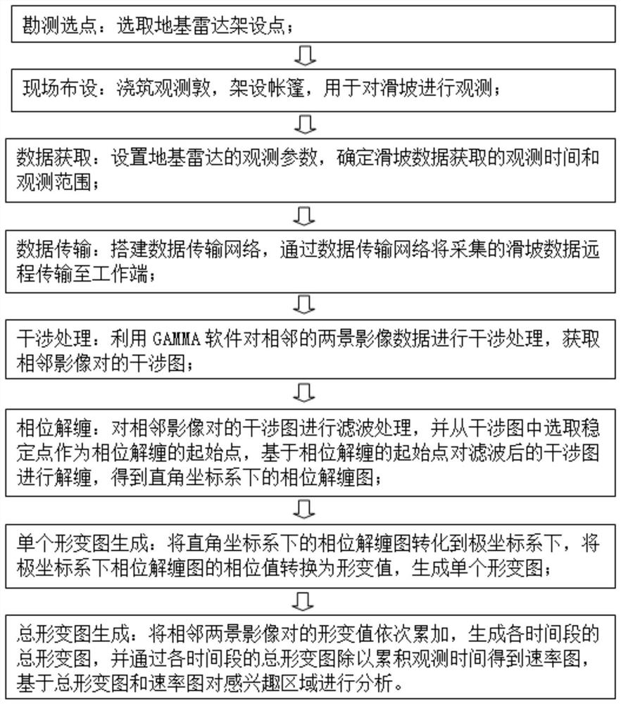
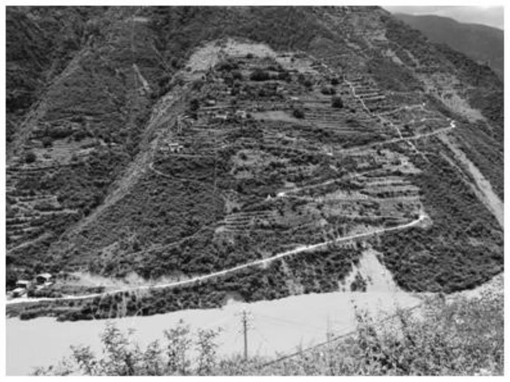
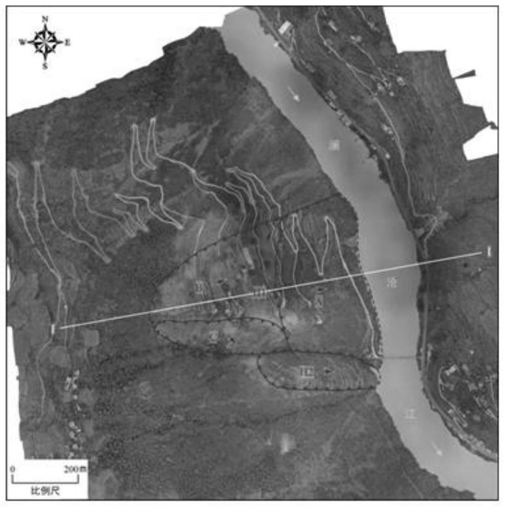
[0038] refer to figure 1 As shown, this embodiment takes the Lajinshengu landslide as an example, and describes in detail a ground-based radar-based emergency monitoring method for landslide disasters of the prese...


PUM


Abstract

The invention discloses a landslide disaster emergency monitoring method based on a ground-based radar. The landslide disaster emergency monitoring method comprises the following steps: surveying andselecting points and arranging on site; performing data acquisition: setting observation parameters of a ground-based radar, and determining observation time and an observation range of landslide dataacquisition; performing data transmission: establishing a data transmission network; interference processing: utilizing GAMMA software to carry out interference processing on two adjacent scene imagedata to obtain an interference pattern; phase unwrapping: filtering the interferogram, selecting a starting point of phase unwrapping, and unwrapping to obtain a phase unwrapping graph under a rectangular coordinate system; generating a single deformation graph: converting the phase unwrapping graph under the rectangular coordinate system into a polar coordinate system to generate the single deformation graph; and generating a total deformation graph: generating a total deformation graph and a rate graph of each time period, and analyzing the region of interest. The landslide can be monitoredin real time for a long time, the two-dimensional deformation graph of the landslide area is obtained, and data support is provided for early warning and treatment of landslide geological disasters.

Description

technical field [0001] The invention relates to the technical field of landslide disaster monitoring, in particular to an emergency monitoring method for landslide disasters based on ground-based radar. Background technique [0002] Landslide monitoring mainly includes total station, GPS, aerial photogrammetry, 3D laser scanning measurement and optical remote sensing measurement. Although the total station and GPS can obtain high-precision landslide point information, they cannot obtain the deformation results of the entire landslide area and cannot conduct large-scale observations. Although 3D laser scanning measurement, aerial photogrammetry and optical remote sensing measurement have high observation accuracy and wide observation range, it is difficult to obtain accurate results under meteorological conditions such as rain, snow, and fog. Space-borne synthetic aperture radar interferometry technology is also widely used in landslide monitoring, which can identify hidden ...

Claims


Application Information

Patent Timeline
Patent Type & Authority Applications(China)
IPC IPC(8): G01S13/89G01B7/16
CPCG01B7/16G01S13/89
Inventor 周伟马洪琪肖海斌程翔迟福东郝卫峰陈鸿杰周志伟马刚
Owner HUANENG LANCANG RIVER HYDROPOWER
Why Eureka
Try Eureka