GIS-based hidden danger investigation and risk assessment system for marine disasters of natural disasters
A risk assessment system and natural disaster technology, applied to unmanned aircraft, sampling devices, remote-controlled aircraft, etc., can solve the problem that the motor shaft cannot maintain a static state, and achieve the effect of novel design and ingenious conception
- Summary
- Abstract
- Description
- Claims
- Application Information
AI Technical Summary
Problems solved by technology
Method used
Image
Examples
Embodiment Construction
[0068] A GIS-based marine disaster hidden danger investigation and risk assessment system for natural disasters of the present invention will be further described in detail below in conjunction with the accompanying drawings and embodiments. In the direction description, the orientation of the fixed shaft is on the left, and the orientation of the motor is on the left. On the right, take the position of the drone as the top, and take the position of the liquid collecting pipe as the bottom.
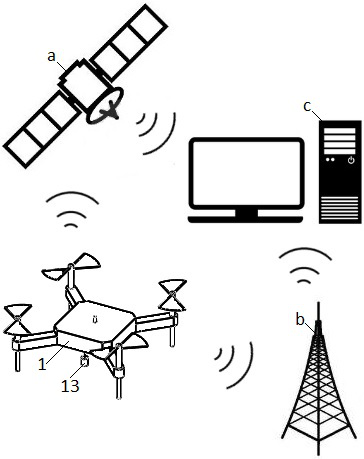
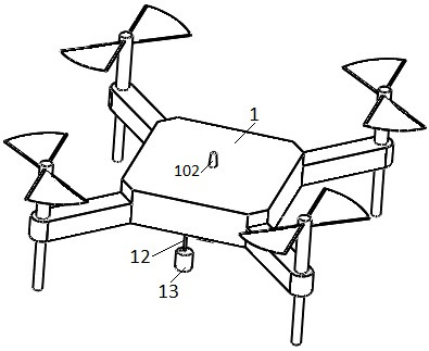
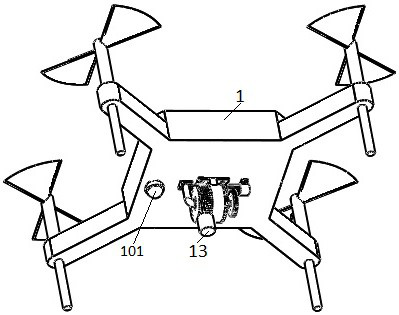
[0069] The GIS-based marine disaster hidden danger investigation and risk assessment system for natural disasters is characterized by: including drone 1, motor 2, drive gear 3, fixed sleeve 4, buckle plate 5, pulling shaft 6, spring 7, cover 8. Transmission gear 9, fixed shaft 10, winding wheel 11, backguy 12, liquid collecting pipe 13, one-way valve 14, bearing 15.
[0070] like figure 2 , image 3 As shown, a camera 101 is installed at the bottom of the drone 1, and a communication c...
PUM
 Abstract
Description
Claims
Application Information
 - R&D
- Intellectual Property
- Life Sciences
- Materials
- Tech Scout
- Unparalleled Data Quality
- Higher Quality Content
- 60% Fewer Hallucinations
Browse by: Latest US Patents, China's latest patents, Technical Efficacy Thesaurus, Application Domain, Technology Topic, Popular Technical Reports.
© 2025 PatSnap. All rights reserved.Legal|Privacy policy|Modern Slavery Act Transparency Statement|Sitemap|About US| Contact US: help@patsnap.com


