

Gravity gradient data joint inversion method
A gravity gradient and data combination technology, which is applied in image data processing, electrical digital data processing, special data processing applications, etc., can solve problems such as out-of-focus, excessive bottom depth, and poor imaging effect at the bottom of deep objects, and achieve improved Resolution, the effect of improving the accuracy of results
- Summary
- Abstract
- Description
- Claims
- Application Information
AI Technical Summary
Problems solved by technology
Method used
Image

Examples
Embodiment Construction
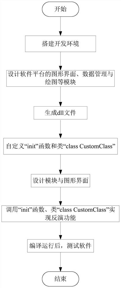
[0042] The invention will be further described below in conjunction with the accompanying drawings and specific implementation examples.
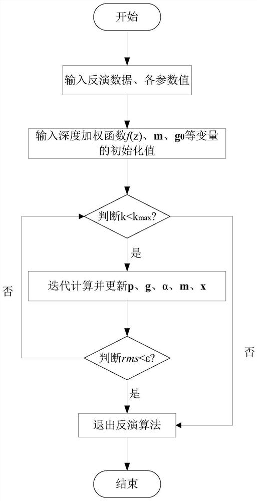
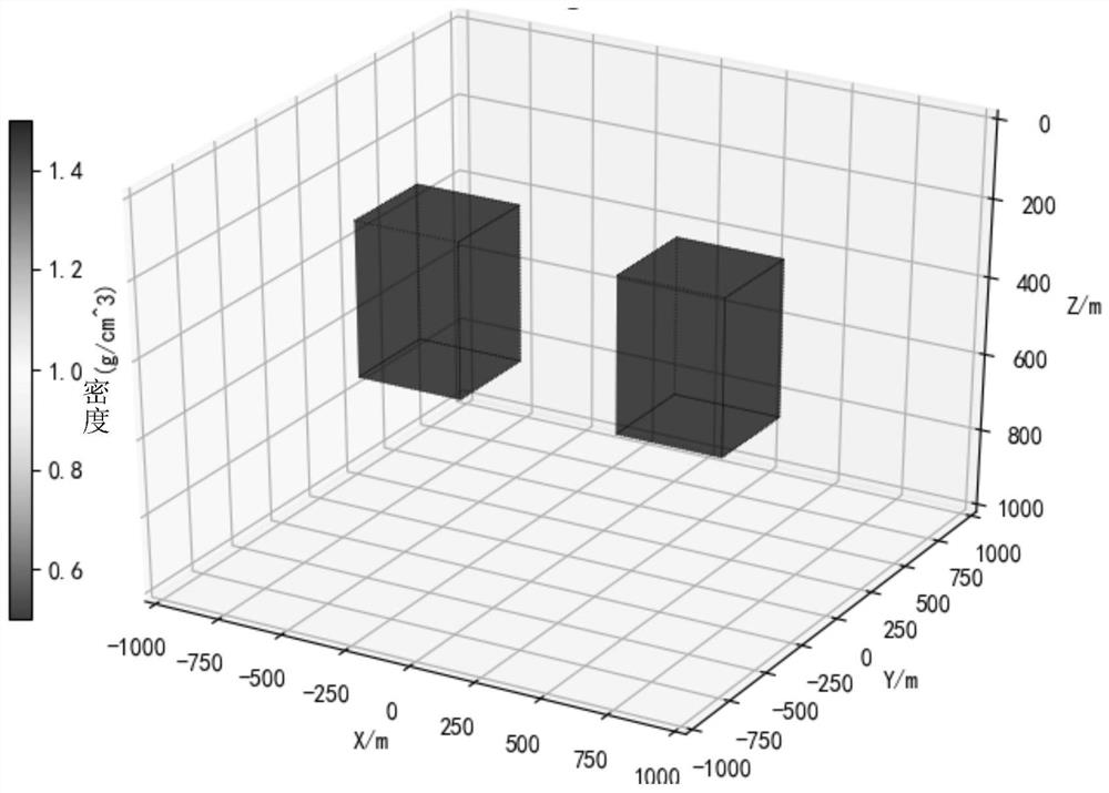
[0043] Such as figure 1 As shown, a joint inversion method of gravity gradient data can accurately calculate the three-dimensional density distribution and effectively improve the spatial resolution of the result, including the following steps:
[0044] Step 1: Construct the objective function φ(m) of three-dimensional physical property inversion according to the gravity gradient data obtained, and the gravity gradient data can be obtained by constructing a theoretical model simulation, or using measuring instruments to obtain measured data;
[0045]
[0046] In the formula, φ d , φ m Represents the data unfit function and the model objective function respectively; λ is the regularization parameter; G represents the sensitivity matrix, d represents the gravity gradient data; m represents the inversion model parameter vector, m j Indicat...
PUM
 Abstract
Description
Claims
Application Information