Supercharge Your Innovation With Domain-Expert AI Agents!

Point cloud optimization method based on ground features and computer readable storage medium

An optimization method and ground point technology, applied in computer components, calculation, image data processing, etc., can solve problems such as large ground elevation, scene deviation, sensor error, etc.

Pending Publication Date: 2021-05-28
中振同辂(江苏)机器人有限公司
View PDF0 Cites 0 Cited by
  • Summary
  • Abstract
  • Description
  • Claims
  • Application Information

AI Technical Summary

Problems solved by technology

There are two main problems with this approach: first, the current lidar data itself has a sensor error; second, there will be errors in point cloud keyframe registration, and this accumulation will also lead to the final point The cloud map deviates from the actual scene, especially the long road splicing, which may cause a large ground elevation difference
The accumulated elevation difference makes the originally flat road appear to have a slope, which is different from the actual collected scene

Method used


Image

  • Point cloud optimization method based on ground features and computer readable storage medium

Examples


Embodiment Construction

[0020] The technical solutions of the present invention will be further described below in conjunction with the accompanying drawings and specific embodiments. It should be understood that the specific embodiments described here are only used to explain the present invention, not to limit the present invention.

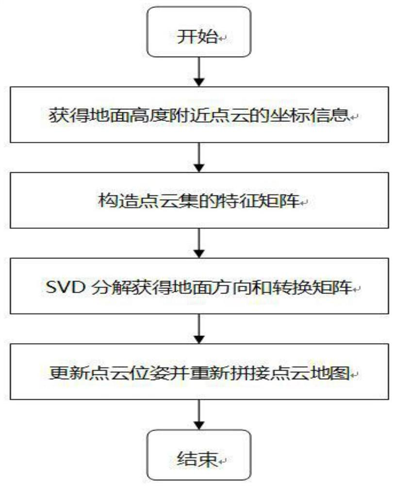
[0021] In one embodiment of the present invention, the present invention provides a kind of point cloud optimization method based on ground feature, and described point cloud optimization method comprises the following steps:

[0022] S1. Collect coordinate data of multiple groups of ground points, and the multiple groups of coordinate data constitute a first point cloud;

[0023] The coordinate data can be collected by laser radar, and laser radar can collect images while moving, so the collected images are different in time and follow a certain sequence, but the image data may or may not include sequence information.

[0024] S2. Construct a coordinate matrix with ...


PUM


Abstract

The invention discloses a point cloud optimization method based on ground features and a computer readable storage medium. The point cloud optimization method comprises the following steps: constructing a coordinate matrix; constructing an average three-dimensional coordinate vector; obtaining a first reference matrix according to the coordinate matrix and the average three-dimensional coordinate vector; multiplying the first reference matrix by a transposed matrix to obtain a second reference matrix, and performing singular value decomposition on the second reference matrix to obtain a right singular matrix; and constructing a third reference matrix according to the right singular matrix, and processing data in the first point cloud set to obtain a second point cloud set. According to the point cloud optimization method, the height error of the laser point cloud map is corrected, the accuracy of the point cloud is improved, and then the mapping error of a high-precision map is reduced.

Description

technical field [0001] The present invention relates to the technical field of unmanned driving, in particular to a ground feature-based point cloud optimization method and a computer-readable storage medium. Background technique [0002] In the field of unmanned driving, high-precision maps play an extremely important role, because unmanned vehicles must refer to the semantics of elements in high-precision maps to operate normally. The so-called high-precision map refers to the rich semantics of the map on the one hand, and the high accuracy of the map on the other hand. At present, there is no clear definition of high-precision maps in the industry, which leads to different ways of making high-precision maps for each company. Most of the high-precision map production is done by fusing multiple sensor data, such as multi-line lidar, camera and imu, etc., and some high-precision map production only uses part of the sensor data. This patent is mainly aimed at optimizing and...

Claims


Application Information

Patent Timeline
IPC IPC(8): G06K9/00G06K9/62G06T3/40G06T17/05G06T17/20
CPCG06T3/4038G06T17/05G06T17/20G06V20/56G06F18/22
Inventor 张磊
Owner 中振同辂(江苏)机器人有限公司
Features
  • R&D
  • Intellectual Property
  • Life Sciences
  • Materials
  • Tech Scout
  • Unparalleled Data Quality
  • Higher Quality Content
  • 60% Fewer Hallucinations
Learn More