

Aerial image aerial triangulation operation method
A technology for aerial triangulation and aerial imagery, which is applied in the interpretation of photos, etc., can solve the problems of many aerial triangulation equipment and long calculation time, and achieve the effect of shortening the construction period and reducing the number of computer equipment.
- Summary
- Abstract
- Description
- Claims
- Application Information
AI Technical Summary
Problems solved by technology
Method used
Image

Examples
Embodiment 1
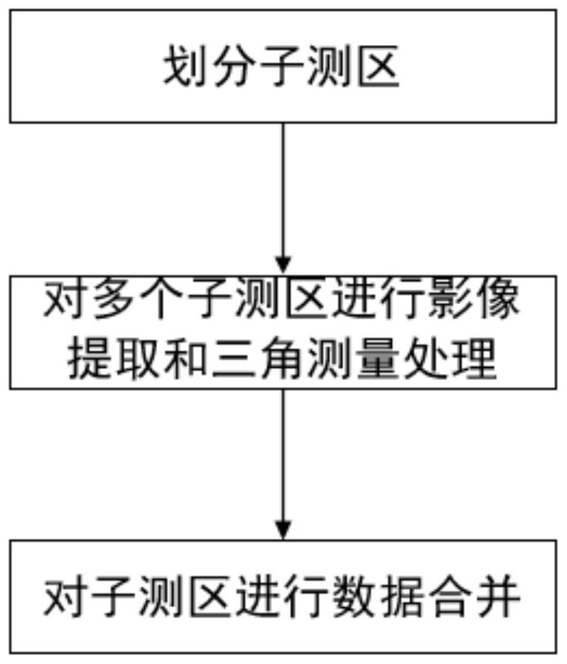
[0023] The invention discloses an aerial image triangulation operation method, comprising the following steps:
[0024] Step 1: Divide multiple sub-survey areas according to the scope of the survey area and terrain conditions, and the number of divided sub-survey areas is N;
[0025] Step 2: Extract the images of the sub-survey areas through aerial photography, and perform aerial triangulation processing on the images of the sub-survey areas that have been extracted in turn;
[0026] In the step 2 of this embodiment, image extraction and triangulation processing work are relayed at the same time. For example, after the aerial photography of the first day is over, the image taken and extracted on that day is submitted as the first sub-survey area, Immediately start the aerial triangulation processing, use the night of the same day and the next day to complete the office processing of these images; continue the aerial photography during the next day, and submit the images taken ...
Embodiment 2
[0037] The method verification effect based on traditional method and embodiment 1 and carry out comparative analysis, test method is as follows:
[0038] Taking a survey area of 20 square kilometers as an example, it is planned to take aerial photos of 2 square kilometers every day, and use two operation schemes to process this survey area.
[0039] In the traditional operation plan, the aerial photography takes 10 days, the aeronautical triangulation office processing starts on the 11th day, and it takes 7 days to complete the aeronautical triangulation office processing, which takes a total of 17 days; the number of computer nodes required is 11.
[0040] Adopt the operation plan of embodiment 1, adopt the relay-type aerial triangulation operation plan, take aerial photography for ten days, start to process the images of the sub-survey areas of the day after the aerial photography ends every day, and finally complete the merging of the sub-survey areas in one day. 12 days...
PUM
 Abstract
Description
Claims
Application Information