A fine land uses type of mining area vegetation carbon exchange remote sensing method
A remote sensing inversion and vegetation technology, which is applied in remote sensing and geographic information, mining, and ecology. Carbon sinks and other issues to achieve the effect of improving the accuracy
- Summary
- Abstract
- Description
- Claims
- Application Information
AI Technical Summary
Problems solved by technology
Method used
Image
Examples
Embodiment
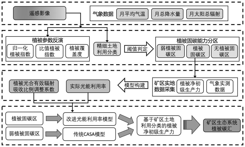
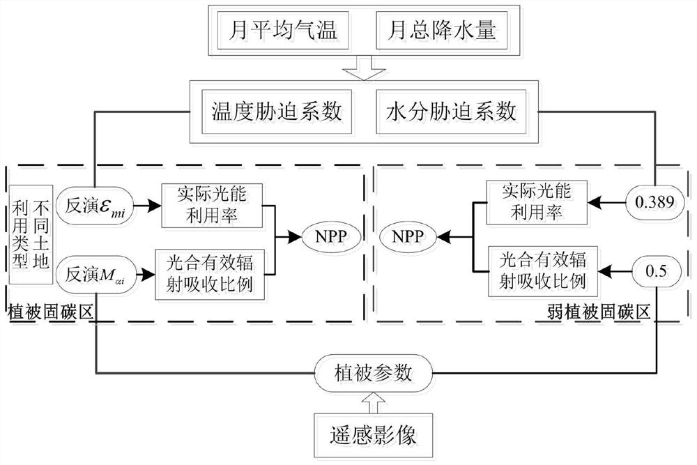
[0080] Such as Figure 1 to Figure 10 As shown, a fine land use type mining vegetation carbon sink remote sensing inversion method, the method is as follows:
[0081] A. Obtain high-resolution image data. High-resolution image data can come from Landsat series satellite remote sensing images or high-resolution satellite remote sensing images or UAV high-resolution remote sensing images or other images (either from a single image or from It is multi-source image data. In order to improve the accuracy, it is preferred to use multi-source observation data, such as Landsat series land resources satellite remote sensing images, domestic high-resolution satellite remote sensing images and other high-resolution image data; If the images in some areas are missing, it is necessary to combine the high spatial resolution sensor of the UAV to confirm and reanalyze the areas that cannot be accurately interpreted by the satellite images), and the high-resolution image data is cut according ...
PUM
 Abstract
Description
Claims
Application Information
 - R&D
- Intellectual Property
- Life Sciences
- Materials
- Tech Scout
- Unparalleled Data Quality
- Higher Quality Content
- 60% Fewer Hallucinations
Browse by: Latest US Patents, China's latest patents, Technical Efficacy Thesaurus, Application Domain, Technology Topic, Popular Technical Reports.
© 2025 PatSnap. All rights reserved.Legal|Privacy policy|Modern Slavery Act Transparency Statement|Sitemap|About US| Contact US: help@patsnap.com


