Space-ground integrated lunar surface landing navigation method
A navigation method and integrated technology, which can be used in integrated navigators, navigation through velocity/acceleration measurement, and space navigation equipment. Uncomplicated, improving on-orbit survivability, and measuring and solving simple effects
- Summary
- Abstract
- Description
- Claims
- Application Information
AI Technical Summary
Problems solved by technology
Method used
Image
Examples
Embodiment Construction
[0046] The present invention will be described in further detail below in conjunction with the accompanying drawings and specific embodiments. Advantages and features of the present invention will be apparent from the following description and claims. It should be noted that the drawings are all in a very simplified form and use imprecise ratios, which are only used to facilitate and clearly assist the purpose of illustrating the embodiments of the present invention.
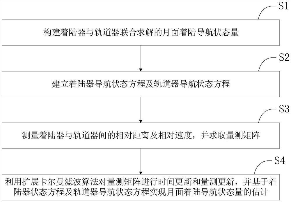
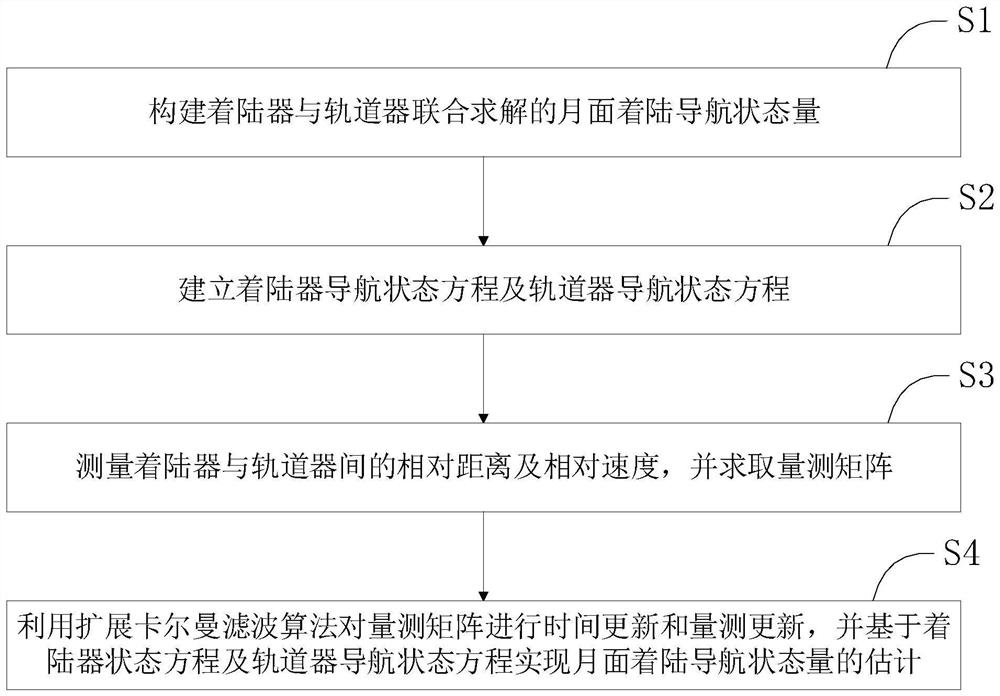
[0047] Such as figure 1 As shown, the present invention proposes a method for landing navigation on the lunar surface based on relative measurement, comprising the following steps:
[0048] S1. Construct the lunar landing navigation state quantities jointly solved by the lander and the orbiter.
[0049] Described step S1 comprises the following steps:
[0050] S1.1. Select the northeast sky coordinate system of the moon as the navigation coordinate system of the lander, obtain the position, speed and attitude...
PUM
 Abstract
Description
Claims
Application Information
 - R&D
- Intellectual Property
- Life Sciences
- Materials
- Tech Scout
- Unparalleled Data Quality
- Higher Quality Content
- 60% Fewer Hallucinations
Browse by: Latest US Patents, China's latest patents, Technical Efficacy Thesaurus, Application Domain, Technology Topic, Popular Technical Reports.
© 2025 PatSnap. All rights reserved.Legal|Privacy policy|Modern Slavery Act Transparency Statement|Sitemap|About US| Contact US: help@patsnap.com


