Field point location lofting method for geophysical exploration

A geophysical exploration and field technology, applied in the field of geophysical exploration, can solve problems such as difficulty in realizing arbitrary conversion of azimuth angles, and achieve the effect of human-computer interaction

Pending Publication Date: 2022-06-21
中国地质调查局西安矿产资源调查中心
View PDF0 Cites 0 Cited by
  • Summary
  • Abstract
  • Description
  • Claims
  • Application Information

AI Technical Summary

Problems solved by technology

In order to obtain as much underground information as possible with less workload, the layout of the profile lines is often perpendicular to the formation trend. In actual field exploration, the point stakeout azimuth and the line stakeout azimuth are often in an orthogonal relationship, and the azimuths differ by 9

Method used


Image

  • Field point location lofting method for geophysical exploration
  • Field point location lofting method for geophysical exploration
  • Field point location lofting method for geophysical exploration

Examples


Embodiment Construction

[0041] The present invention will be described in detail below with reference to specific embodiments. The following examples will help those skilled in the art to further understand the present invention, but do not limit the present invention in any form. It should be noted that, for those skilled in the art, several modifications and improvements can be made without departing from the concept of the present invention. These all belong to the protection scope of the present invention.

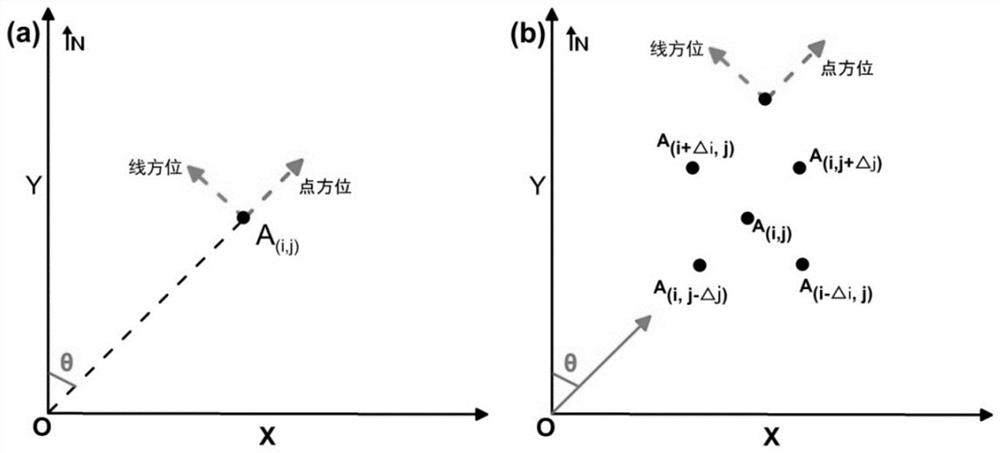
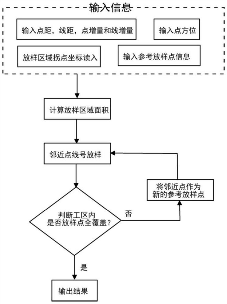
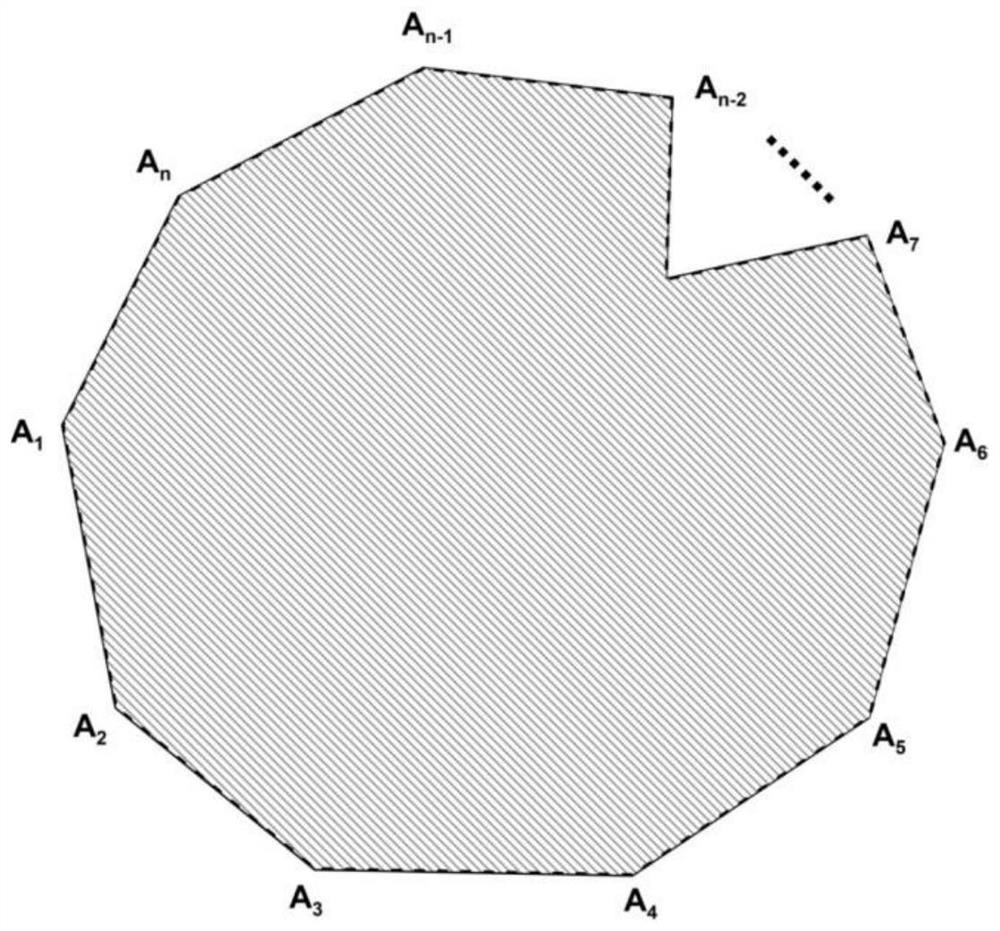
[0042] A method of setting out points in the field of geophysical exploration, such as figure 1 As shown in .a, A(i, j) in the figure is the reference stakeout point, where i and j are the line number and point number of the point respectively, Δi and Δj are the line increment and point increment, respectively, where the azimuth direction of the point is θ, where θ∈0°: 360°, it can be seen from figure (a) that point orientation and line orientation are orthogonal; number to stake out, assu...


PUM


Abstract

The invention relates to the field of geophysical exploration, and discloses a field point lofting method for geophysical exploration, which is characterized in that a lofting reference point is determined in a lofting area, and then field point lofting is carried out through a recursion method. According to the method, any lofting angle can be selected for the point orientation and the line orientation of field geophysical exploration; the situation that single-line lofting is easily interfered by factors such as field rivers, lakes and villages is avoided, and multi-line lofting in the area can be carried out at the same time; according to the method, a related operation interface can be developed based on a Matlab language, man-machine interaction can be realized, and lofting parameters can be changed according to requirements.

Description

technical field [0001] The present application relates to the field of geophysical prospecting, in particular to a method for setting out points in the field of geophysical prospecting. Background technique [0002] In regional geological survey and resource exploration, geophysical exploration methods are conventional application methods, such as gravity exploration, magnetic exploration, electrical exploration and so on. The stakeout in exploration work mainly includes the following information: point stakeout orientation, line stakeout orientation, point distance, line distance, point number increment, line number increment and other related information. The rapid positioning of dotted line numbers in field geophysical exploration is an important part of project design and establishment. It is a necessary work based on the relevant design requirements of the project on the basis of collecting relevant geological data and surveying. In the actual geophysical exploration w...

Claims


Application Information

Patent Timeline
IPC IPC(8): G01B21/28G06F30/20
CPCG01B21/28G06F30/20Y02A90/30
Inventor 郝奥伟杨瀚文
Owner 中国地质调查局西安矿产资源调查中心
Why Eureka
Try Eureka