Urban underground comprehensive pipe network connectivity analysis method based on GIS + graph database
An analysis method and database technology, applied in the field of pipeline network connectivity analysis, can solve the problems of large amount of data transmitted in pipeline network connectivity analysis and the inability to visually display geographic location in the analysis results.
- Summary
- Abstract
- Description
- Claims
- Application Information
AI Technical Summary
Problems solved by technology
Method used
Image
Examples
Embodiment Construction
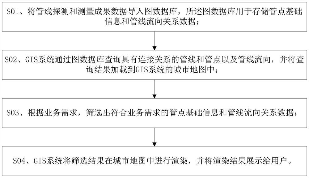
[0016] The method for analyzing the connectivity of urban underground comprehensive pipe network based on GIS+map database of the present invention is as follows: figure 1 shown, including the following steps:
[0017] S01, import pipeline detection and measurement result data into a graph database, and the graph database is used to store basic information of pipe points and pipeline flow direction relationship data;
[0018] Specifically, the basic information of the pipe point includes the pipe point number;
[0019] S02, the GIS system queries the pipelines and pipe points with connection relationships and the pipeline flow direction through the graph database, and loads the query results into the city map of the GIS system;
[0020] Specifically, the city map in the GIS system contains the locations of all pipe points and pipelines, and the query statement can use "match(a:Line{lineId:{'ID'}})-[:STREAM_TO*]-(b: Line) return b";
[0021] S03. According to the business re...
PUM
 Abstract
Description
Claims
Application Information
 - R&D
- Intellectual Property
- Life Sciences
- Materials
- Tech Scout
- Unparalleled Data Quality
- Higher Quality Content
- 60% Fewer Hallucinations
Browse by: Latest US Patents, China's latest patents, Technical Efficacy Thesaurus, Application Domain, Technology Topic, Popular Technical Reports.
© 2025 PatSnap. All rights reserved.Legal|Privacy policy|Modern Slavery Act Transparency Statement|Sitemap|About US| Contact US: help@patsnap.com

