Unmanned aerial vehicle route validity verification method based on laser point cloud

A laser point cloud and verification method technology, applied in computer components, instruments, calculations, etc., can solve problems such as track deviation, danger of drones hitting towers, and collection of photos that cannot meet mission requirements.

Pending Publication Date: 2022-08-02
北京中关村智连安全科学研究院有限公司
View PDF0 Cites 0 Cited by
  • Summary
  • Abstract
  • Description
  • Claims
  • Application Information

AI Technical Summary

Problems solved by technology

However, with the popularization of UAV applications, people have higher and higher requirements for UAV control technology, and the demand for UAV pilots is also increasing. The aircraft performs more detailed tasks, such as the execution of tasks such as surveying and mapping, electric power, meteorology, environmental protection, and sea surveillance. Since the pilots completely rely on the skills and experience of the pilots, there will inevitably be track deviations, and the collection of photos The problem of failing to meet the mission requirements. During the tower inspection flight mission, the deviation of the track will lead to the danger of the UAV hitting the tower and the risk of the tower inspection photos being unqualified, and the mission needs to be re-executed

Method used


Image

  • Unmanned aerial vehicle route validity verification method based on laser point cloud
  • Unmanned aerial vehicle route validity verification method based on laser point cloud
  • Unmanned aerial vehicle route validity verification method based on laser point cloud

Examples


Embodiment Construction

[0042] The technical solutions in the embodiments of the present invention will be clearly and completely described below with reference to the accompanying drawings in the embodiments of the present invention. Obviously, the described embodiments are only a part of the embodiments of the present invention, but not all of the embodiments. Based on the embodiments of the present invention, all other embodiments obtained by those of ordinary skill in the art without creative efforts shall fall within the protection scope of the present invention.

[0043] It should be noted that when a component is referred to as being "fixed to" another component, it can be directly on the other component or there may also be a centered component. When a component is considered to be "connected" to another component, it may be directly connected to the other component or there may be a co-existence of an intervening component. When a component is considered to be "set on" another component, it ...


PUM


Abstract

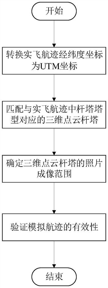
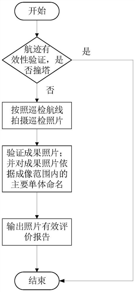
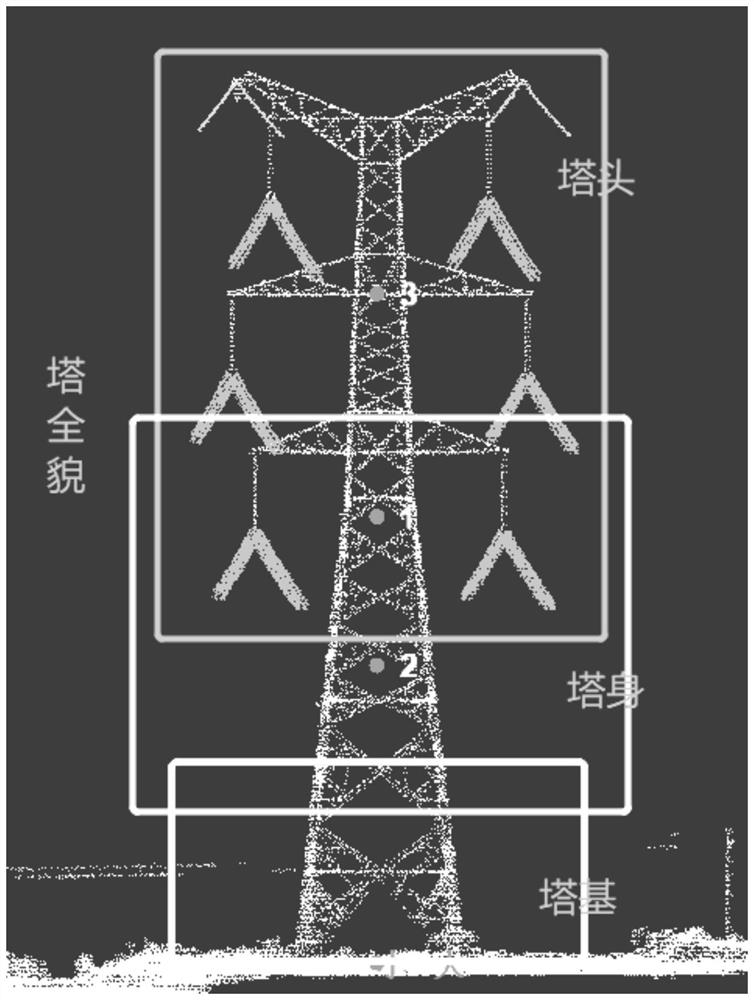
The invention relates to the technical field of unmanned aerial vehicle flight path verification, and discloses a laser point cloud-based unmanned aerial vehicle flight path validity verification method, which comprises the following steps of converting real flight flight path latitude and longitude coordinates into UTM coordinates; matching a three-dimensional point cloud tower corresponding to the tower type of the tower in the real flight track; determining a photo imaging range of the three-dimensional point cloud tower; verifying the validity of the simulated track; the method comprises the following steps: establishing a three-dimensional point cloud model matched with a tower in an actual track, simulating track flight inspection in the three-dimensional point cloud model, shooting a model picture, effectively evaluating the picture, generating an evaluation report, simulating track flight inspection in the three-dimensional model, and analyzing the effectiveness of the simulated picture. The safety and the accuracy of the actual flight path can be judged, and the fine inspection actual flight capability of a pilot can be inspected at the same time.

Description

technical field [0001] The invention relates to the technical field of UAV track verification, in particular to a method for verifying the validity of an UAV route based on a laser point cloud. Background technique [0002] As an emerging technology, low-altitude UAV control technology has shown its unique role in various industries. Due to the low cost of UAVs, no risk of casualties, good maneuverability, over-the-horizon flight, convenient and efficient use, etc. Features are also widely used in various industries. However, with the popularity of drone applications, people have higher and higher requirements for drone control technology, and the demand for drone pilots is also increasing. The aircraft carries out more detailed tasks, such as the execution of tasks such as surveying and mapping, electric power, meteorology, environmental protection, and maritime surveillance. Since the pilots rely entirely on the pilot's technology and experience to perform tasks, it is in...

Claims


Application Information

Patent Timeline
Patent Type & Authority Applications(China)
IPC IPC(8): G06V20/17G06V10/74G06V10/764
CPCG06V20/17G06V10/74G06V10/764
Inventor 李文娟张忠诚冀树伟闫亭亭王东东吕凤晨焦健
Owner 北京中关村智连安全科学研究院有限公司
Why Eureka
Try Eureka