
Three-dimensional geologic model automatic merging method for block modeling

A 3D geological and block-based technology, applied in 3D modeling, instrumentation, design optimization/simulation, etc., can solve problems such as lack of integrity of the model, obvious splicing traces of modeling units, and poor smoothness of the model

Pending Publication Date: 2022-08-09
山东省地质调查院
View PDF0 Cites 0 Cited by
  • Summary
  • Abstract
  • Description
  • Claims
  • Application Information

AI Technical Summary

Problems solved by technology

But this method also has obvious disadvantages: the model lacks integrity, the splicing traces of the modeling units are more obvious, and the smoothness of the model is poor

Method used


Image

  • Three-dimensional geologic model automatic merging method for block modeling
  • Three-dimensional geologic model automatic merging method for block modeling
  • Three-dimensional geologic model automatic merging method for block modeling

Examples


Embodiment 1

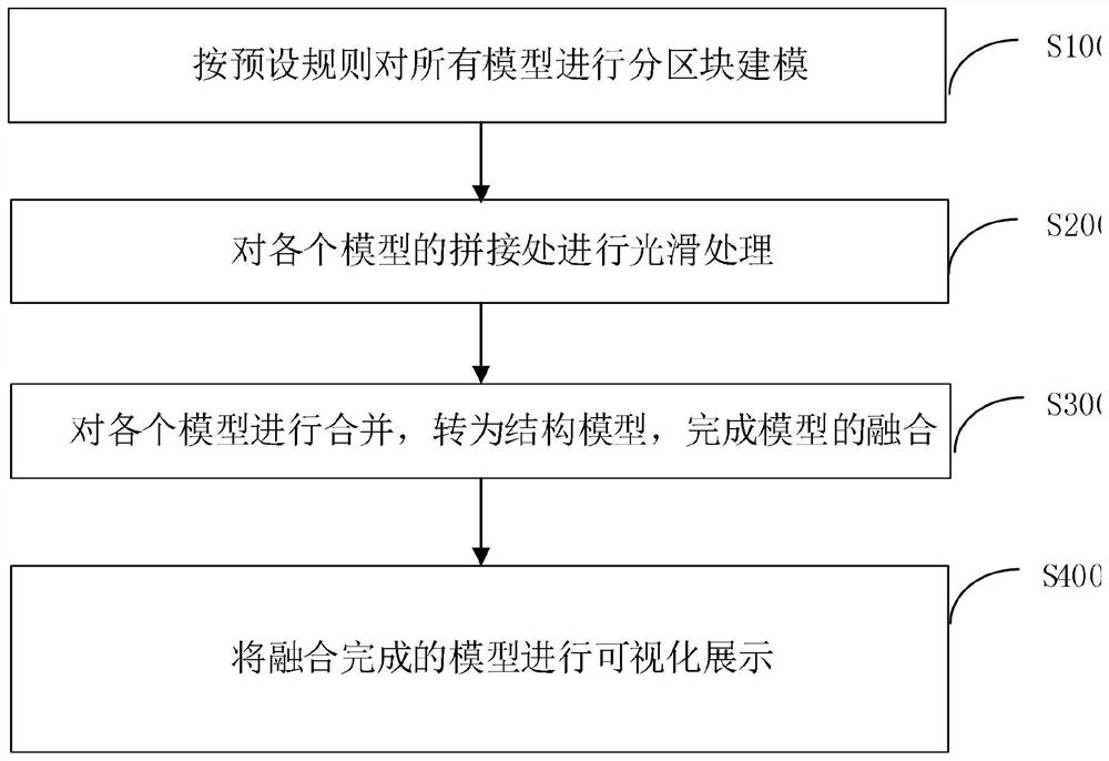
[0029] The present embodiment discloses a method for automatic merging of three-dimensional geological models for sub-block modeling, including:

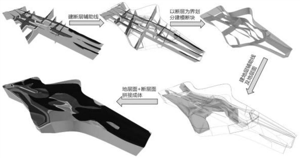
[0030] S100. Perform block modeling on all models according to preset rules; in the present embodiment S100, the method for performing block modeling on all models includes: a method of dividing cells by a cross section, a method of dividing cells by a parallel section, The way of dividing the level as the boundary and the dividing way of artificially constructing the interface.

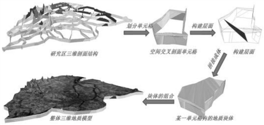
[0031] Specifically, as figure 2 , the method of dividing the block modeling by dividing the cell by the cross section includes: using multiple cross sections in the modeling area to divide the space into multiple cells, using a series of closed contour lines in a single cell to establish a surface patch, and then Determine the spatial geometry of all geological bodies in the cell to form a single-hug geological block, and combine the geological blocks o...


PUM


Abstract

The invention discloses a method for automatically merging three-dimensional geologic models through block modeling. The method comprises the following steps: carrying out block modeling on all models according to a preset rule; carrying out smoothing processing on the splicing part of each model; the models are merged and converted into structural models, and fusion of the models is completed; and carrying out visual display on the fused model. The problems that in the prior art, a model lacks integrity, splicing traces of modeling units are obvious, and the smoothness of the model is poor are solved.

Description

technical field [0001] The invention relates to the field of three-dimensional geological models, in particular to an automatic merging method of three-dimensional geological models for sub-block modeling. Background technique [0002] MapGIS is a general-purpose tool-based geographic information system software developed by Wuhan Zhongdi Digital Technology Co., Ltd. It is developed on the basis of MAPCAD, a well-known map editing and publishing system. It can collect, store, retrieve, analyze and analyze spatial data. Graphical representation. MAPGIS includes all the basic cartographic functions of MAPCAD, and can produce very complex topographic and geological maps with publication accuracy. At the same time, it can conduct integrated management and spatial analysis and query of terrain data and various professional data, thus providing an ideal platform for comprehensive analysis of multi-source geoscience information. [0003] The specific implementation form of the in...

Claims


Application Information

Patent Timeline
IPC IPC(8): G06F30/20G06T17/00G06T19/20
CPCG06F30/20G06T17/00G06T19/20
Inventor 朱恒华刘春华马瑜宏卫政润郭晶刘治政王玮刘柏含纪汶龙董健李三凤石劲一郭晨光胡进
Owner 山东省地质调查院
Learn More