Geographic space conversion

A technique of geospatial, transformation method, applied in the field of geospatial transformation

Inactive Publication Date: 2005-12-28
FENG CHIA UNIVERSITY
View PDF0 Cites 6 Cited by
  • Summary
  • Abstract
  • Description
  • Claims
  • Application Information

AI Technical Summary

Problems solved by technology

[0006] From the above, in order to solve the inconvenience and defects of the above-mentioned existing GPS navigation equipment and tracking and dispatch management systems, this application proposes a geographic space conversion method, which can convert spatial coordinates into actual geographic locations, and can be widely used Applied to other GIS and GPS-related systems, its design is reasonable and can effectively improve the above defects

Method used


Image

  • Geographic space conversion
  • Geographic space conversion
  • Geographic space conversion

Examples


Embodiment Construction

[0028] In order to enable a further understanding of the technology, means and effects that the present invention takes to achieve the intended purpose, please refer to the following detailed descriptions and accompanying drawings of the present invention. It is believed that the purpose, features and characteristics of the present invention can be obtained from this And for specific understanding, however, the drawings are provided for reference and illustration only, and are not intended to limit the present invention.

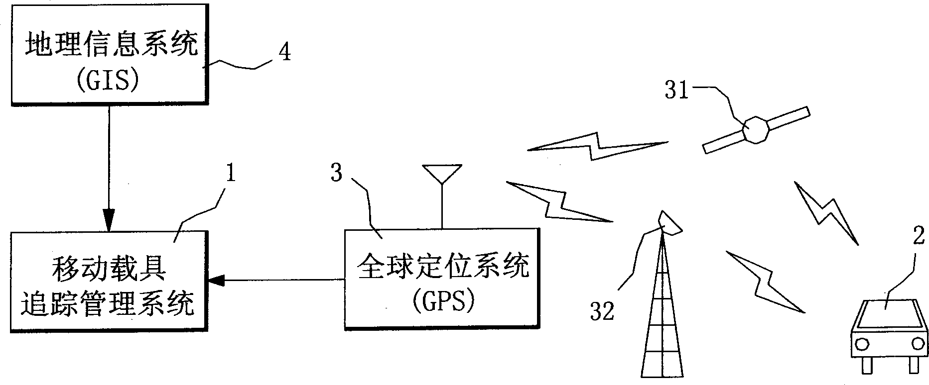
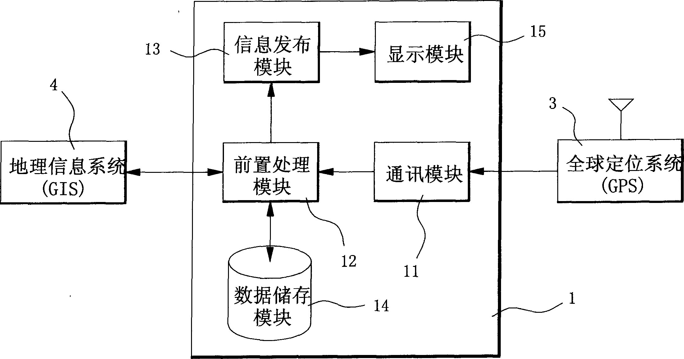
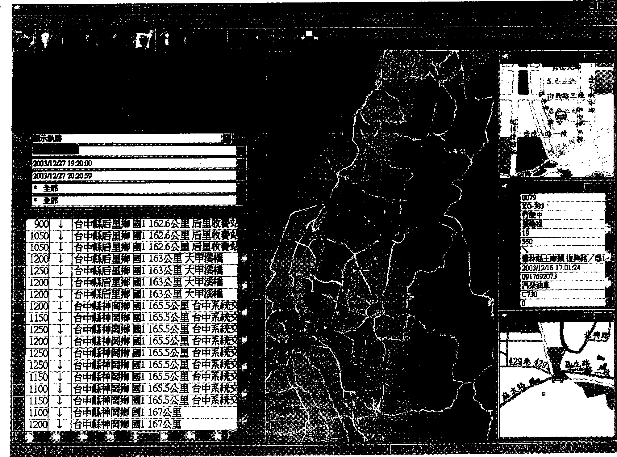
[0029] First of all, the present invention uses a tracking management system as an embodiment of the geographic space conversion method of the present invention to illustrate the implementation of the present invention. Please refer to figure 1 Shown is a schematic diagram of the structure of a tracking management system. and figure 2 It is a schematic block diagram of the tracking management system. When the present invention is applied to the tracking m...


PUM


Abstract

A method for converting geographical space includes utilizing preposition process to device space information to be multiple geographic positions and converting its top point coordinate value for setting up a data table of geographic position containing code name and coordinate value of geographic position, substituting a point and judging geographic position range dropped in by the point and using voice or writing mode to replace drawing for presenting geographic position corresponded by the point correctly .

Description

technical field [0001] The present invention relates to a geographical space conversion method, in particular to a method for using geographic information system (GIS) and satellite global positioning system (GPS) as tracking management of mobile vehicles, and converting spatial coordinates into actual geographic location. Background technique [0002] Generally, Geographic Information Systems (GIS) is an integrated system that is based on information technology and can be used to create, access, analyze, manage and display spatial data. It does not belong to an independent technology. It is formed by the technical essence of computer surveying and mapping, remote sensing detection, database management and computer-aided design and other fields. It mainly processes and displays various spatial information in a graphical way, digitally converts the geographic data of the real world into clear map locations, and stores them in digital map files. These digital maps clearly reco...

Claims


Application Information

Patent Timeline
Patent Type & Authority Applications(China)
IPC IPC(8): G01C21/26
Inventor 陈章毅周天颖穆青云
Owner FENG CHIA UNIVERSITY
Why Eureka
Try Eureka