Dynamic drawing system for network electronic map and method therefor

An electronic map and dynamic map technology, which is applied to maps/plans/charts, electrical digital data processing, special data processing applications, etc., can solve problems such as map reading performance and poor load balance, and achieve improved map reading performance and reduced The effect of fast load and performance

Inactive Publication Date: 2006-12-13
FENG CHIA UNIVERSITY
View PDF0 Cites 10 Cited by
  • Summary
  • Abstract
  • Description
  • Claims
  • Application Information

AI Technical Summary

Problems solved by technology

[0006] The purpose of the present invention is to solve the problem of poor map reading efficiency and load balance of the known network geographic information system map platform

Method used


Image

  • Dynamic drawing system for network electronic map and method therefor
  • Dynamic drawing system for network electronic map and method therefor
  • Dynamic drawing system for network electronic map and method therefor

Examples


Embodiment Construction

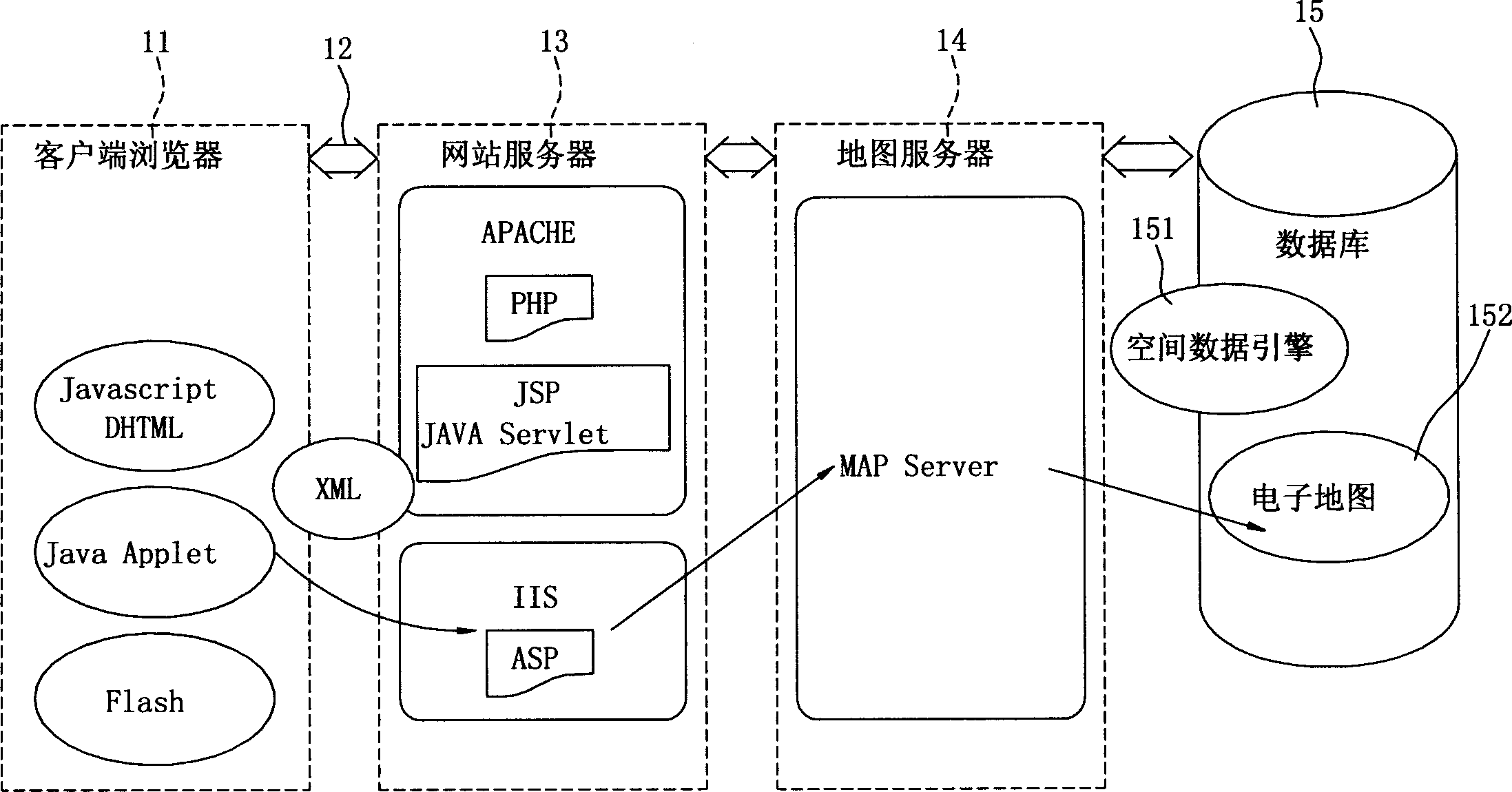
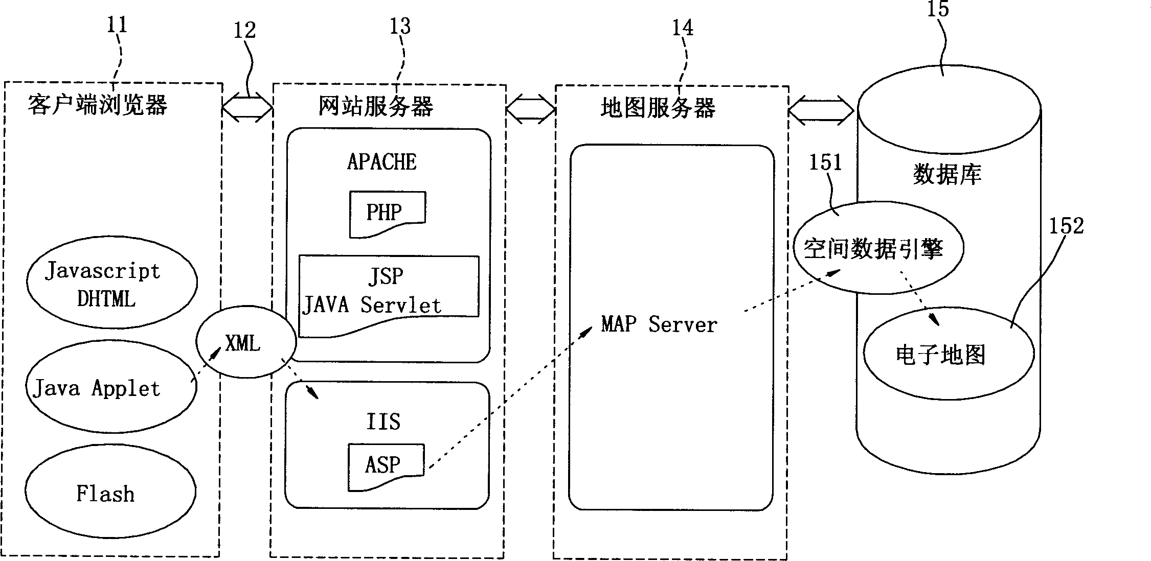
[0065] see image 3 , image 3 It is a schematic diagram of the structure of the dynamic drawing system of the network electronic map of the present invention. The dynamic drawing system 20 of the network electronic map of the present invention includes: a client unit, a database unit, a website server unit and a network transmission unit 22 . Wherein the client unit can be a client browser 21, which is a web browser supporting dynamic web page programming languages ​​such as DHTML, JavaScript, css or VBScript. After the client browser 21 inputs parameters such as map coordinates, map image height, or map image width of at least one electronic map 241 required, the dynamic drawing system 20 then outputs the required at least one electronic map 241 and displays it on the client browser. Device 21.

[0066] The database unit can be a database 24, which stores the image content or geographic information of a plurality of themed maps for users to select and use. The electronic...


PUM


Abstract

The invention relates to a dynamic image output system for network electronic map and method for making the same. The invention merges and converts maps of different subject types into image files, and stores the image files in database for user accessing needed electronic map file directly. The dynamic image output system comprises a client terminal unit, a database unit, a website service unit and a network transmission unit. The invention has the advantages of being stable, of being able to lower server load and make plural users be served at the same time.

Description

technical field [0001] The present invention relates to a dynamic drawing system and method of a network electronic map, in particular to merging and converting maps of various theme types into map files through a map transfer program, and then storing the map files in a database for the convenience of users A dynamic drawing system and method thereof capable of directly reading required electronic map files. Background technique [0002] In recent years, due to the development of various software technologies and the rapid rise of the Internet, the application scope of geographic information system (GIS) software has also developed from a single-person stand-alone system to a network-based GIS application system with multiple people. However, the price of most network-based GIS software is too high, often hundreds of thousands or even as high as one million yuan, and the purchased software will be updated or upgraded due to the time being too old, and it is often necessary ...

Claims


Application Information

Patent Timeline
Patent Type & Authority Applications(China)
IPC IPC(8): G06F17/00G09B29/00
Inventor 简甫任周天颖张英晖
Owner FENG CHIA UNIVERSITY
Why Eureka
Try Eureka