Supercharge Your Innovation With Domain-Expert AI Agents!

Visual simultaneous localization and mapping system

a simultaneous localization and mapping technology, applied in image analysis, image enhancement, details involving image processing hardware, etc., can solve the problems of time-consuming algorithms that are impractical to use, frustrate the purpose, and the task is much more difficult to accomplish, so as to fast and accurately localize an object in space

Active Publication Date: 2020-05-19
SLIGHTECH
View PDF6 Cites 3 Cited by
  • Summary
  • Abstract
  • Description
  • Claims
  • Application Information

AI Technical Summary

Benefits of technology

The present patent is about a device and method for simultaneously locating and mapping objects in space using a camera and a special field to track the position of the camera. The device can take a series of images and use them to create a map of the surrounding environment. This technology is useful in a variety of applications, like in self-driving cars or robotics.

Problems solved by technology

For machines, though, this task is much more difficult, especially in fields such as computer vision and autonomous driving.
SLAM is a very resource-intensive task, and as such, SLAM algorithms are tailored to produce usable environments with any available resources as opposed to creating perfect environments that may frustrate the purpose of the machine.
While this technology exists today, it often requires several types of sensors, involves time-consuming algorithms that are impractical to use, and has difficulty mapping other objects in a given space.

Method used


Image

  • Visual simultaneous localization and mapping system
  • Visual simultaneous localization and mapping system
  • Visual simultaneous localization and mapping system

Examples


Embodiment Construction

[0019]Illustrative embodiments of the invention are described below. The following explanation provides specific details for a thorough understanding of and enabling description for these embodiments. One skilled in the art will understand that the invention may be practiced without such details. In other instances, well-known structures and functions have not been shown or described in detail to avoid unnecessarily obscuring the description of the embodiments.

[0020]Unless the context clearly requires otherwise, throughout the description and the claims, the words “comprise,”“comprising,” and the like are to be construed in an inclusive sense as opposed to an exclusive or exhaustive sense; that is to say, in the sense of “including, but not limited to.” Words using the singular or plural number also include the plural or singular number respectively. Additionally, the words “herein,”“above,”“below” and words of similar import, when used in this application, shall refer to this appli...


PUM


Abstract

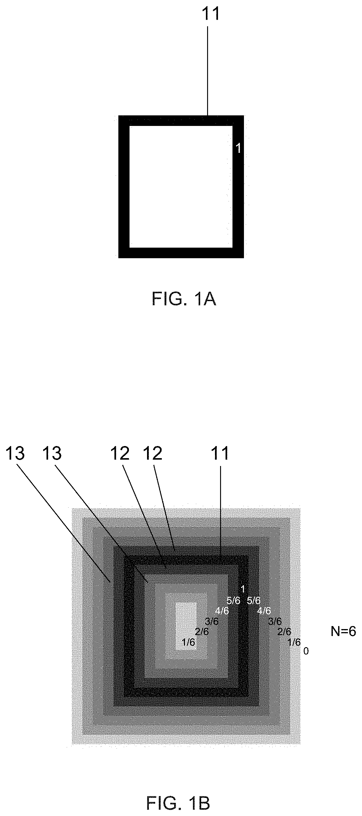
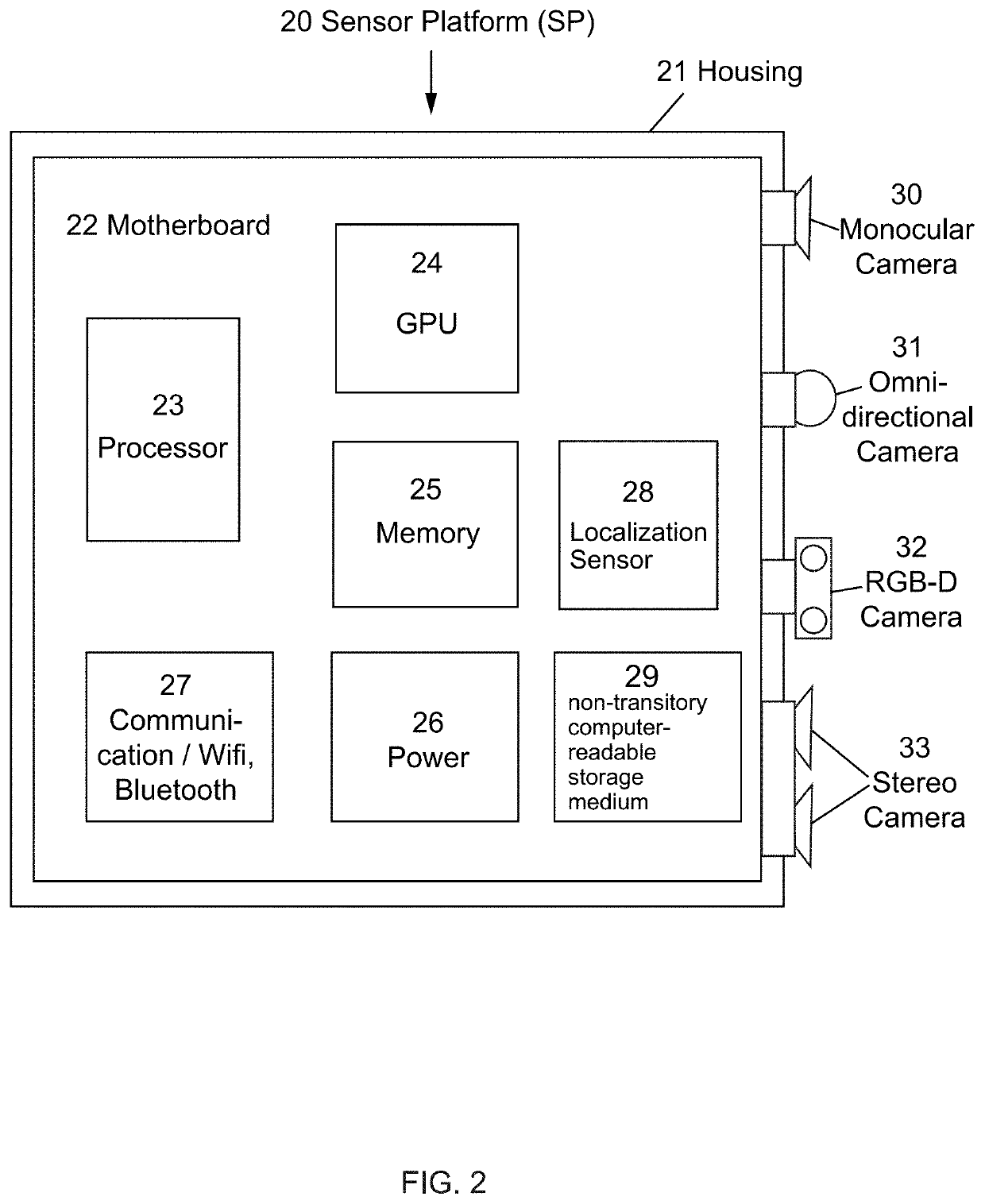
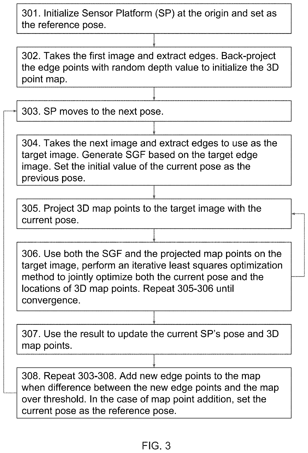
A system and method for the visual simultaneous localization and mapping can quickly and accurately localize an object in space and map the surrounding environment. This is accomplished using at least one camera and a synthetic gradient field for tracking the pose of the camera and optimizing the 3D point map. More specifically, a sequence of image frames taken from the camera is used to compute the relative transformation between camera poses and generate a map of the surrounding environment.

Description

CROSS-REFERENCE TO RELATED APPLICATIONS[0001]This application claims the benefit of U.S. Provisional Patent Application 62 / 570,195, filed on Oct. 10, 2017, and U.S. Provisional Patent Application 62 / 593,326, filed on Dec. 1, 2017, both of which are incorporated herein by reference.STATEMENT REGARDING FEDERALLY SPONSORED RESEARCH AND DEVELOPMENT[0002]Not Applicable.FIELD OF THE INVENTION[0003]This invention relates to a system and method for visual simultaneous localization and mapping, and more particularly, to localize an object in 3D space and map the surrounding environment using a camera.DISCUSSION OF RELATED ART[0004]As humans, we have an innate ability to view an image and identify objects, their depth and distance from other objects, lighting, perspective, and various other features. For machines, though, this task is much more difficult, especially in fields such as computer vision and autonomous driving. Edge detection, also called step detection, can generally be described...

Claims


Application Information

Patent Timeline
IPC IPC(8): H04N13/00G06T7/246G06K9/00G06T7/269G06T7/579H04N13/271
CPCH04N13/271G06T7/248G06T7/579G06T7/269G06T2207/30244G06T2207/10028G06T7/246G06T2200/28H04N2013/0081H04N23/698H04N23/695
Inventor ZHANG, GUOXUAN
Owner SLIGHTECH
Features
  • R&D
  • Intellectual Property
  • Life Sciences
  • Materials
  • Tech Scout
  • Unparalleled Data Quality
  • Higher Quality Content
  • 60% Fewer Hallucinations
Learn More