
Wireless communication system and method to provide geo-spatial related event data

a technology of geo-spatial related data and wireless communication, applied in the direction of data switching network, data switching details, instruments, etc., can solve the problem that systems do not provide complex geo-spatial related data (information) to users

Inactive Publication Date: 2002-08-29
EBAY INC
View PDF0 Cites 150 Cited by
  • Summary
  • Abstract
  • Description
  • Claims
  • Application Information

AI Technical Summary

Benefits of technology

[0007] It is, therefore, a primary object of the present invention to provide a system and method for communication of data (information) that has particular significance to a specific location only to those individuals that are at or near that location. A common use of the invention is to deliver location-based safety information to users. The invention allows information to be tailored to the individual at that location by selective filtering of what is communicated.
[0009] It is another object of the invention to provide a method of activating geo-spatial dependent data using a server and a global positioning satellite-based wireless component, wherein the method comprises receiving input event data associated with a designated geo-spatial area at the server, maintaining and updating the event managed data and event subscribed data at the server, matching a profile that is subscribed to by a user when the user enters the designated geo-spatial area, and notifying the wireless component of the event data.
[0009] It is another object of the invention to provide a method of activating geo-spatial dependent data using a server and a global positioning satellite-based wireless component, wherein the method comprises receiving input event data associated with a designated geo-spatial area at the server, maintaining and updating the event managed data and event subscribed data at the server, matching a profile that is subscribed to by a user when the user enters the designated geo-spatial area, and notifying the wireless component of the event data.

Problems solved by technology

However, such systems do not provide complex geo-spatial related data (information) to a user while using wireless-based components to make informed decisions where an awareness of location-based event information is necessary.

Method used


Image

  • Wireless communication system and method to provide geo-spatial related event data
  • Wireless communication system and method to provide geo-spatial related event data
  • Wireless communication system and method to provide geo-spatial related event data

Examples


Embodiment Construction

[0017] The purpose of this invention is to present a global positioning satellite-based wireless component user with a geo-spatial activated system and method.

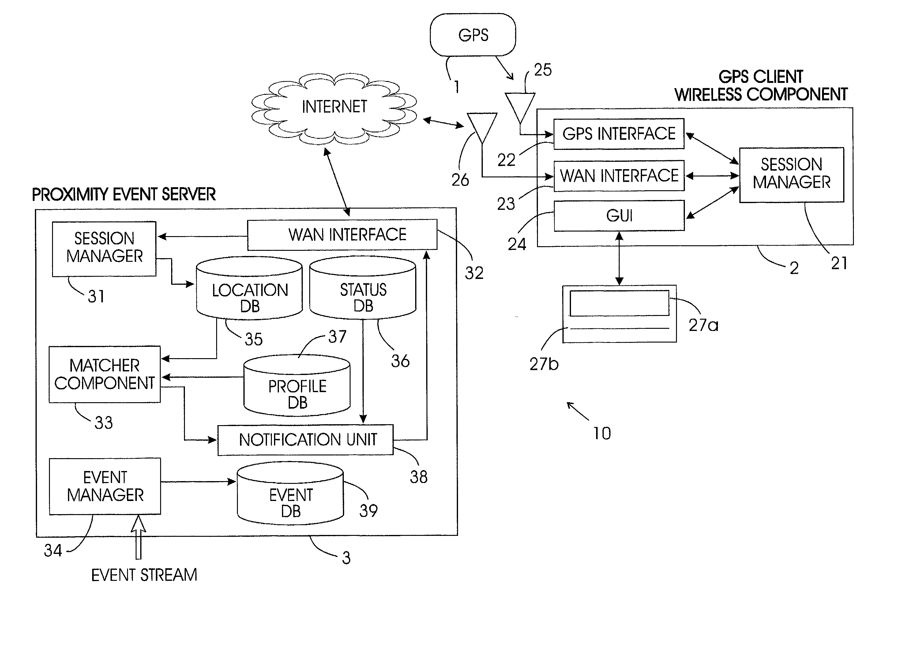
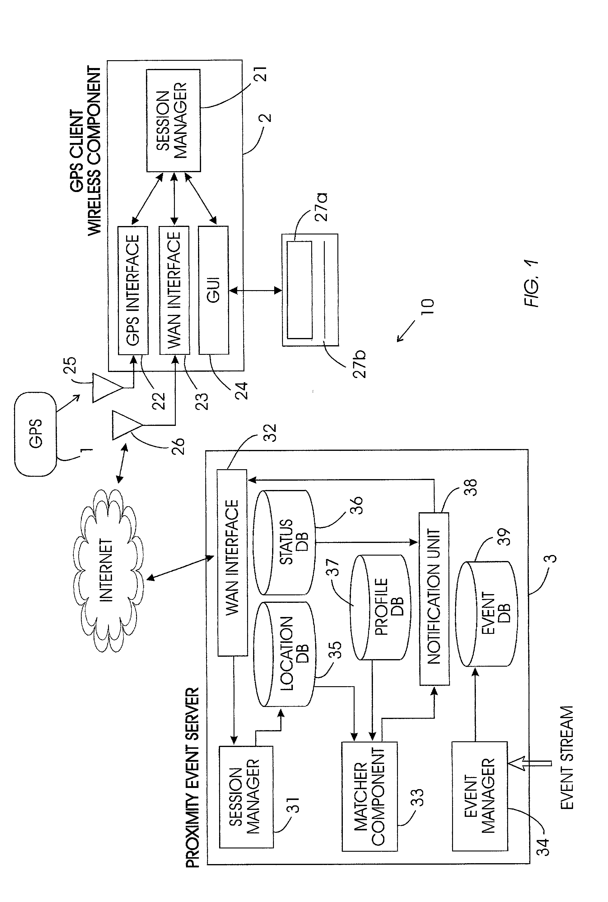
[0018] An exemplary implementation of system hardware of the invention is shown in FIG. 1. The event proximity activated system 10 includes two main components: a GPS client wireless component 2 and a proximity event server 3.

[0019] As illustrated in FIG. 1, a typical configuration of an information handling / wireless communication system in accordance with the invention has a central processing units in both the server 3 and the wireless component 2. Each of these central processing unit could include various mapping units, weighting units, classification units, clustering units, filters, adders, subtractors, comparators, etc. Alternatively, as would be known by one ordinarily skilled in the art given this disclosure, multiple specialized CPU's (or other similar individual functional units) could perform the same processing, m...


PUM


Abstract

A system and method for communication of information that has particular significance to a specific location only to those individuals that are at or near that geo-spatial location. In particular, providing safety factor data and alerts is a preferred use of the invention. The invention allows information to be tailored to the individual at that location by selectively filtering what is communicated and what is not. The system includes a transmitting proximity event server, a GPS client wireless component that can be a personal wireless communication device (such as Palm Pilot, cellular digital phones, etc.) or personal computer configured for use within a global position satellite network.

Description

[0001] 1. Field of the Invention[0002] This invention generally relates to wireless communication components and more particularly to global positioning satellite (GPS) technology / wireless communication integration of such components, and notifies a person or object that they are at or near the geo-spatial location of a significant event of subscribed data by the person or object.[0003] 2. Description of the Related Art[0004] Rapid advances are being made in the field of wireless communication. An increasing number of applications are being developed for the wireless device platform, ranging from smart cellular phones to two-way text pagers. By the year 2001, new cellular phones are required to have a location-tracking device based on the global position satellite (GPS) network. This gives rise to systems that deliver real-time, location-based information and services to wireless subscribers. Typically, a wireless application retrieves data from a server to the wireless handset when...

Claims


Application Information

Patent Timeline
Patent Type & Authority Applications(United States)
IPC IPC(8): G01C21/20G01S19/48G01S5/14H04W4/021G06F17/30G08B27/00H04L12/18H04L29/08H04W4/02
CPCG01C21/20G06F17/30241G08B27/005G08B27/006H04L12/1859H04L12/189H04L12/1895H04W4/02H04L67/16H04L67/22H04L67/306H04L67/26H04L67/18H04L69/329G06F16/29H04W4/021H04L67/52H04L67/51H04L67/535H04L67/55
Inventor MYLLYMAKI, JUSSI PETRICAO, KEVIN TRUNGFORD, DANIEL ALEXANDERKRAFT, REINER
Owner EBAY INC
Learn More