

Method and system for forecasting events and results based on geospatial modeling
- Summary
- Abstract
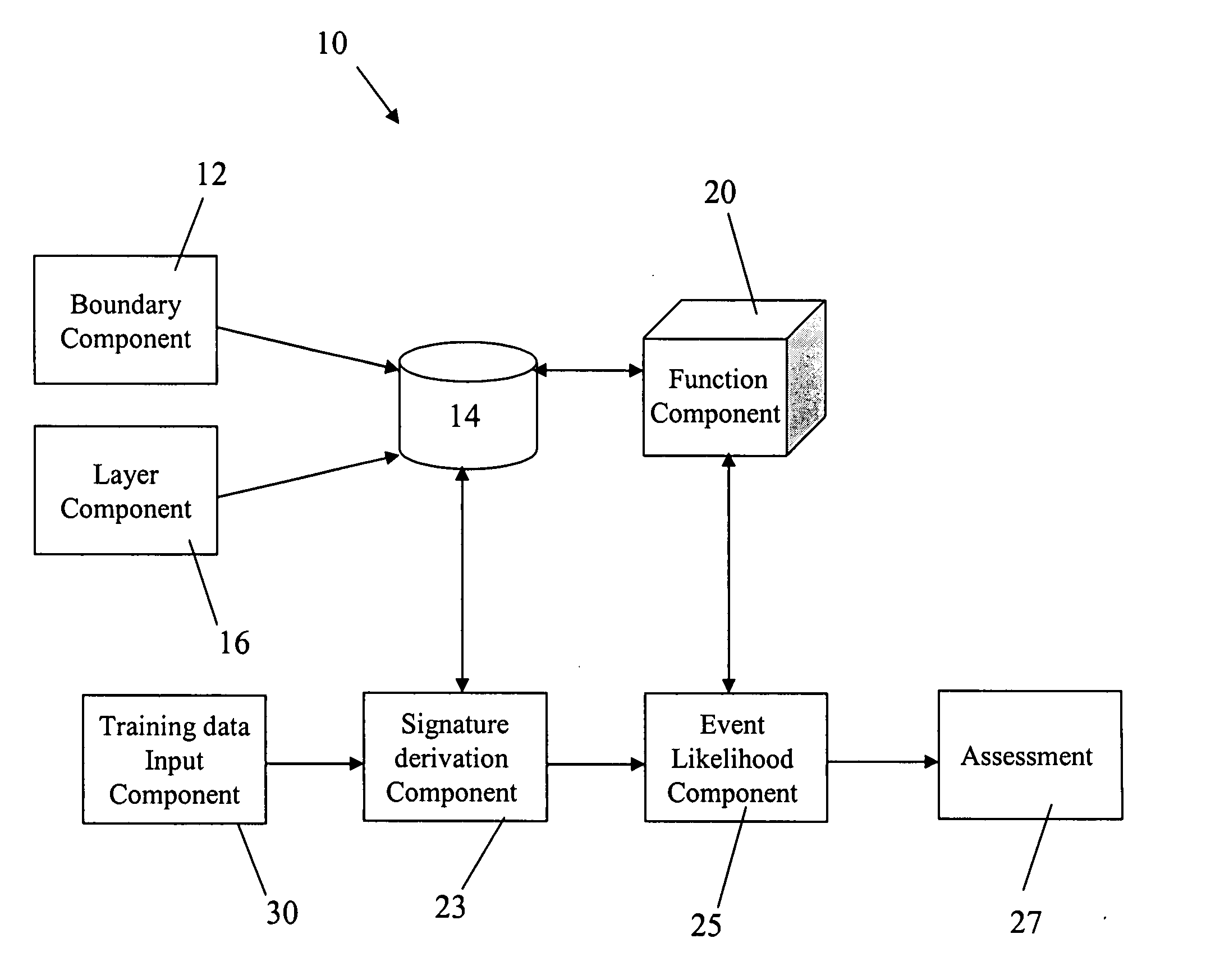
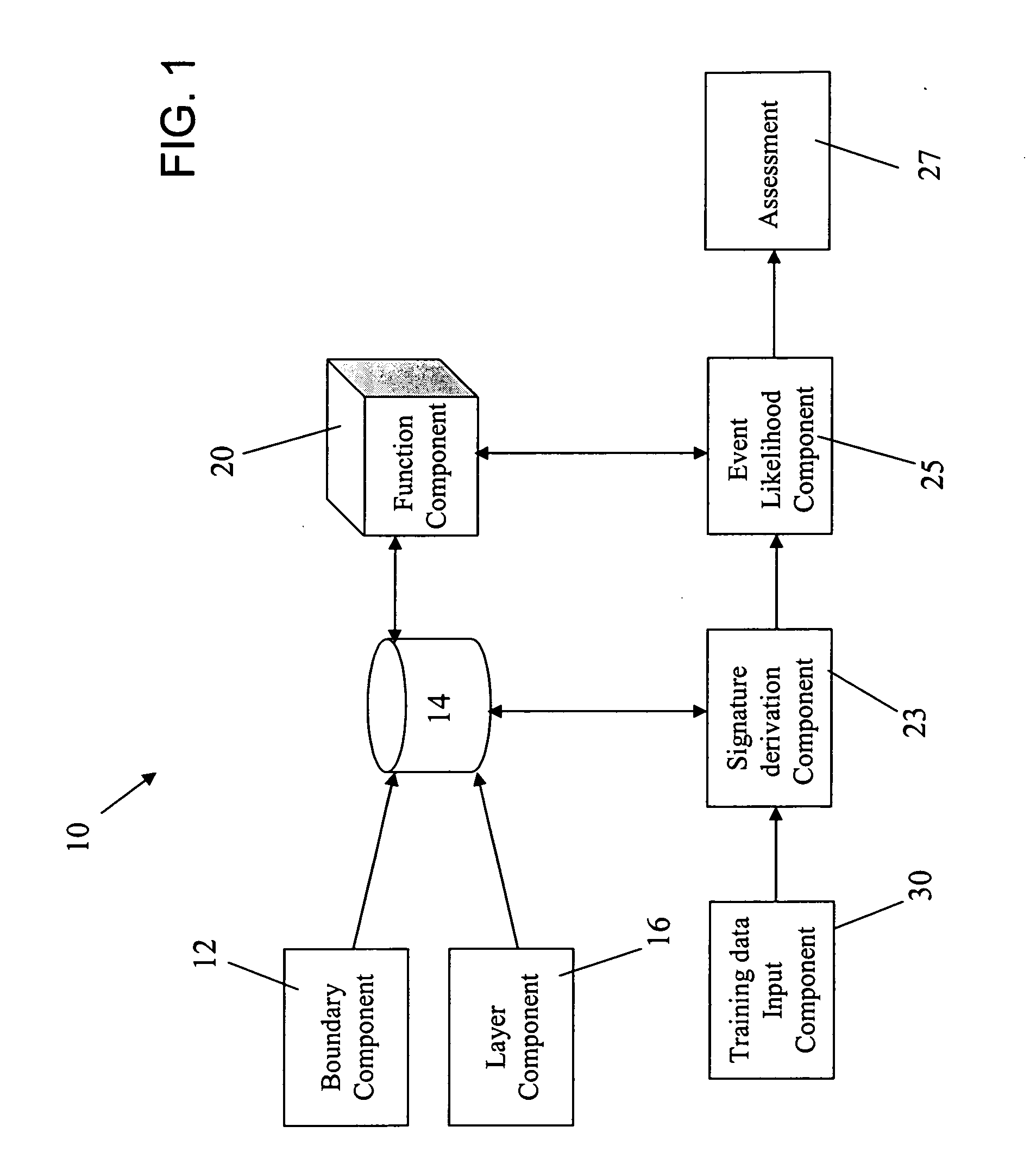
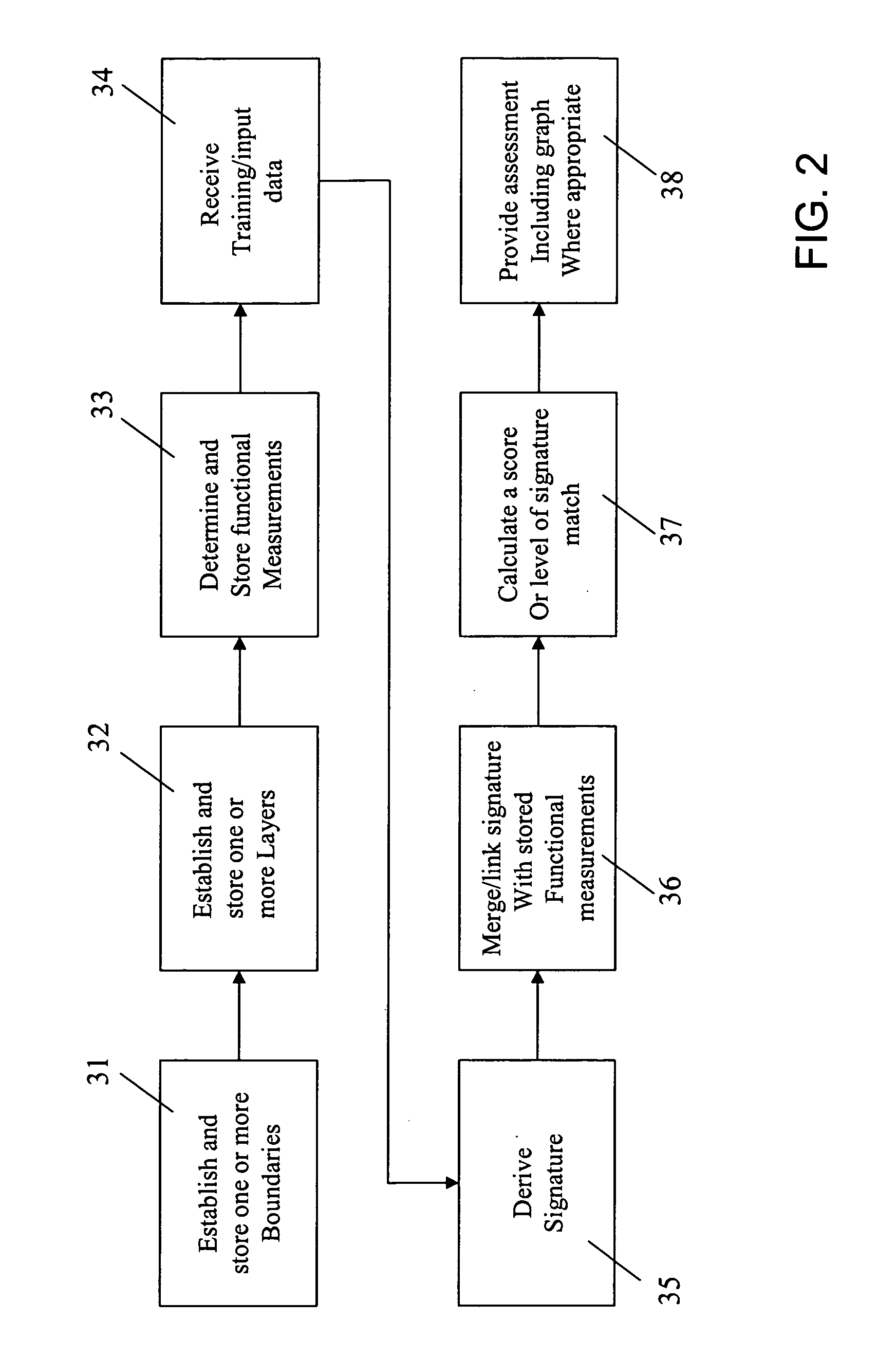
- Description
- Claims
- Application Information
AI Technical Summary
Benefits of technology
Problems solved by technology
Method used
Image

Examples
example 1
[0067] The following example is provided as an illustrative case of the operation of the present invention.
[0068] User A is a metropolitan crime analyst who develops planning maps for the tasking of law enforcement units. Due to a recent increase in breaking and entering offenses, User A desires to create a summary map that will describe the likelihood of a breaking and entering event occurring throughout her city.
[0069]FIG. 14 is an example geographical depiction of an area of interest 140 within User A's city, available through the boundary component of the present invention. As noted by elements 141 in FIG. 15, User A can apply training data from the previous month's breaking and entering offenses onto the area of interest, using training data input component 30. As shown in FIG. 16, User A can then import relevant base layer data from her city as available through layer component. The layers included are “roads”142, “rivers”143, “cul-de-sacs”144, and “street lamps”145.
[0070] ...
example 2
[0073] The following example is provided as an additional illustrative case of the operation of the present invention.
[0074] User B is a planning district manager deciding on the best location for a new municipal fire station. There are twenty-two possible neighborhoods in the city where a fire station could be located. User B would like to recommend a location that will place the new fire station in the area most likely to have fire incidents causing a significant amount of damage based on observed data for the previous year. The travel time for an emergency vehicle to the fire location is the primary measure of distance for this task. Data for city locations is stored in a parcel map outlining each identified parcel in the community; these parcels will be used as the output grid for the analysis.
[0075] As shown in FIG. 21, User B applies training data 210 from the previous year's house fire incidents. In this example, User B uses the invention to import relevant base layer data ...
PUM
 Abstract
Description
Claims
Application Information