Method for representing the vertical component of road geometry and computing grade or slope

a technology of road geometry and vertical component, applied in the field of geodatabases, can solve the problems of increasing the overall size of the geographic database and increasing the cost of the data storage medium, and achieve the effect of accurate representation of road geometry and high level of accuracy

Inactive Publication Date: 2006-07-06
HERE GLOBAL BV
View PDF12 Cites 44 Cited by
  • Summary
  • Abstract
  • Description
  • Claims
  • Application Information

AI Technical Summary

Benefits of technology

[0009] The use of parabolic arcs and line segments to represent the altitudinal component of roads may be advantageous for certain applications that require an accurate representation of road geometry. Such a representation may be a space efficient way to represent roads with a high level of accuracy, because the representation directly exploits the fact that vertical curves are parabolic.

Problems solved by technology

Storing large numbers of shape points increases the overall size of the geographic database thereby increasing the cost of the data storage medium.

Method used


Image

  • Method for representing the vertical component of road geometry and computing grade or slope
  • Method for representing the vertical component of road geometry and computing grade or slope
  • Method for representing the vertical component of road geometry and computing grade or slope

Examples


Embodiment Construction

I. Introduction

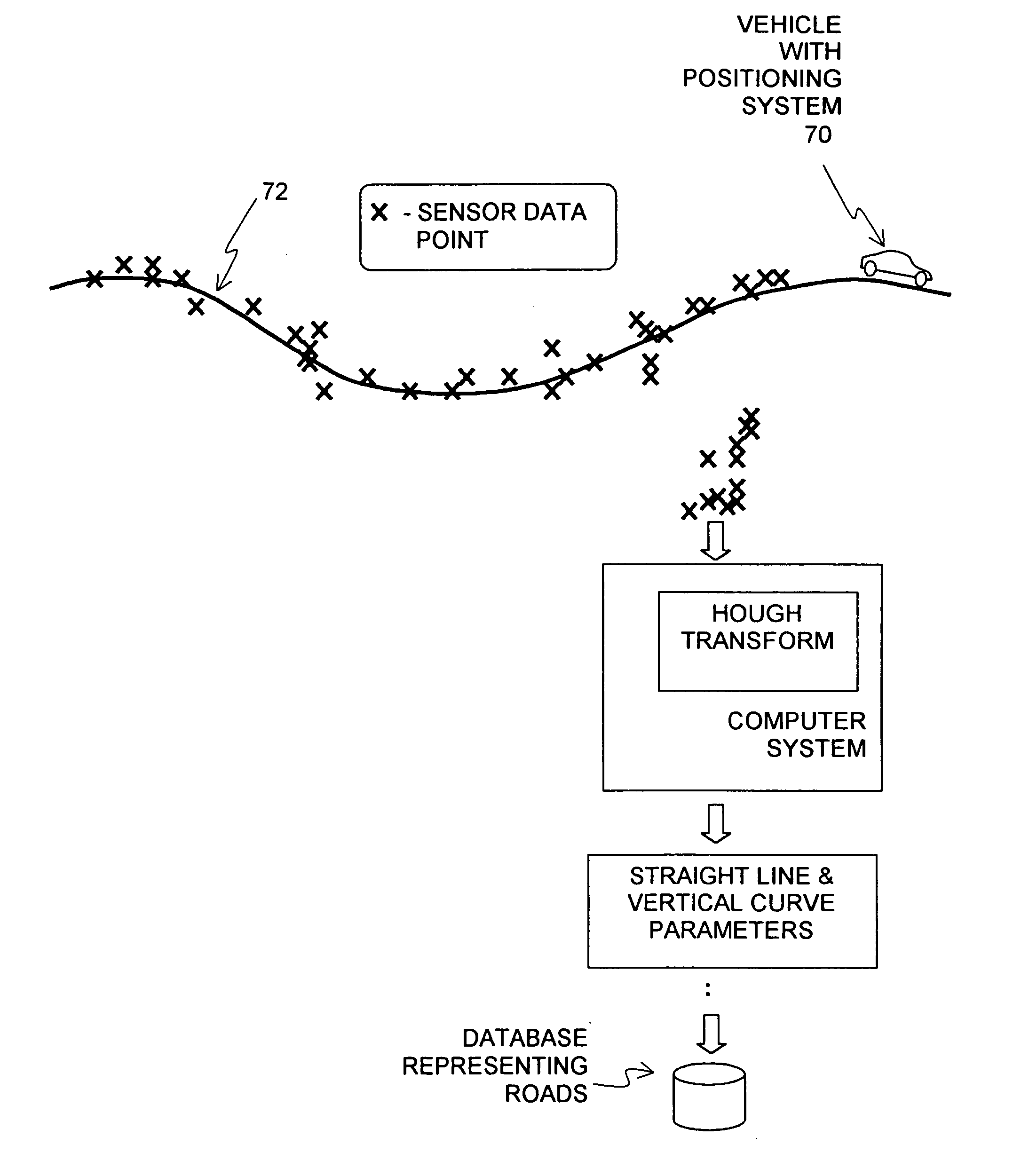
[0015] Those who develop geographic databases that represent roads have a need for ways to accurately represent roads in three dimensions. In conventional databases, the shapes of roads are represented using shape points. Shape points consist of coordinate pairs (longitude, latitude) or coordinate triples (longitude, latitude, altitude).

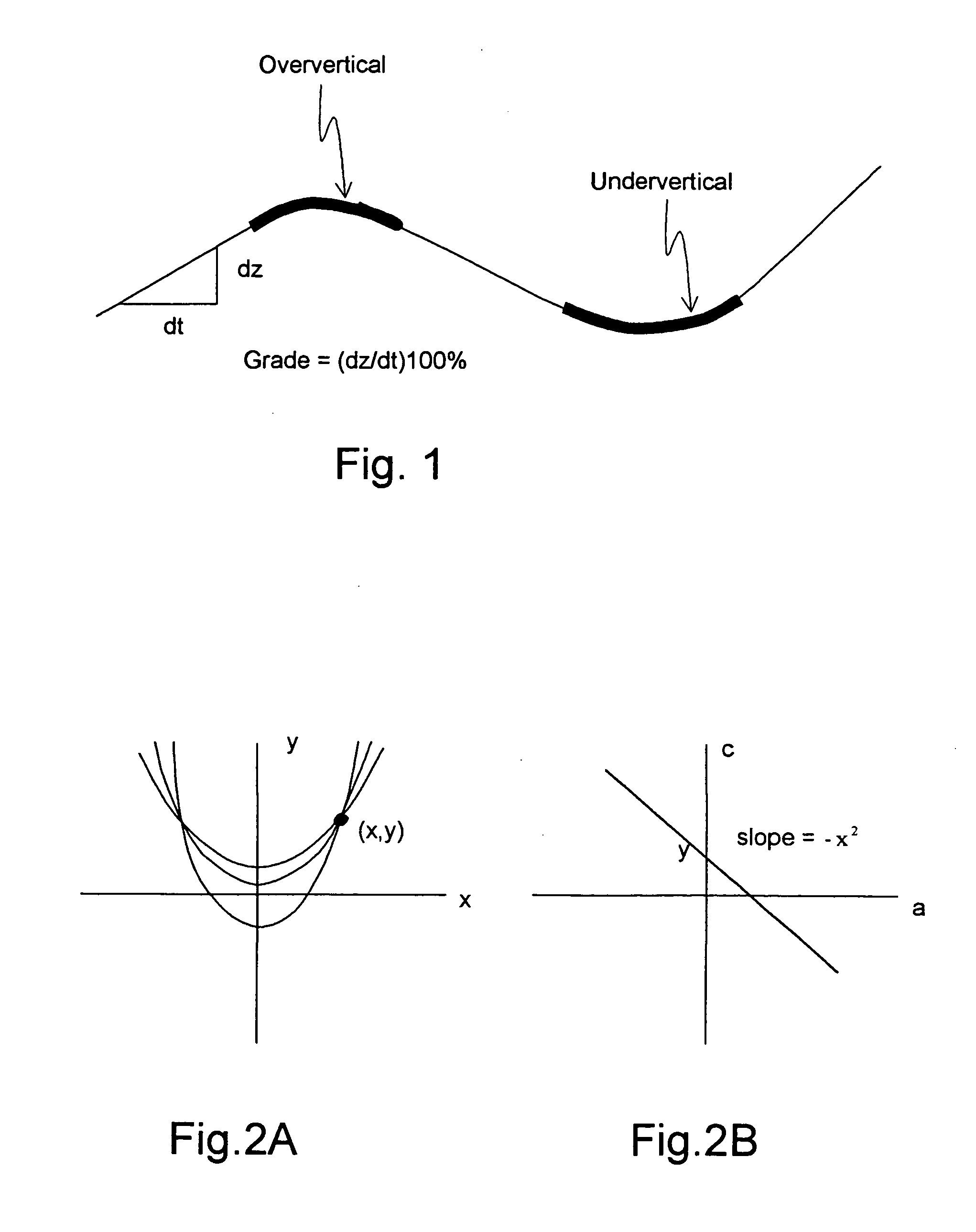
[0016] A present embodiment relates to a way to represent the vertical (i.e., altitudinal) component of the geometry of a road. The present embodiment provides a representation of the altitude variation in road geometry and an accurate representation of the grade and / or slope of a road. Grade is defined as the altitudinal change per unit change in horizontal distance. Grade may be expressed as a percentage.

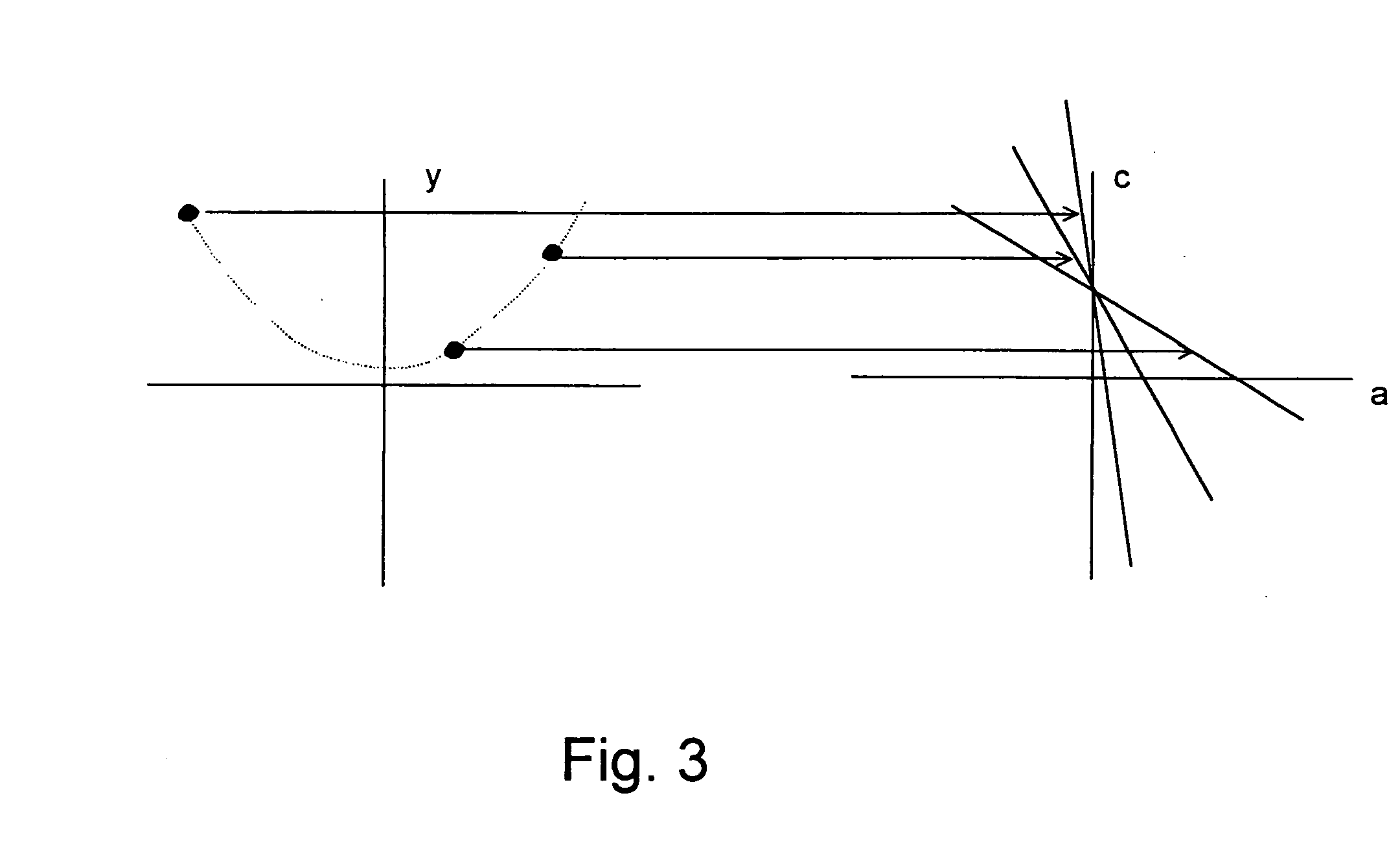
[0017] According to a present embodiment, the altitudinal component of a data representation of a road is defined using vertical curves (parabolic arcs) and constant grades (line segments). The vertical curves are used to connect s...


PUM


Abstract

A geographic database represents roads including an altitudinal component of the geometry of the roads. The altitudinal component of the geometry of roads is represented using data that indicate straight line segments and vertical curves, in particular parabolic vertical curves. The straight lines and vertical curves are determined by providing data, indicating the altitude at a plurality of locations along portions of roads, as an input to a Hough transform to determine the straight line segments and vertical curves that coincide with the portions of the roads vertically. Then, data that define the straight line segments and vertical curves are stored to represent the altitudinal component of the geometry of the portions of the roads in the geographic database. The altitudinal variation of roads is thus expressed in closed form. From this closed form representation, the slope or grade at any point along the road can be easily computed.

Description

REFERENCE TO RELATED APPLICATION [0001] The present application is a continuation of Ser. No. 09 / 970,233 filed Oct. 3, 2001, the entire disclosure of which is incorporated herein by reference. The present application is related to the co-pending application entitled “APPLICATION OF THE HOUGH TRANSFORM TO MODELING THE HORIZONTAL COMPONENT OF ROAD GEOMETRY AND COMPUTING HEADING AND CURVATURE” filed on the same date herewith, now U.S. Pat. No. 6,732,046, the entire disclosure of which is incorporated by reference herein.BACKGROUND OF THE INVENTION [0002] The present invention relates generally to geographic databases and, more particularly, the present invention relates to a way to represent the altitudinal component of road geometry in a geographic database and a method for forming the representation. [0003] Geographic databases have many uses. Geographic databases are used in navigation systems to display maps and provide route calculation and guidance. Geographic databases are also ...

Claims


Application Information

Patent Timeline
Patent Type & Authority Applications(United States)
IPC IPC(8): G06F17/00G06F7/00
CPCG06F17/30241Y10S707/99933Y10S707/99934G06F16/29
Inventor JOSHI, RAJASHRI
Owner HERE GLOBAL BV
Why Eureka
Try Eureka