

Navigation system with intersection and three-dimensional landmark view
- Summary
- Abstract
- Description
- Claims
- Application Information
AI Technical Summary
Benefits of technology
Problems solved by technology
Method used
Image

Examples
Embodiment Construction
[0020]FIG. 1 illustrates an example vector graphic 101 obtained from a digital picture 110 taken with a camera. Digital images of points of interest may be recorded by video cameras, photo cameras, digital cameras, cellular telephone cameras, or other imaging devices. The digital images of the points of interest may be converted to a vector graphics representation and stored in a map database in the navigation system. The navigation system may then display the vector graphics representation of the points of interest on the digital map generated by the navigation system. The points of interest may include town landmarks, prominent buildings, distinctive geographical features, gas stations, museums, parks, restaurants, intersections, or any other points of interest.
[0021] The navigation system may synthesize three-dimensional models for display on the digital map using vector graphics representations of the points of interest and / or intersections. A vector graphics representation of ...
PUM
 Abstract
Description
Claims
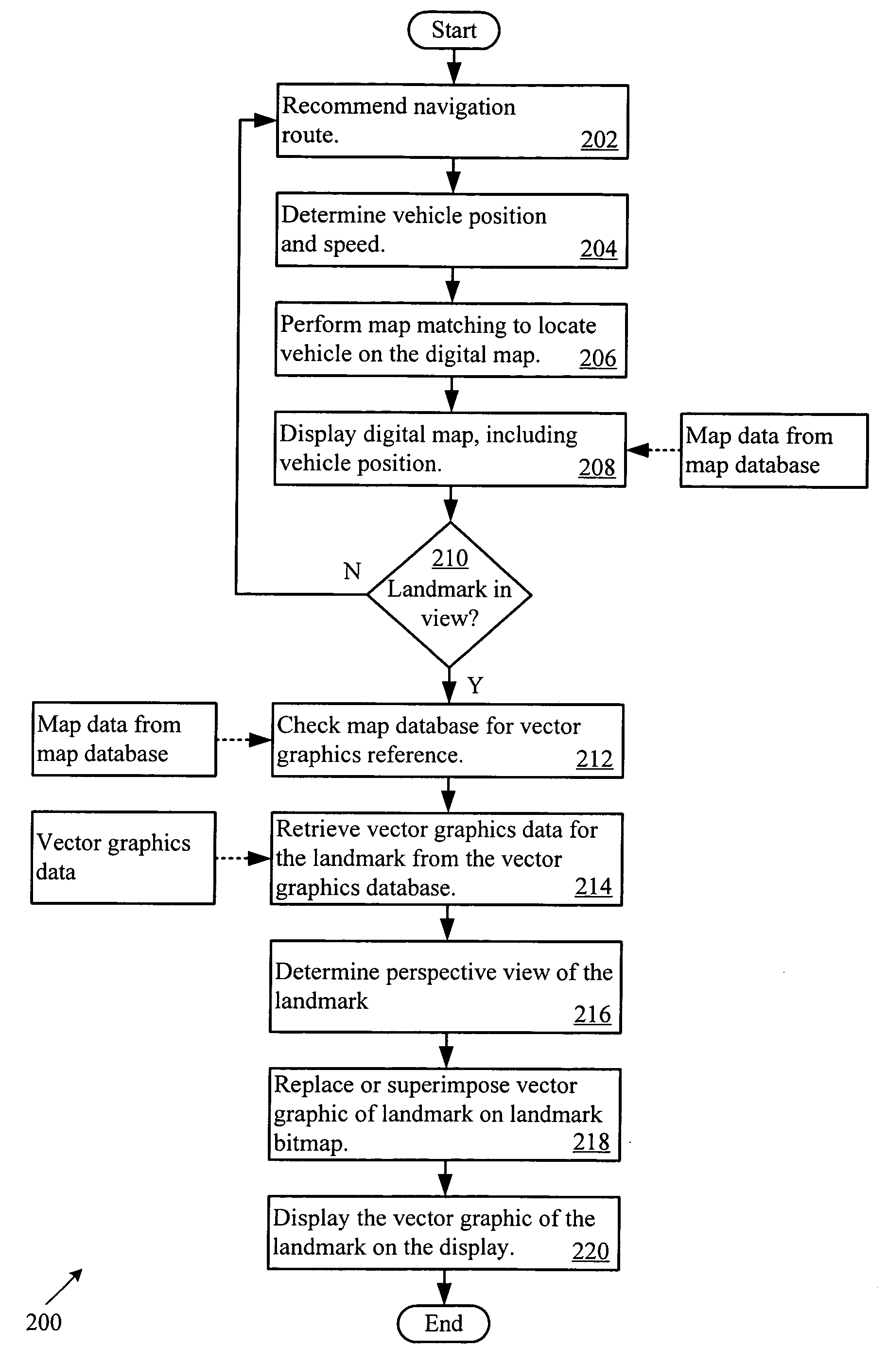
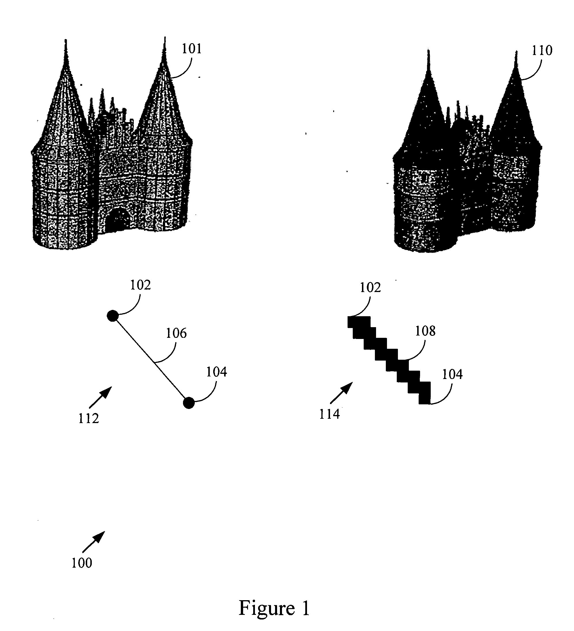
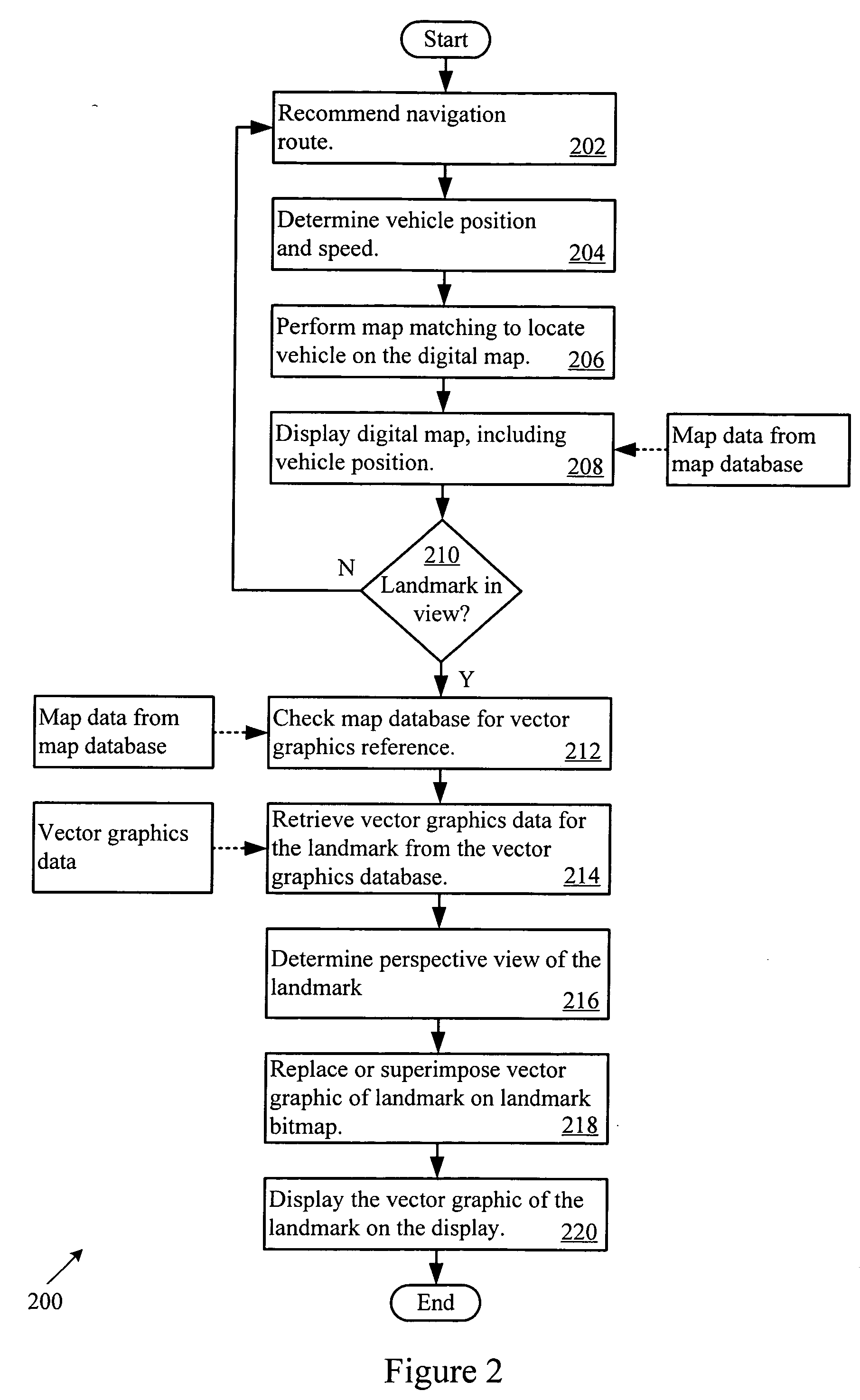
Application Information