

System and method for extending GPS to divers and underwater vehicles
a technology for underwater vehicles and gps navigation, applied in the field of underwater navigation, can solve the problems of limited utility, buoys not staying in place, and divers and underwater vehicles under water's surface are not able to utilize gps signals to accurately navigate between two points, etc., and achieve the effect of effectively extending gps to underwater users
- Summary
- Abstract
- Description
- Claims
- Application Information
AI Technical Summary
Benefits of technology
Problems solved by technology
Method used
Image

Examples
Embodiment Construction
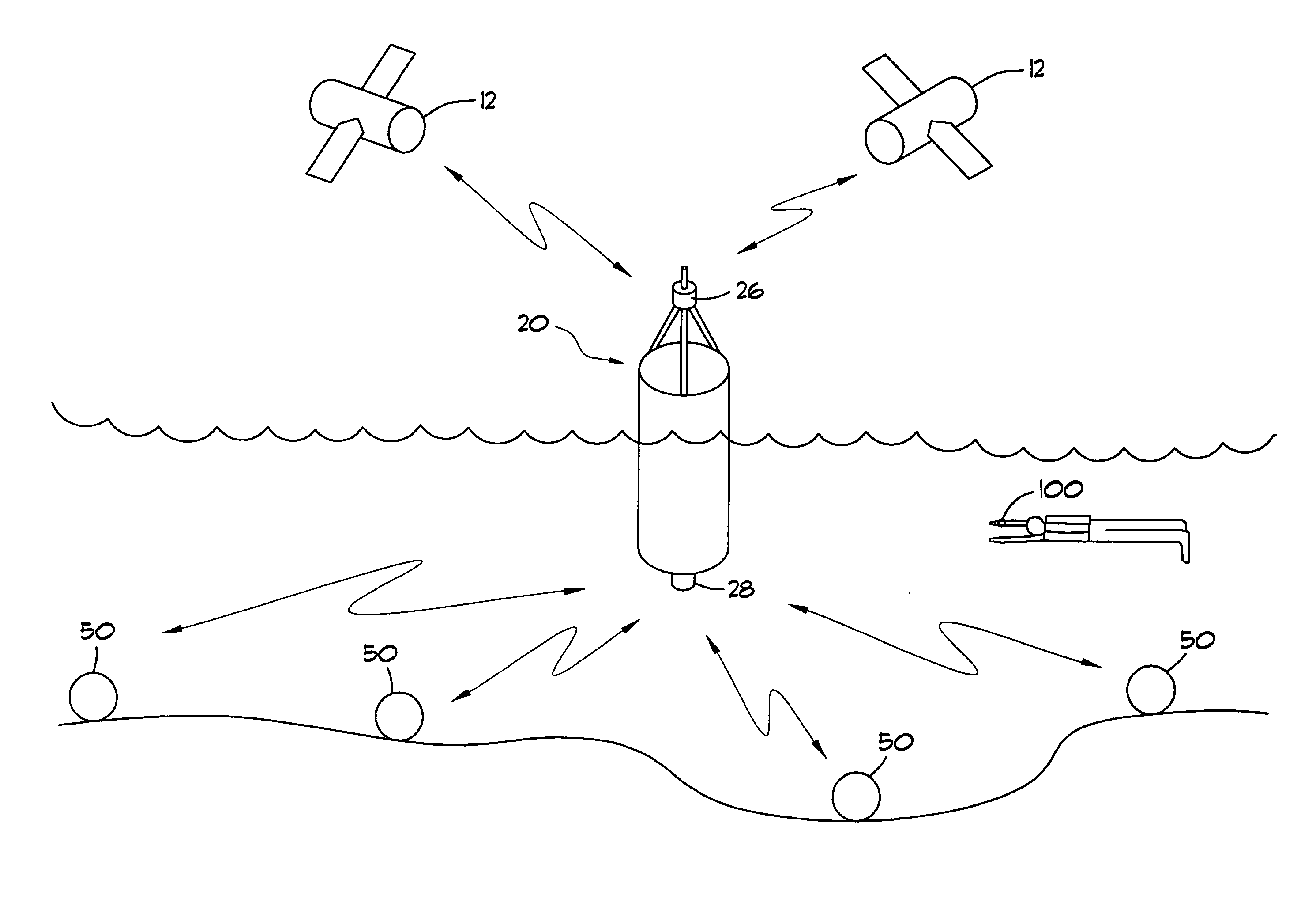
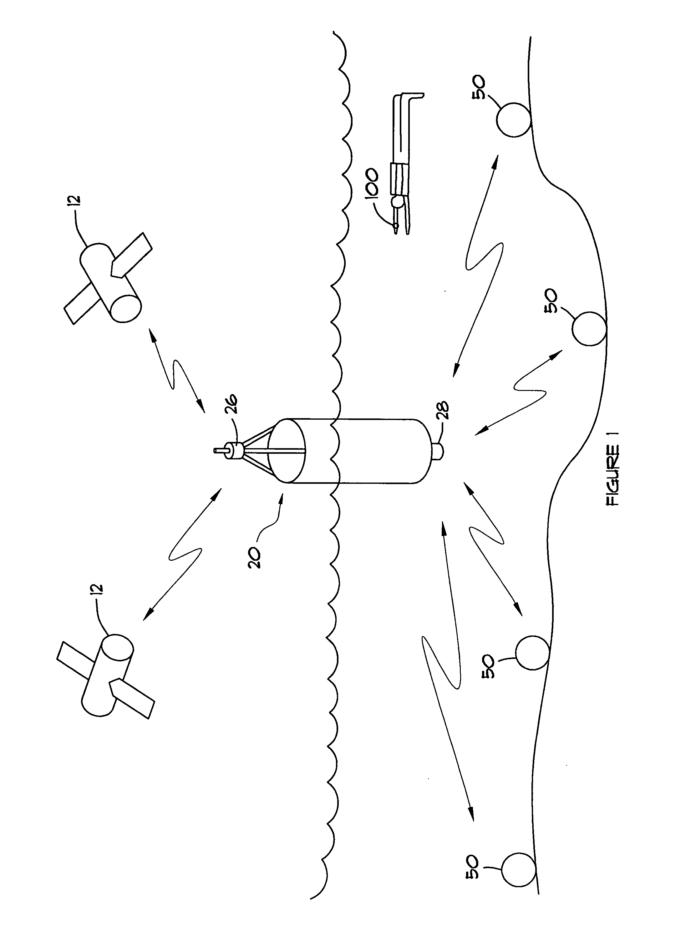
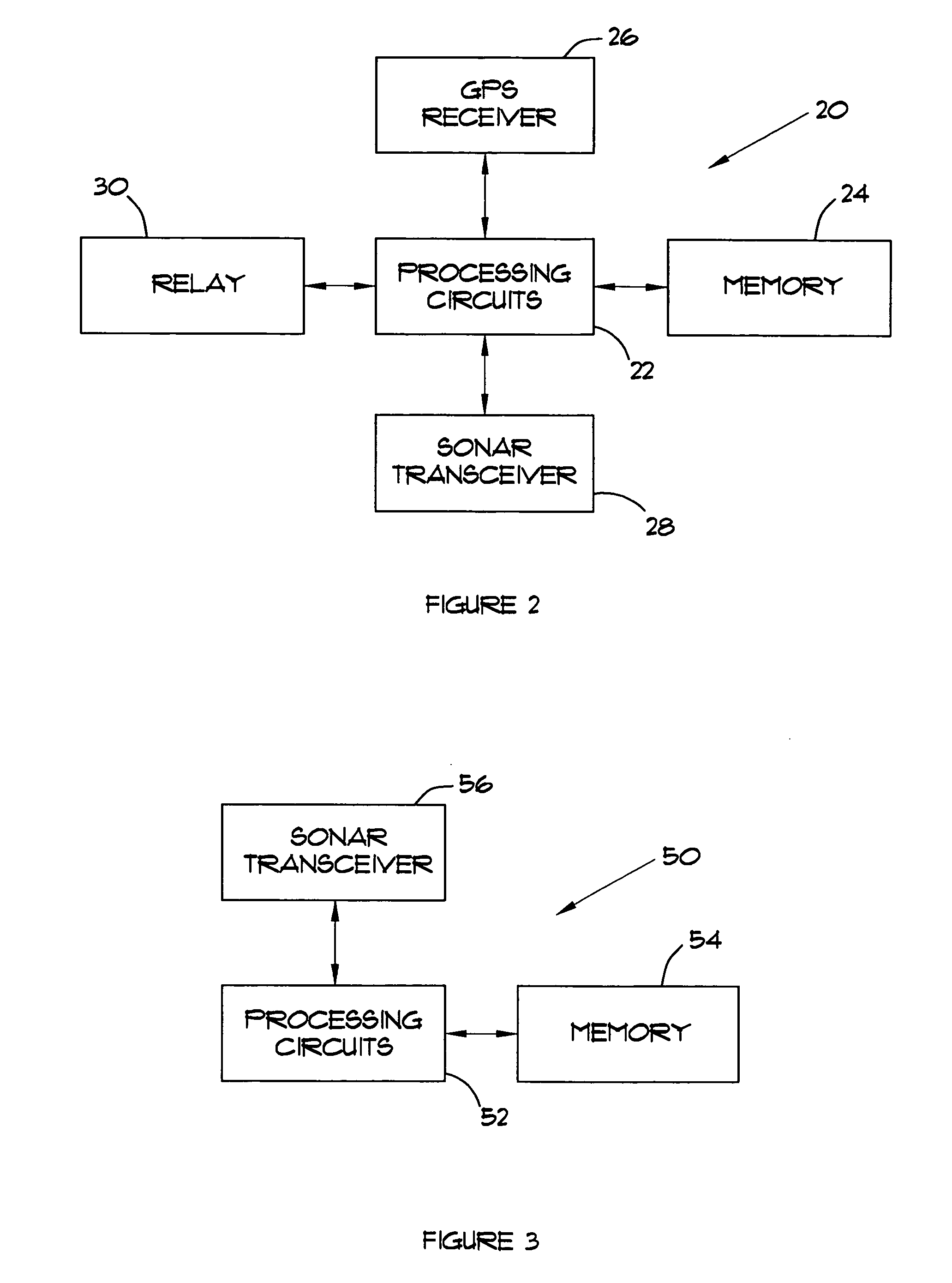
[0012] Referring now to the drawings, FIG. 1 illustrates an underwater navigation system 10 to provide navigation assistance to a diver or underwater vehicle. The underwater navigation system 10 comprises at least one surface unit 20 that communicates with earth-orbiting satellites 12 and a plurality of beacon units 50 located beneath the water's surface that communicate with the surface unit 20. The surface unit 20 includes a GPS receiver 26 for receiving GPS signals from GPS satellites 12. The surface 20 communicates with the sub-surface beacon units 50 using acoustic signals.
[0013] The beacon units 50 and surface unit 20 are dropped in an area where navigation assistance is needed. The beacon units 50 are designed to sink immediately to the ocean floor. The surface unit 20 floats on the surface long enough for the beacon units 50 to determine its positions as hereinafter described and then sinks to the bottom. While the surface unit 20 is floating on the surface, it receives GPS...
PUM
 Abstract
Description
Claims
Application Information