Method and apparatus for automated mapping cell handset location data to physical maps for data mining (traffic patterns, new roads)

a technology of location data and physical maps, applied in the direction of electrical equipment, substation equipment, eavesdropping prevention circuits, etc., can solve problems such as system errors

Inactive Publication Date: 2007-09-20
LUCENT TECH INC
View PDF10 Cites 3 Cited by
  • Summary
  • Abstract
  • Description
  • Claims
  • Application Information

AI Technical Summary

Benefits of technology

[0019] The present invention exists in the construction, arrangement, and combination of the various parts of the device, and steps of the method, whereby the objects contemplated are attained as hereinafter more fully set forth, specifically po...

Problems solved by technology

However, these systems are sometimes inaccurate because new roads are being built and routes are being changed in real time....

Method used


Image

  • Method and apparatus for automated mapping cell handset location data to physical maps for data mining (traffic patterns, new roads)
  • Method and apparatus for automated mapping cell handset location data to physical maps for data mining (traffic patterns, new roads)
  • Method and apparatus for automated mapping cell handset location data to physical maps for data mining (traffic patterns, new roads)

Examples


Embodiment Construction

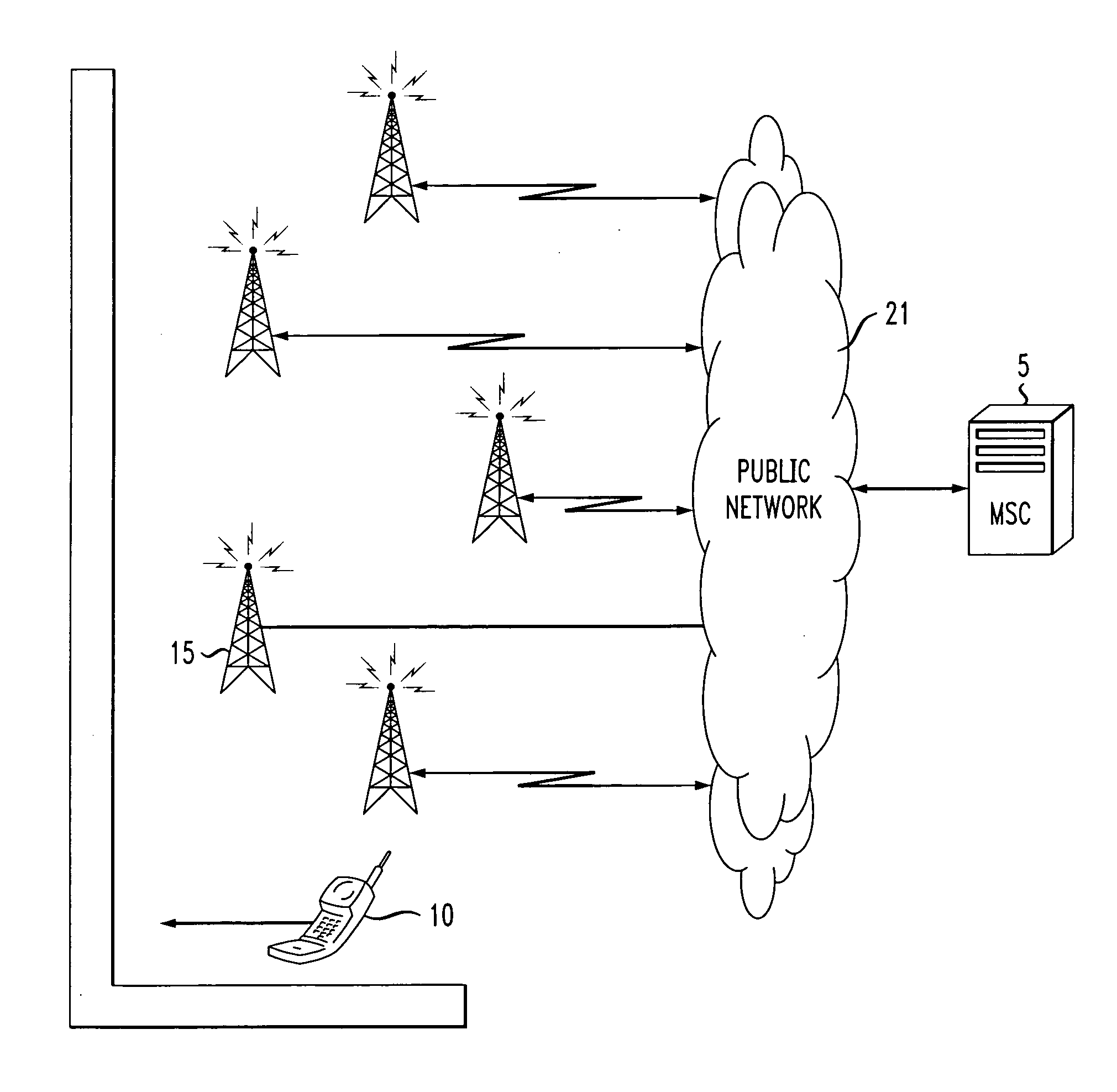
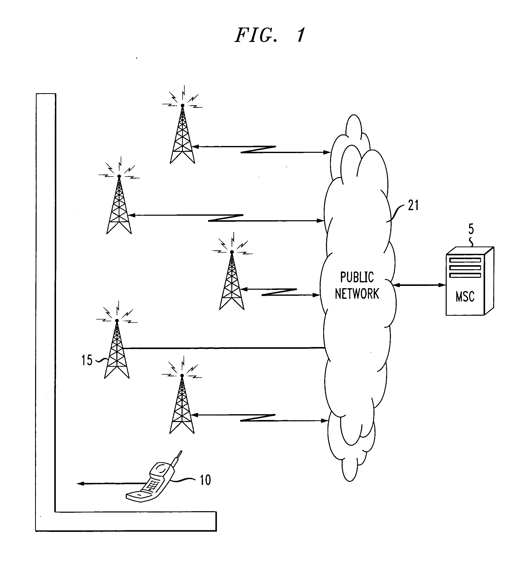
[0024] Referring now to the drawings wherein the showings are for purposes of illustrating the exemplary embodiments only and not for purposes of limiting the claimed subject matter, FIG. 1 provides a view of a system into which the present invention may be incorporated. As shown generally, FIG. 1 is a communications network infrastructure. The communications network infrastructure includes a public network 21, and mobile switching center (MSC) 5, at least one base station 15 and a mobile station 10.

[0025] The presently described embodiments include a method for automated mapping of mobile station location data to physical maps for data mining. This technique contemplates a form of tracking mobile stations for use in gaining insight into traffic patterns for the purposes of traffic navigation and mapping. In one form, this service maps the traveler's mobile stations without violating the privacy rights and concerns of the public.

[0026] Still referring to FIG. 1, the mobile station...


PUM


Abstract

A method and system for the automated mapping of a mobile station and/or handset are provided. The technique includes capturing the identification information of a mobile station, linking a unique tag to the identification information, releasing the identification information of the mobile station, while maintaining the unique tag, tracking the movement of the mobile station through the use of the unique tag and releasing the unique tag after a predetermined amount of time. This method and system could be used for mapping and data mining of traffic flow patterns. As such, this method and system will be useful in determining the amount of use a road may receive automatically, without having traffic counters. It can also be used in determining automatically when new roads have become opened. Furthermore, this data could be used for foot traffic flow through a building.

Description

BACKGROUND OF THE INVENTION [0001] This disclosure relates to a method and apparatus for gathering mobile station information and more particularly to a method and system for automated mapping of mobile station location data to physical maps. [0002] While the invention is particularly directed to the art of cellular mobile station location data mapping, and will be thus described with specific reference thereto, it will be appreciated that the invention may have other useful fields of application. For example, the invention may be used for mining traffic patterns and / or automated traffic counters. [0003] By way of background, many governments and organizations gather and interpret traffic information manually. These organizations use human sources, such as traffic counters, to measure the amount of traffic that may pass through a given area. This information is often sent to a database in order to be interpreted by traffic engineers. This information is then gathered and interpreted...

Claims


Application Information

Patent Timeline
IPC IPC(8): H04M3/16
CPCH04W8/16
Inventor PFLEGING, GERALD W.WILKIN, GEORGE PAUL
Owner LUCENT TECH INC
Why Eureka
Try Eureka