Map data utilization apparatus

Inactive Publication Date: 2008-04-03
DENSO CORP
View PDF9 Cites 31 Cited by
  • Summary
  • Abstract
  • Description
  • Claims
  • Application Information

AI Technical Summary

Benefits of technology

[0009]By using the map data utilization apparatus, map data of the specific area in the map is appropriately updated at a suitable timing without inquiring of the user about a map data acquisition timing for updating map data. Thus, only the specific area of the map data is maintained to be the latest version with a reduced cost and time for communication in comparison to the update of the map data of a whole map.
[0010]The comparison timing of the ve

Problems solved by technology

Therefore, the map data stored in the navigation system is kept un-updated when the user does not transmit a request for a newer version of the map data despite of an issuance of the newer version of

Method used


Image

  • Map data utilization apparatus
  • Map data utilization apparatus
  • Map data utilization apparatus

Examples


modification example 1

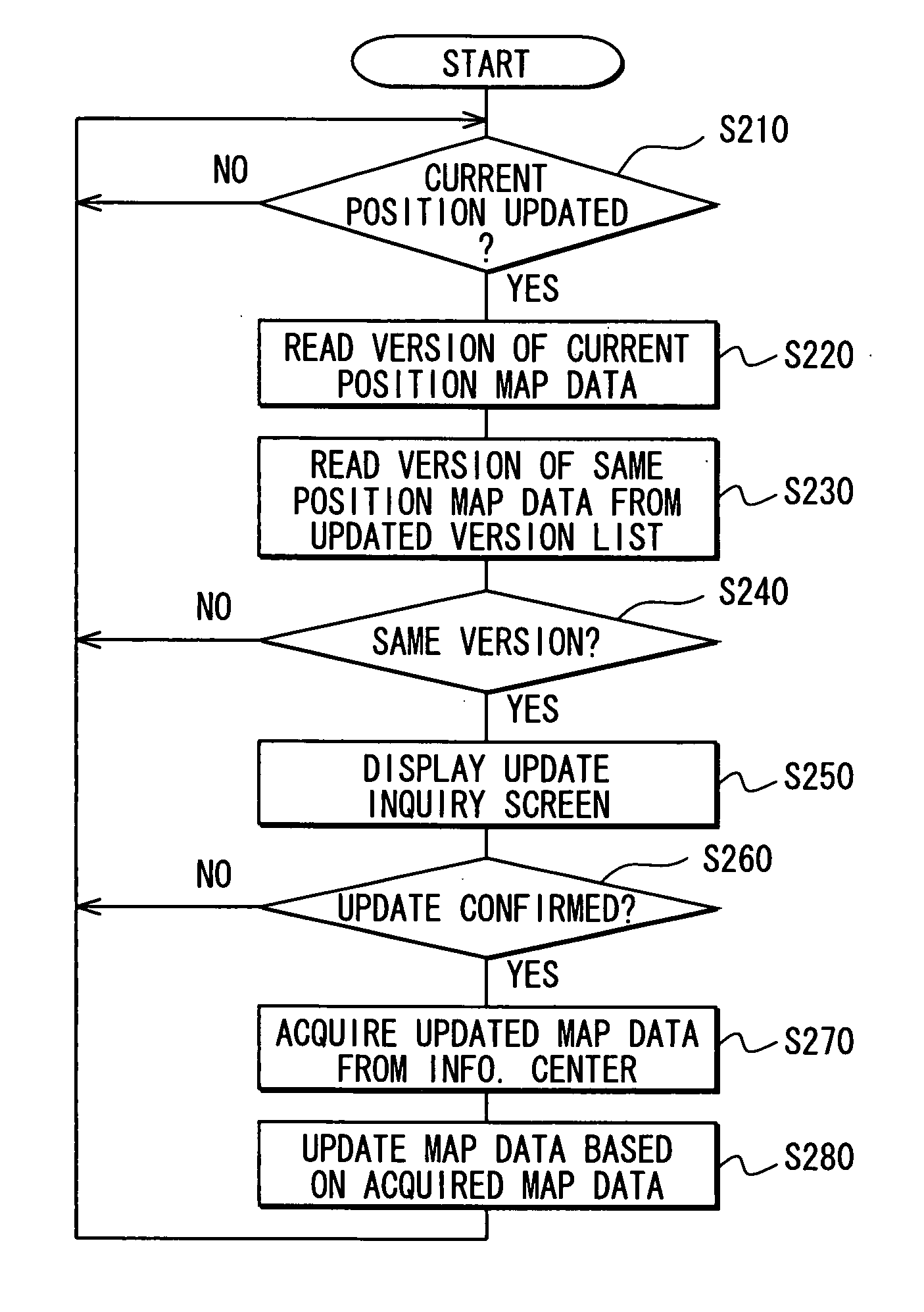
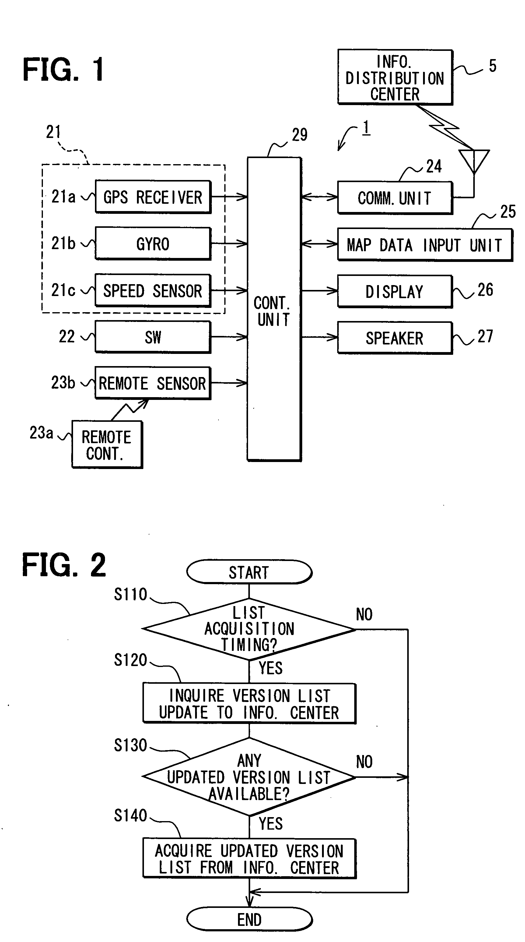
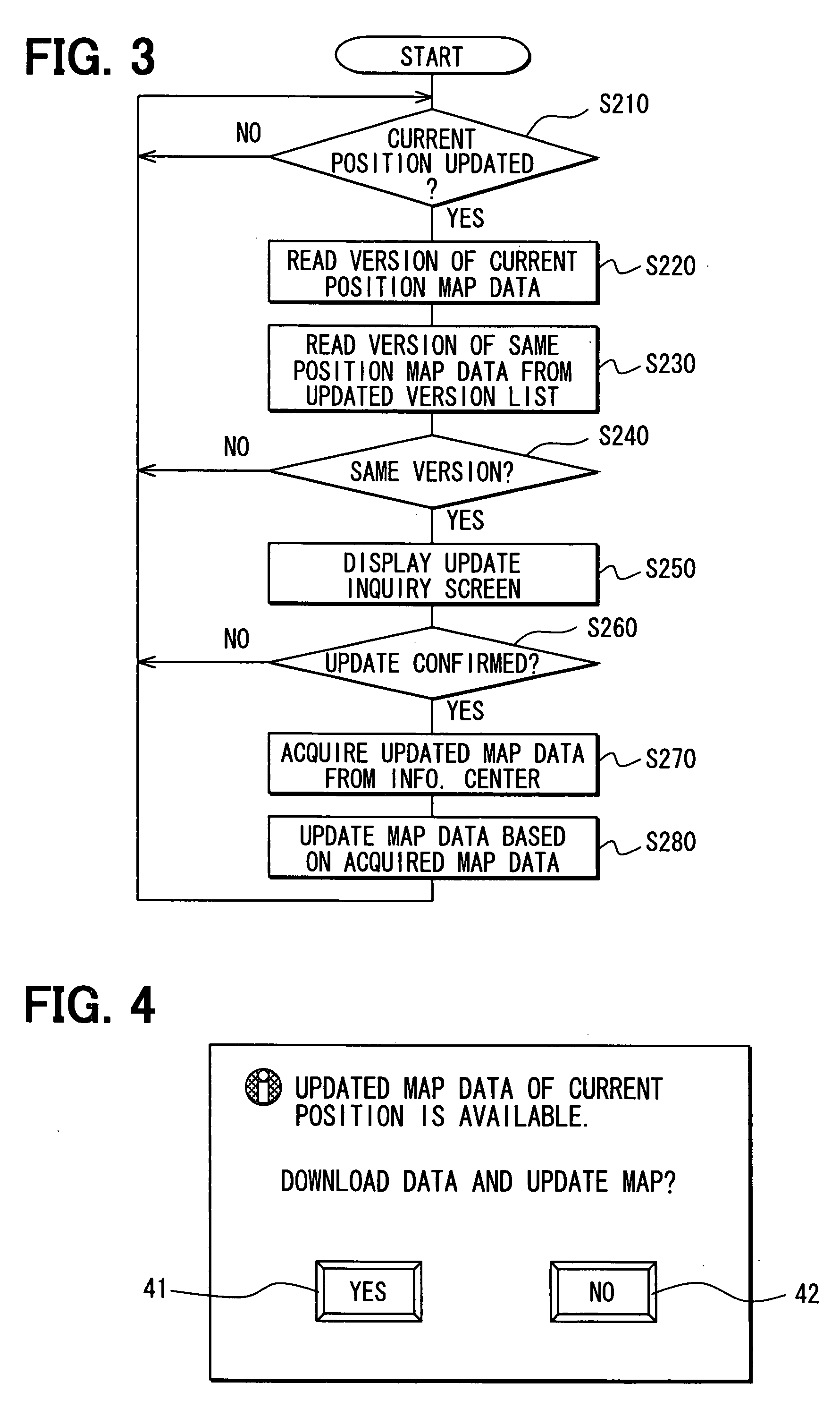
[0048]When POI information is provided for the user or POI is used as a destination in the route guidance upon having a POI setting regarding specific facilities, a place or the like from the user, the timing when the user inputs the POI may be used as the map data update timing and the area including the POI may be specified as the update area. In this case, in step S210 of the flowchart in FIG. 3, an input for specifying the POI from a user is determined, and in step S220, the version information of the map data corresponding to an area including the POI is read out. The following process handles the area including the POI as the update area.

[0049]In this way, the map data of the area including the POI is always maintained to be the latest condition for the convenience of the user when the user searches the POI information, or when the user sets the destination.

modification example 2

[0050]The update timing may be set to the timing when the geographical range of the map displayed on the display unit 26 changes, and the area including the display range after the change may be set as the update area.

[0051]In this case, the change of the display range includes cases such as a jump of the display range from the current display range to another range, a scrolling of the current display range gradually toward another range or the like. The former case is the one that the user sets a point to be included in the display range, or that the scale of the map is changed to the user-specified magnitude, or the like. The latter case is the one that, for example, the display range is changed according to the change of the current vehicle position, or that the display range is gradually changed according to the user operation of an arrow key or the like for changing the display range.

[0052]In this case, in step S210 in the flowchart in FIG. 3, whether the geographical range of ...

modification example 3

[0054]Further, the Modification 1 and 2 may be combined with the map data update process in the embodiment above. That is, in step S210 in the flowchart in FIG. 3, the update of the current vehicle position (in the above embodiment) as well as the POI input instruction (Modification 1) and the change of the geographical range of the displayed map (Modification 2) may be determined, and in step S220, the version information of the map data of the area that corresponds to each of the conditions described above may be read out. The update area may be set to the area that satisfies the condition set in step S210 for performing the process described above thereafter.


PUM


Abstract

A map data utilization apparatus retrieves a version information of map data for a specific area when a current position of a vehicle is updated. Then, the version information of the map data of the specific area is compared with a version information of the map data of an identical area in a version list that is retrieved in advance for map data updating. When the version of the map data in the version list is different from the one of the map data of the specific area, an inquiry screen is displayed on a display unit for inquiring a user whether the map data is updated. When an update is instructed by the user, map data update data is acquired from an information center, and the map data of the specific area is updated by using the map data update data.

Description

CROSS REFERENCE TO RELATED APPLICATION[0001]The present application is based on and claims the benefit of priority of Japanese Patent Application No. 2006-271823 filed on Oct. 3, 2006, the disclosure of which is incorporated herein by reference.FIELD OF THE DISCLOSURE[0002]The present disclosure generally relates to a map data utilization method and apparatus for use in a vehicle.BACKGROUND INFORMATION[0003]Conventionally, a navigation system that executes various processes based on map data in a storage medium is, for example, capable of updating the map data in the storage medium by acquiring a newer version of the map data through a communication with an external resource. In this manner, the usability of map data utilization apparatus including the navigation system is improved.[0004]Japanese patent document JP-A-2003-315054 discloses a navigation system that updates map data by receiving a newer version of the map data of a predetermined area from an external data center for an...

Claims


Application Information

Patent Timeline
IPC IPC(8): G01C21/34G01C21/00G06F17/30
CPCG01C21/32G01C21/3889G01C21/3896G01C21/3859
Inventor KIMURA, HIROKI
Owner DENSO CORP
Why Eureka
Try Eureka