

Data Presentation for Navigation System
a data presentation and navigation system technology, applied in the field of navigation systems, can solve the problems of increasing the scope of map data changes required, reducing compatibility with older map data sets, and unnecessarily inflated result sets, so as to reduce the processing time of route calculations and reduce storage space requirements
Inactive Publication Date: 2008-12-18
MITAC INT CORP
View PDF12 Cites 24 Cited by
- Summary
- Abstract
- Description
- Claims
- Application Information
AI Technical Summary
Benefits of technology
[0012]U.S. Pat. No. 5,285,391A, U.S. Pat. No. 6,473,770B and EP0838663A all disclose vehicle navigation systems in which the map data has been pre-processed to ef
Problems solved by technology
As a result of result duplication, multiple entries in a results list are effectively referring to the same road (although different segments of it) and so the size of the result set is unnecessarily inflated necessitating the user wading through more results than is strictly necessarily.
It would be possible to manually pre-process the map data to clump equivalent results together under a generic name however, this would reduce compatibility with older map data sets and increase the scope of map data changes required when map data is periodically updated.
This problem occurs when multiple results which are actually separate roads close by each other are merged into a single entry in a results list by virtue of the fact that they have the same name and the same combination of area names.
In summary there are two main problems that cause results to be included in a results list that make little sense t
Method used
View moreImage
Smart ImageViewing Examples

Examples
 PUM
 Abstract
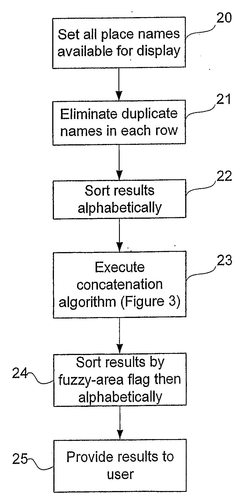
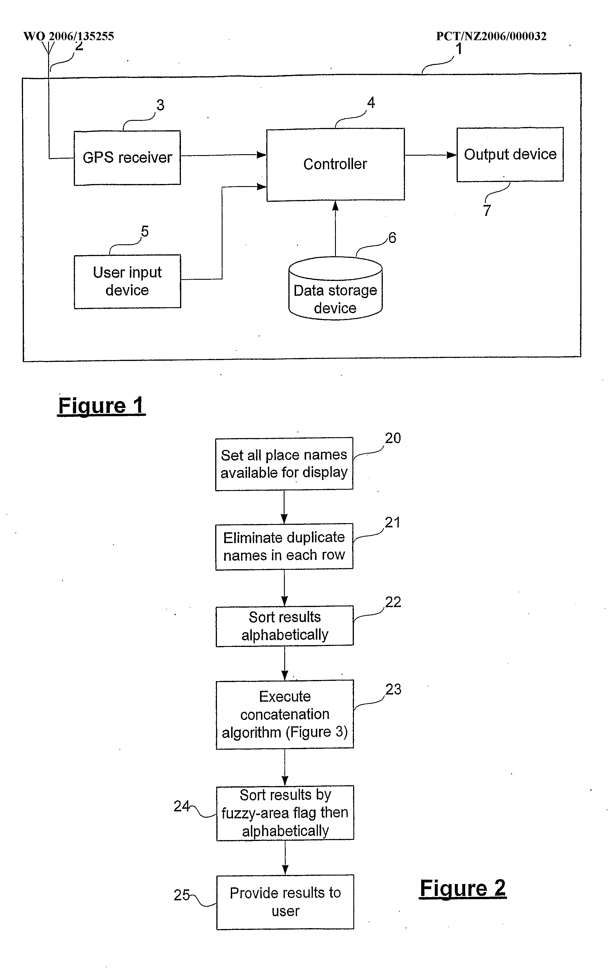
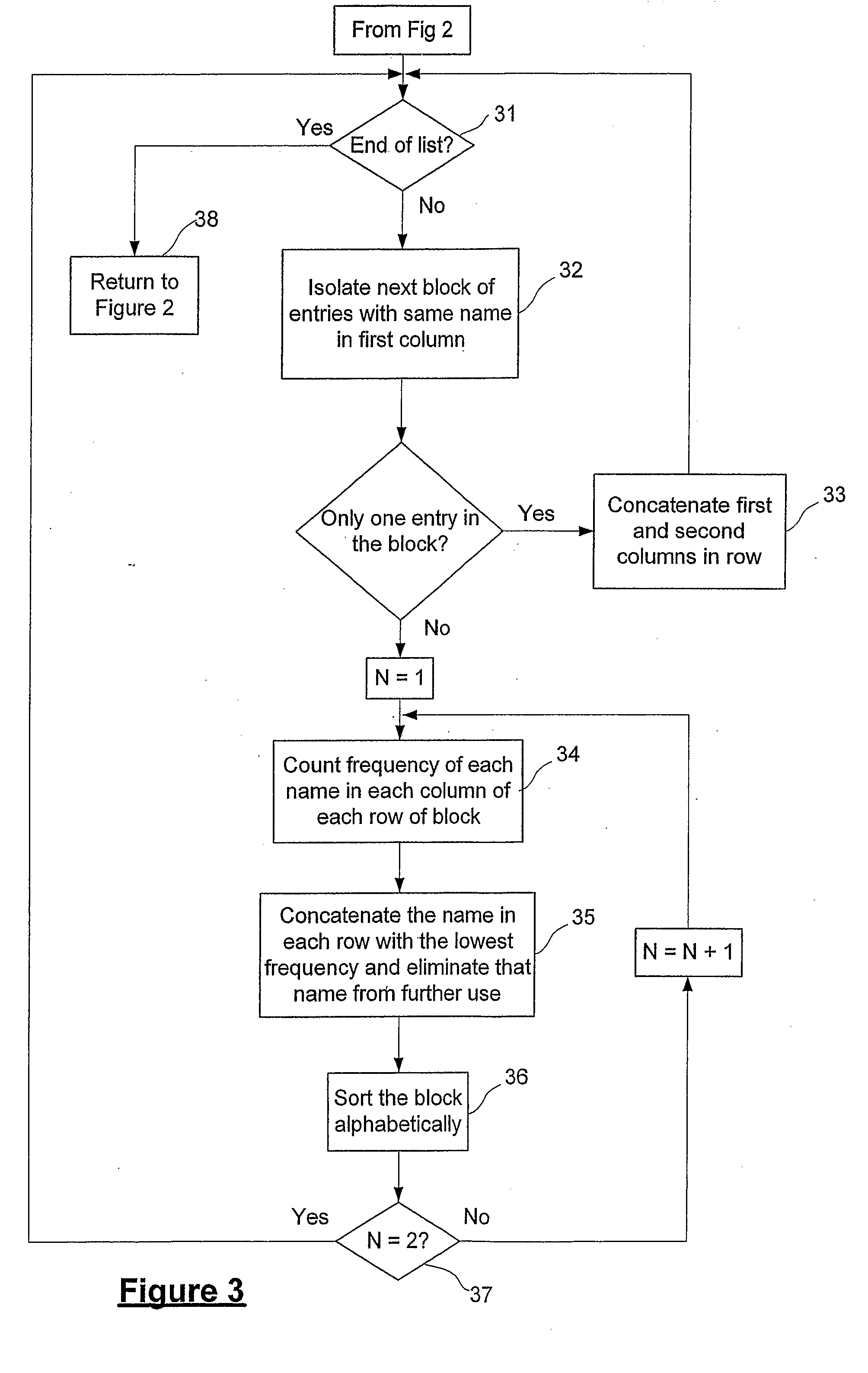
An in-car navigation system (1) which, in response to a user query, outputs a modified list of results aimed at making it easier for a user to locate the intended result. In one aspect, the navigation system selectively merges together different matching results. In another aspect, the system decides which fields from each matching entry should be displayed in the results list so that the displayed results may be easily differentiated from one another by the user. In a further aspect, the system provides a country- or region-specific address presentation format so that a user may be presented with a full address in a manner which is typical of the country or region in which the address is found.
Description
BACKGROUND TO THE INVENTION[0001]1. Field of the Invention[0002]This invention relates to navigation systems and in particular, though not solely, to methods and apparatus for dynamically improving the search interface (or “map engine”) of a personal or vehicle navigation system so that, based upon a standard map data information file, the results of a search for a place name or location by a user are more concise, less ambiguous, more meaningful, and / or presented to the user in a more appropriate format for that user.[0003]2. Background Art[0004]Navigation systems such as personal or vehicle (or “in-car”) navigation systems usually utilise a GPS receiver and map data to determine a vehicle's current location. The position determined by the GPS receiver is combined with digital map data describing the environment within which the vehicle is positioned to provide a user with navigational information. For example, from the digital map data, the navigation system may create and display...
Claims
Login to View More Application Information
Patent Timeline
 IPC IPC(8): G01C21/36
CPCG01C21/3611
InventorBROADBENT, MATTHEW JOHNCALLAGHER, BRUCE MATTHEW
OwnerMITAC INT CORP