General Map Web Interface

a web interface and map technology, applied in the field of general map web interface, can solve problems such as poor design

Inactive Publication Date: 2012-03-22
RAYTHEON CO
View PDF1 Cites 7 Cited by
  • Summary
  • Abstract
  • Description
  • Claims
  • Application Information

AI Technical Summary

Benefits of technology

[0007]An additional advantage of the GMWI is that it is web based. Thus, application programs running on other systems can inject their data onto a map via the Internet, even if they are not on the same server or even in the same location as the GIS. This allows for data sharing between different local or remote systems.
[0008]An additional advantage of the GMWI is that it is programming language independent. Thus application programs written in one language can communicate with GIS systems written in another language. Further, more than one application program or more than one GIS can all intercommunicate, even when the various application programs are written in different languages and the various GISs are written in different programming languages.

Problems solved by technology

That would be a poor design, requiring separate software development for each GIS used with the application program.

Method used


Image

  • General Map Web Interface
  • General Map Web Interface
  • General Map Web Interface

Examples


Embodiment Construction

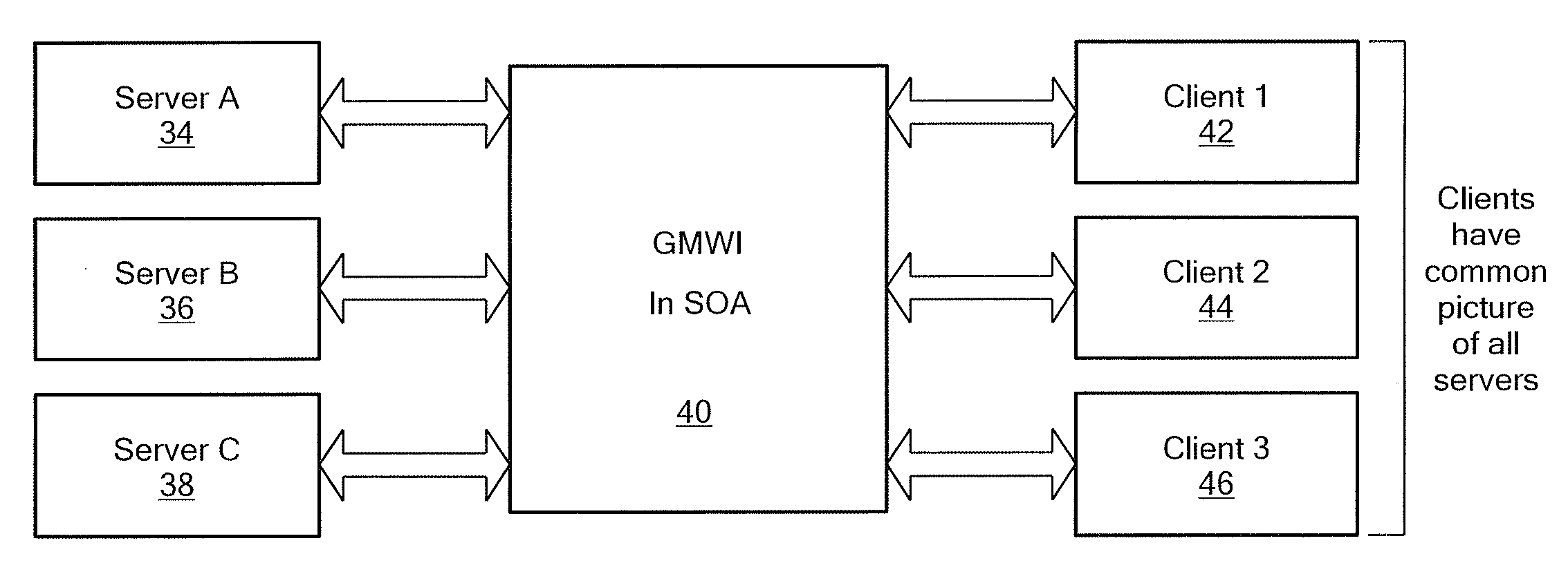
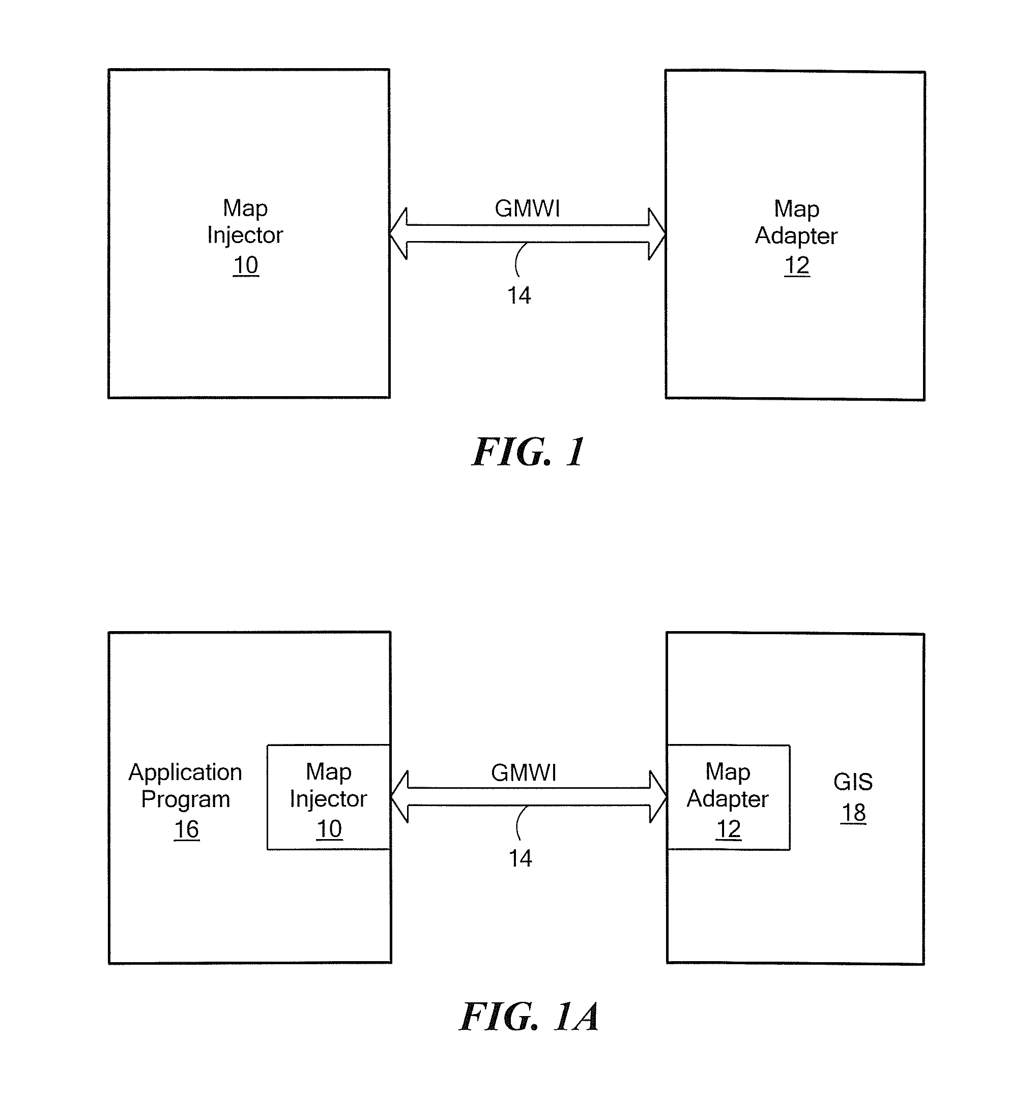
[0025]Referring now to FIG. 1, the general map web interface (GMWI) 14 defines an interface between two different software elements: (1) a map injector 10; and (2) a map adapter 12. The bi-directional arrow 14 in the figure shows that two way communication between the map injector and map adapter is compliant with the GMWI format. The map injector is a data provider for the map adapter. The map adapter processes the data being sent from the map injector. The GMWI also defines an interface from the map adapter back to the map injector, which allows the map injector to be notified of any changes or actions that the map adapter has performed or of any user actions, such as clicking on an object in the GIS or clicking on a menu item, performed on the map adapter.

[0026]Referring now to FIG. 1A, the map injector 10 and map adapter 12 provide a means for an application program 16 to interface with a GIS 18. Specifically, the map injector is integrated into the application program and the m...


PUM


Abstract

A data processing system including one or more geographic information systems (GISs) and one or more application programs, in which a common interface supports communication between multiple application programs and multiple GISs. The application programs and GISs may be implemented in different programming languages. Communication may occur in the same physical computer, or locally, or over an Internet.

Description

FIELD OF THE INVENTION[0001]This application relates to Geographic Information Systems (GISs) and more particularly to a method and apparatus for interfacing a plurality of GIS's with a pplurality of application programs.BACKGROUND OF THE INVENTION[0002]As is known in the art, a geographic information system (GIS) such as Google Earth integrates hardware, software, and data for capturing, managing, analyzing, and displaying all forms of geographically referenced information. In the simplest terms, a GIS is the merging of cartography, statistical analysis, and database technology. GIS systems are used for many purposes, including cartography, remote sensing, land surveying, public utility management, natural resource management, geography, urban planning, emergency management, navigation, and localized search engines.[0003]As is also known in the art, an application program may require the capability to interchange data between itself and a GIS. For that purpose, the application prog...

Claims


Application Information

Patent Timeline
Patent Type & Authority Applications(United States)
IPC IPC(8): G06F17/30G06F9/44
CPCG06F8/24G06T17/05G06F17/30241G06F9/54G06F16/29
Inventor KIRALY, DAVID A.BHARGAVA, MANJARIJEWELL, GREGORY M.SCARBOROUGH, BENJAMIN C.
Owner RAYTHEON CO
Why Eureka
Try Eureka