Camera-based position location and navigation based on image processing

a technology of image processing and position location, applied in wave based measurement systems, instruments, television systems, etc., can solve the problems of satellite navigation no longer being possible, low resolution of position location, and inability to accurately predict the position of a new position,

Active Publication Date: 2012-07-12
QUALCOMM INC
View PDF9 Cites 128 Cited by
  • Summary
  • Abstract
  • Description
  • Claims
  • Application Information

AI Technical Summary

Benefits of technology

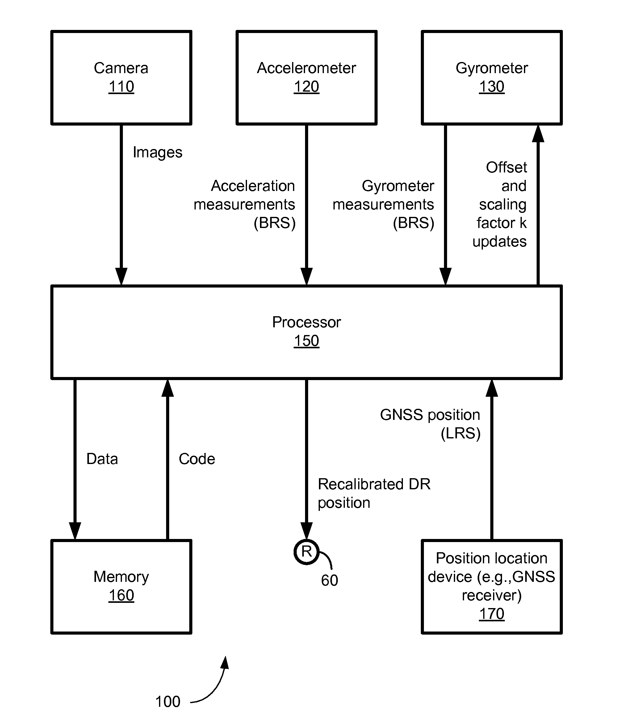
[0011]Disclosed is an apparatus and method for determining a position of a mobile device and for recalibrating a dead-reckoning system based on one or more images.

Problems solved by technology

Unfortunately, cellular-based techniques often result in a position location having a low resolution and an unacceptable high level of uncertainty.
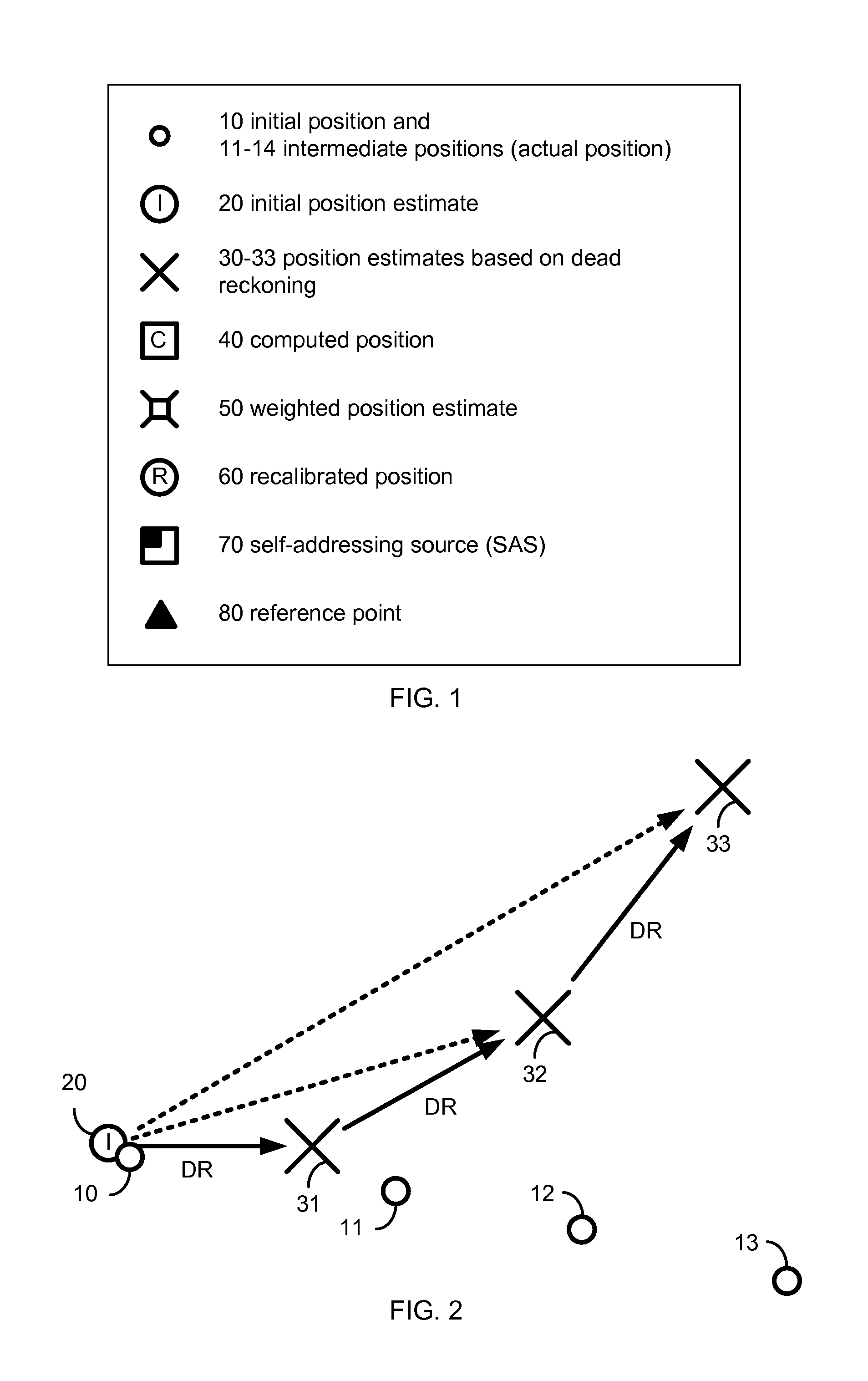
Each new position estimate also accumulates position error from current inertial measurements with errors from past position estimates.
While indoors or in an urban canyon, satellite-based navigation may no longer be possible because GNSS signals are fully or partially blocked.
These radio techniques may be difficult to model and may require extensive calibration and measurements across a large number of sampled positions within building (e.g., a measurement may be taken at least once within every square meter to map building) and may still result in low precision or low resolution position estimates.

Method used


Image

  • Camera-based position location and navigation based on image processing
  • Camera-based position location and navigation based on image processing
  • Camera-based position location and navigation based on image processing

Examples


Embodiment Construction

[0032]The detailed description set forth below in connection with the appended drawings is intended as a description of various aspects of the present disclosure and is not intended to represent the only aspects in which the present disclosure may be practiced. Each aspect described in this disclosure is provided merely as an example or illustration of the present disclosure, and should not necessarily be construed as preferred or advantageous over other aspects. The detailed description includes specific details for the purpose of providing a thorough understanding of the present disclosure. However, it will be apparent to those skilled in the art that the present disclosure may be practiced without these specific details. In some instances, well-known structures and devices are shown in block diagram form in order to avoid obscuring the concepts of the present disclosure. Acronyms and other descriptive terminology may be used merely for convenience and clarity and are not intended...


PUM


Abstract

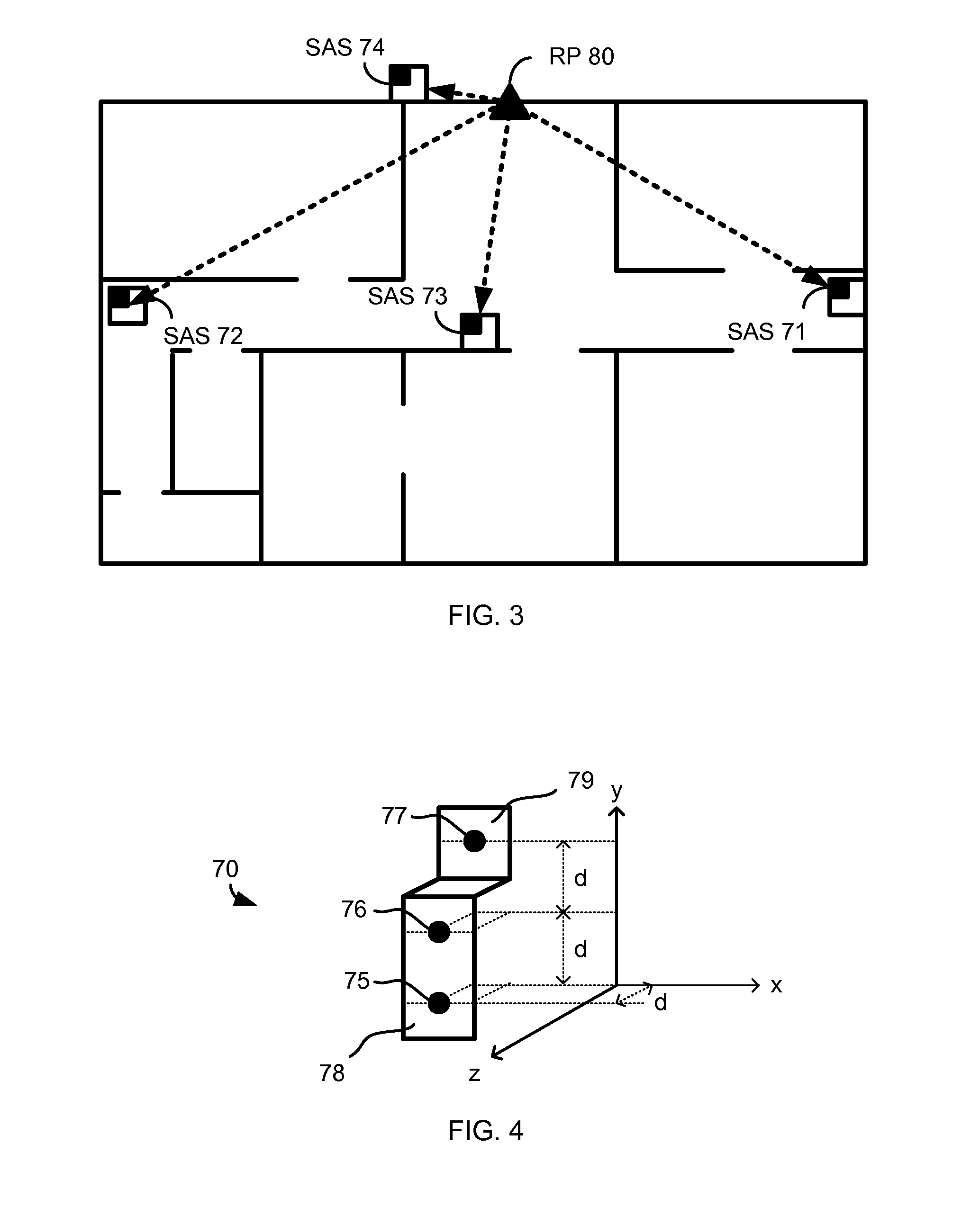
An apparatus and method for estimating a position of a mobile device based on one or more images is disclosed. Positioning information is derived from an image containing an SAS (self-addressing source such as a QR code), thereby setting a first vector V1 and an SAS pose. The image is also used to determine a displacement between the mobile device and the self-addressing source, thereby setting a second vector V2. Using the first vector V1, the SAS pose and the second vector V2, the mobile device may estimate its position with high accuracy and may also recalibrate dead-reckoning navigation and a gyrometer.

Description

CROSS-REFERENCE TO RELATED APPLICATIONS[0001]This application claims priority to and the benefit of U.S. Provisional Application 61 / 431,742 filed on Jan. 11, 2011 (Atty Docket 090498P1) titled “Navigation based on image processing”, which is incorporated by reference herein in its entirety.BACKGROUND[0002]I. Field of the Invention[0003]This disclosure relates generally to apparatus and methods for camera-based navigation based on image processing. More particularly, the disclosure relates to camera-based pedestrian navigation for indoor and urban environments, where satellite reception is unavailable, restricted, or nonexistent, based on image processing and feature interpretation.[0004]II. Background[0005]Many personal navigation devices (PNDs) include a Global Navigation Satellite System (GNSS), which receives GNSS signals and provides outdoor navigation. When GNSS signals are partially blocked, such as in an urban environment, determined position estimates deteriorates. When GNSS...

Claims


Application Information

Patent Timeline
Patent Type & Authority Applications(United States)
IPC IPC(8): H04N7/18
CPCG01S19/49G01S19/235G01S19/485G01C21/28
Inventor GARIN, LIONEL J.NAGUIB, AYMANBERGAN, CHARLES A.
Owner QUALCOMM INC
Why Eureka
Try Eureka