
Three-dimensional digital map

a digital map and three-dimensional technology, applied in the field of three-dimensional digital map system, can solve the problems of not being able to recognize the terrain located in the flight direction or at the side of the aircraft, and achieve the effect of simplifying the terrain

Active Publication Date: 2013-04-11
KOREA AEROSPACE INDUSTRIES
View PDF24 Cites 25 Cited by
  • Summary
  • Abstract
  • Description
  • Claims
  • Application Information

AI Technical Summary

Benefits of technology

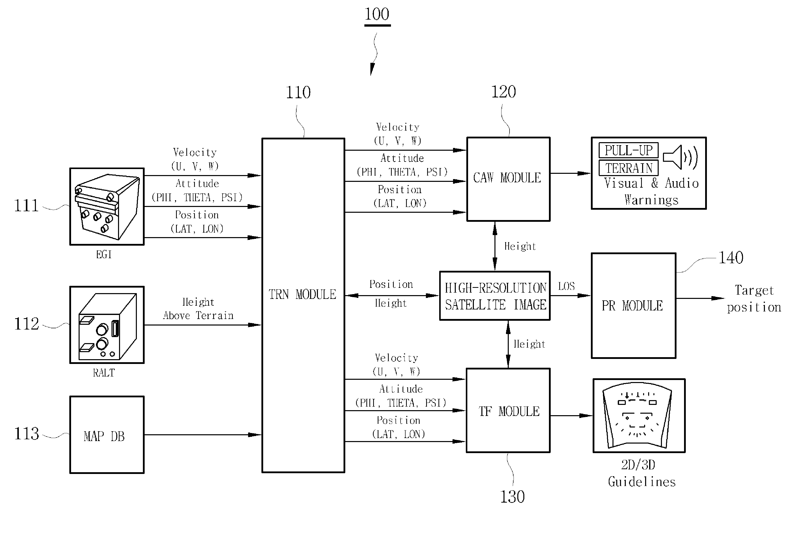
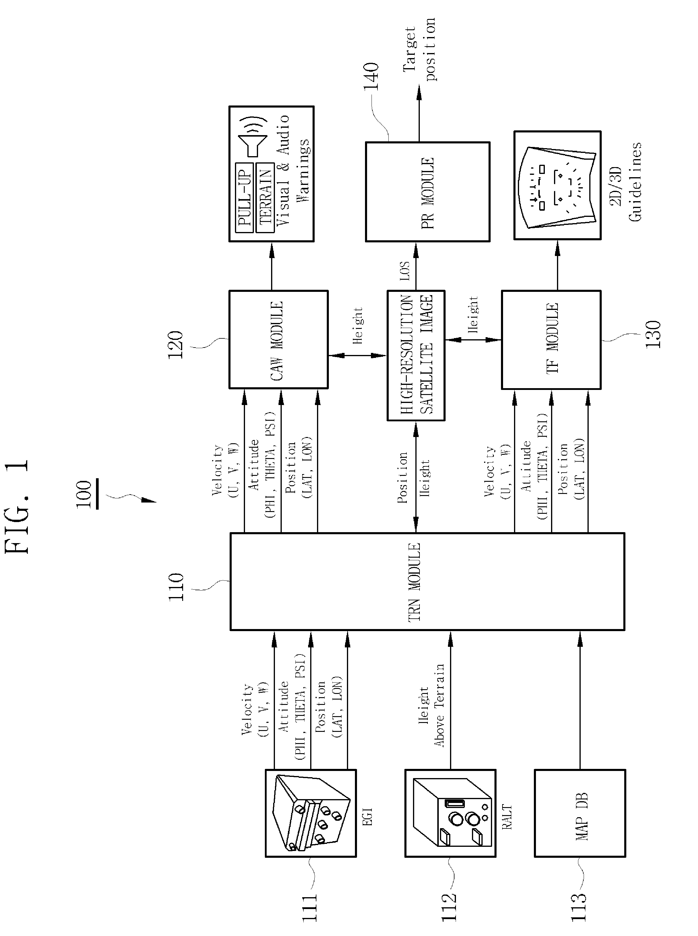
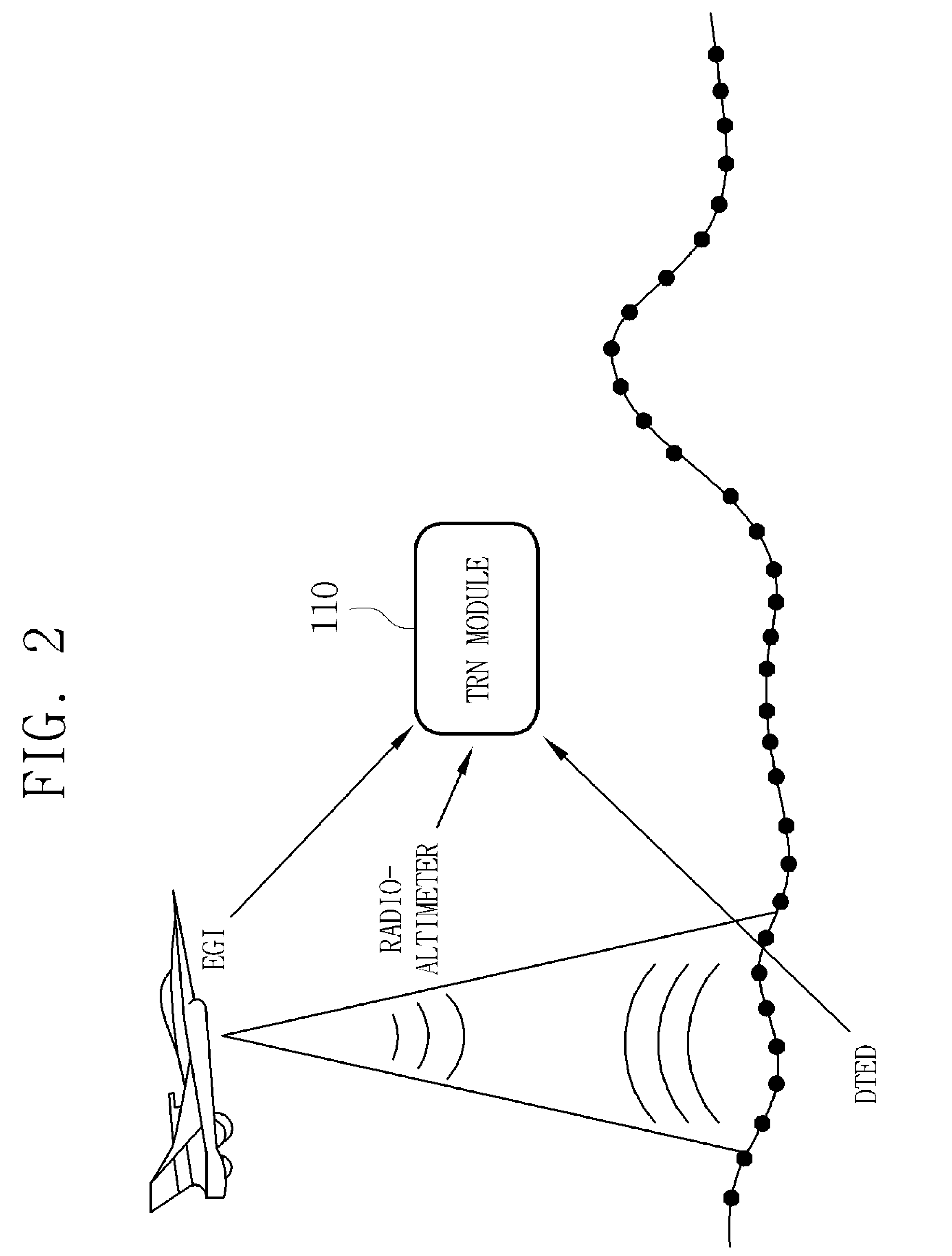
The present invention provides a 3D digital map system for implementing a navigation and ground collision preventing method using 3D terrain information. The system includes a navigation module, a collision warning module, a terrain database, an obstacle database, a terrain following module, and a passive ranging module. The navigation module receives data from EGI, a radio-altimeter, and a map database, corrects the data, and outputs it for accurate navigation computation. The collision warning module generates a warning against collision of the aircraft with the ground or an obstacle. The terrain database and the obstacle database provide information on the terrain and obstacles. The terrain following module generates a trajectory for the aircraft based on the same information. The passive ranging module receives the database and line-of-sight information of a target to calculate the distance and position of the target. The system allows for accurate navigation and prevents collisions with the environment.

Problems solved by technology

However, in the GPWS of the related art, since a radio-altimeter measures a distance between an aircraft and the ground, a terrain located under the aircraft is recognized, but an obstacle or terrain located in a flight direction or at the side of the aircraft is not recognized.

Method used


Image

  • Three-dimensional digital map
  • Three-dimensional digital map
  • Three-dimensional digital map

Examples


Embodiment Construction

[0025]Exemplary embodiments now will be described more fully hereinafter with reference to the accompanying drawings, in which exemplary embodiments are shown. The present invention may, however, be embodied in many different forms and should not be construed as limited to the exemplary embodiments set forth therein. Rather, these exemplary embodiments are provided so that the present disclosure will be thorough and complete, and will fully convey the scope of the present disclosure to those skilled in the art. In the drawings, like reference numerals denote like elements. The terminology used herein is for the purpose of describing particular embodiments only and is not intended to be limiting of the present disclosure. As used herein, the singular forms are intended to include the plural forms as well, unless the context clearly indicates otherwise. It will be further understood that the terms “comprises” and / or “comprising” when used in this specification, specify the presence of...


PUM


Abstract

Disclosed herein is a three-dimensional (3D) digital map system for implementing a navigation and ground collision preventing method using 3D terrain information. The 3D digital map system includes a terrain referenced navigation module configured to receive data from EGI (Embedded GPS / INS), a radio-altimeter (RALT) and a map database, corrects the data to perform accurate navigation computation, and outputs the corrected data, a collision avoidance warning module configured to generate a warning against collision of an aircraft with the ground or an obstacle using the corrected data, a 3D terrain database and an obstacle database, a terrain following module configured to generate a terrain following trajectory of the aircraft using the same information, and a Passive Ranging module configured to receive the 3D terrain database and line-of-sight (LOS) information of a target and calculate distance and position information of the target located on the ground.

Description

CROSS-REFERENCE TO RELATED APPLICATIONS[0001]This application claims priority to Korean Patent Application No. 10-2011-0102318 filed on Oct. 7, 2011 the contents of which are incorporated herein by reference in its entirety.BACKGROUND OF THE INVENTION[0002]1. Field of the Invention[0003]The present invention relates to a three-dimensional (3D) digital map system, and particularly, to a 3D digital map system manufactured to optimally implement a 3D map with respect to a supersonic advanced trainer (T-50).[0004]2. Description of the Related Art[0005]Most aircraft accidents are caused by aircraft personnel. 70% of these accidents are due to the pilot error. More than half of these accidents are related to Controlled Flight Into Terrain (CFIT).[0006]CTIF refers to an accident in which an aircraft is unintentionally flown into the ground, an obstacle or water under pilot control or an accident in which an aircraft collides with the ground or the surface of sea through inattention of the ...

Claims


Application Information

Patent Timeline
Patent Type & Authority Applications(United States)
IPC IPC(8): G06F17/00G08G5/04G01C21/00
CPCG01S13/94G09B29/12G09B29/007G08G5/0086G01S13/935
Inventor RYU, KWANG SUKIM, JIN BOKYANG, GYEONG SIK
Owner KOREA AEROSPACE INDUSTRIES
Learn More