System and Method for Construction Estimation Using Aerial Images
a construction estimation and aerial image technology, applied in image data processing, instruments, image enhancement, etc., can solve the problems of time-consuming and difficult use of systems, and systems often require a large amount of manual input by users
- Summary
- Abstract
- Description
- Claims
- Application Information
AI Technical Summary
Benefits of technology
Problems solved by technology
Method used
Image
Examples
Embodiment Construction
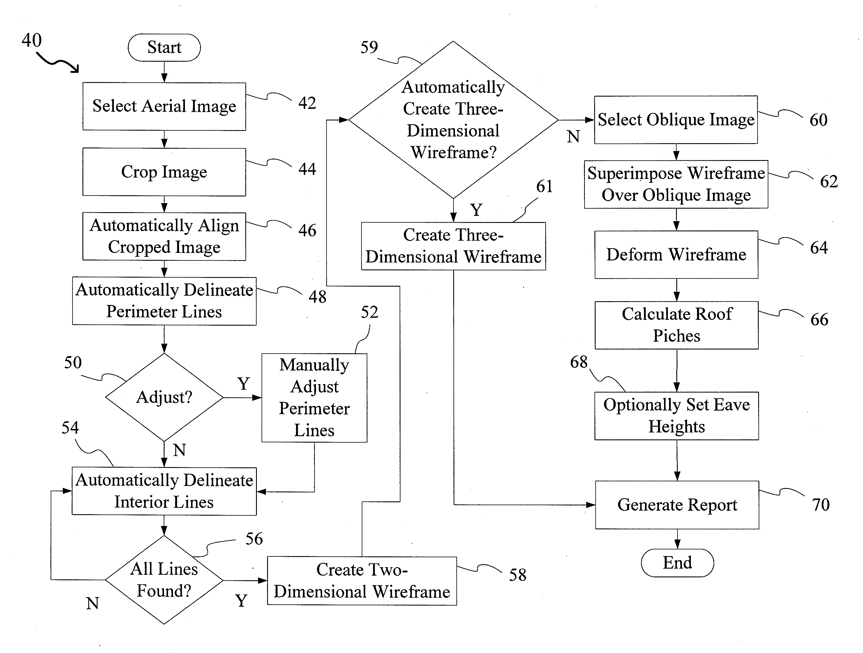
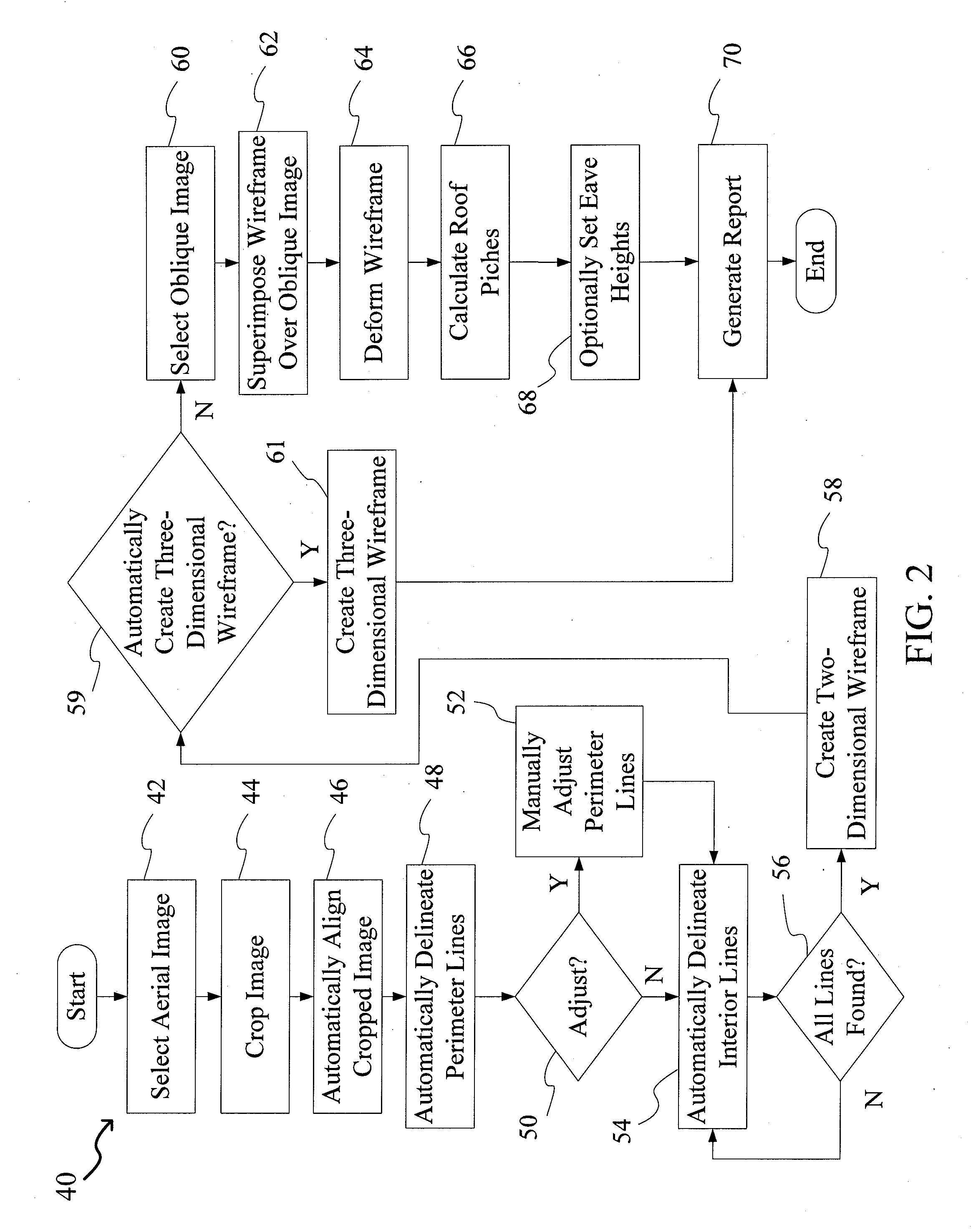
[0017]The present invention relates to a system and method for construction estimation using aerial images, as discussed in detail below in connection with FIGS. 1-6K.
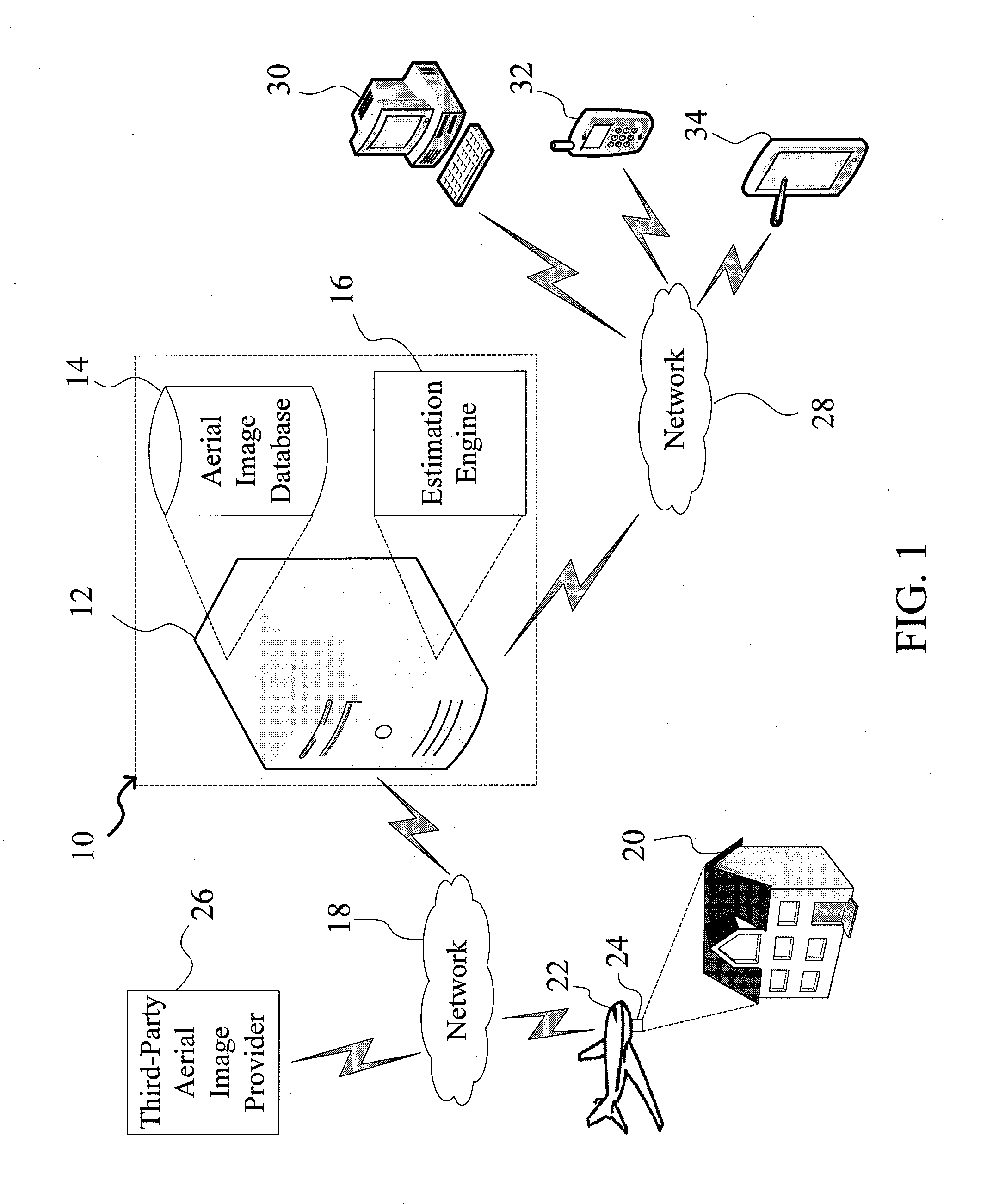
[0018]FIG. 1 is a diagram showing the system of the present invention, indicated generally at 10. The system 10 comprises a computer system 12 (e.g., a server) having an aerial image database 14 stored therein and an estimation software engine (module) 16. The database 14 could be stored on the computer system 12, or located externally (e.g., in a separate database server in communication with the system 10). As will be discussed in greater detail below, the estimation engine 16 allows users to generate three-dimensional models of roofs and buildings / structures to estimate dimensions of such structures as well as material costs and other parameters. Importantly, the estimation engine 16 allows users to easily generate such models by automatically delineating various roof structures such as eaves, hips, ridges, valleys,...
PUM
 Abstract
Description
Claims
Application Information
 - R&D
- Intellectual Property
- Life Sciences
- Materials
- Tech Scout
- Unparalleled Data Quality
- Higher Quality Content
- 60% Fewer Hallucinations
Browse by: Latest US Patents, China's latest patents, Technical Efficacy Thesaurus, Application Domain, Technology Topic, Popular Technical Reports.
© 2025 PatSnap. All rights reserved.Legal|Privacy policy|Modern Slavery Act Transparency Statement|Sitemap|About US| Contact US: help@patsnap.com


