

Flight path development for remote sensing vehicles in a moving reference frame
Active Publication Date: 2015-08-13
UNIV OF FLORIDA RES FOUNDATION INC
View PDF7 Cites 68 Cited by
- Summary
- Abstract
- Description
- Claims
- Application Information
AI Technical Summary
Benefits of technology
[0025]Embodiments of the invention relate to a method and apparatus to produce a flightplan for a sUAS. Embodiments can produce such a flightplan for a variety of environmental and/or geographical parameters. A specific embodiment produces an optimal flightplan based on one or more metrics and/or one or more assumptions or boundary conditions. Embodiments take in vehicle parameters and/or the properties of the sensor systems used for imaging, and compute a partial,
Problems solved by technology
Furthermore the capital cost of developing, launching, and maintaining a satellite precludes rapid evolution of satellite-based imagery.
When military sUAS are adapted to civilian mapping missions, the design tradeoffs of the military sUAS severely limit the performance of the systems.
While these imaging systems may be adequate for locating a man-sized object on the move from 300 m, they are less effective at geospatial data collection.
Moreover, progressive scan cameras add further image loss as compared to stills.
While more “pictures” will guarantee coverage, the use of real time video results in the need for extra processing and larger logistical footprint in exchange for the extra coverage.
Video generates large amounts of data that can be cost prohibitive to store on board the aircraft, and, therefore, the data is typically sent back to the ground via a line-of-sight radio modem.
Any break in the link between the aircraft and the recording station on the ground results in lost coverage.
Furthermore, the processi
Method used
View moreImage
Smart ImageViewing Examples

Examples
 PUM
 Abstract
Embodiments of the invention relate to a method and apparatus to produce a flightplan for a sUAS. Embodiments can produce such a flightplan for a variety of environmental and/or geographical parameters. A specific embodiment produces an optimal flightplan based on one or more metrics and/or one or more assumptions or boundary conditions. Embodiments take in vehicle parameters and/or the properties of the sensor systems used for imaging, and compute a partial, or complete, flightplan. Such a flightplan can include altitude, airspeeds, flight paths encompassing the target area, and/or the direction and/or path to turn in-between flightlines. Embodiments can improve the flight planning procedure compared to a manual process, which can be completely dependent on the operator, to implement a partially, or totally, automated process. Specific embodiments can produce a flightplan that results in the optimal data collection path.
Description
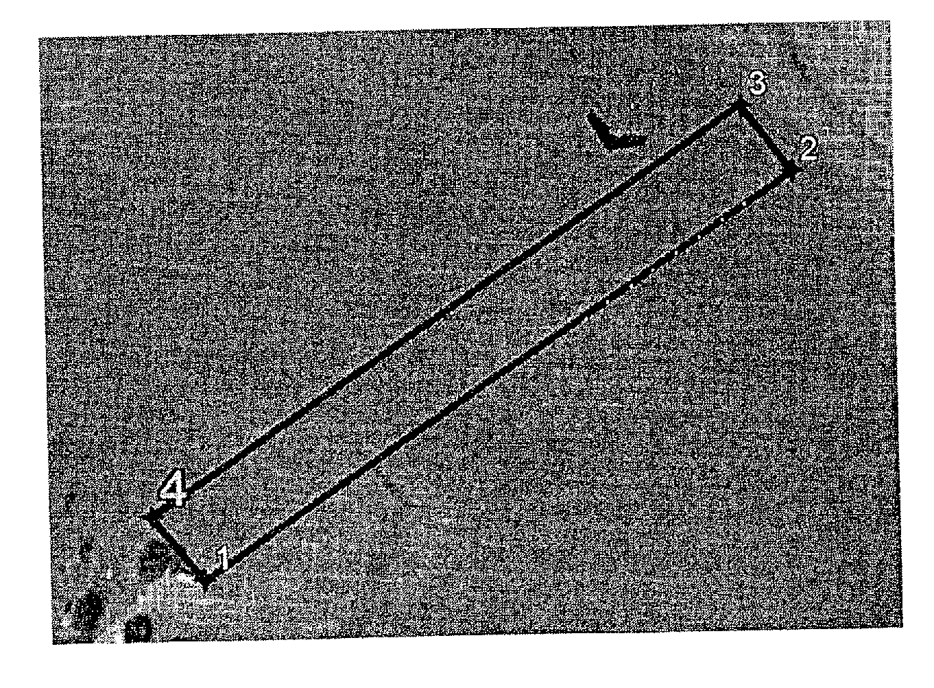
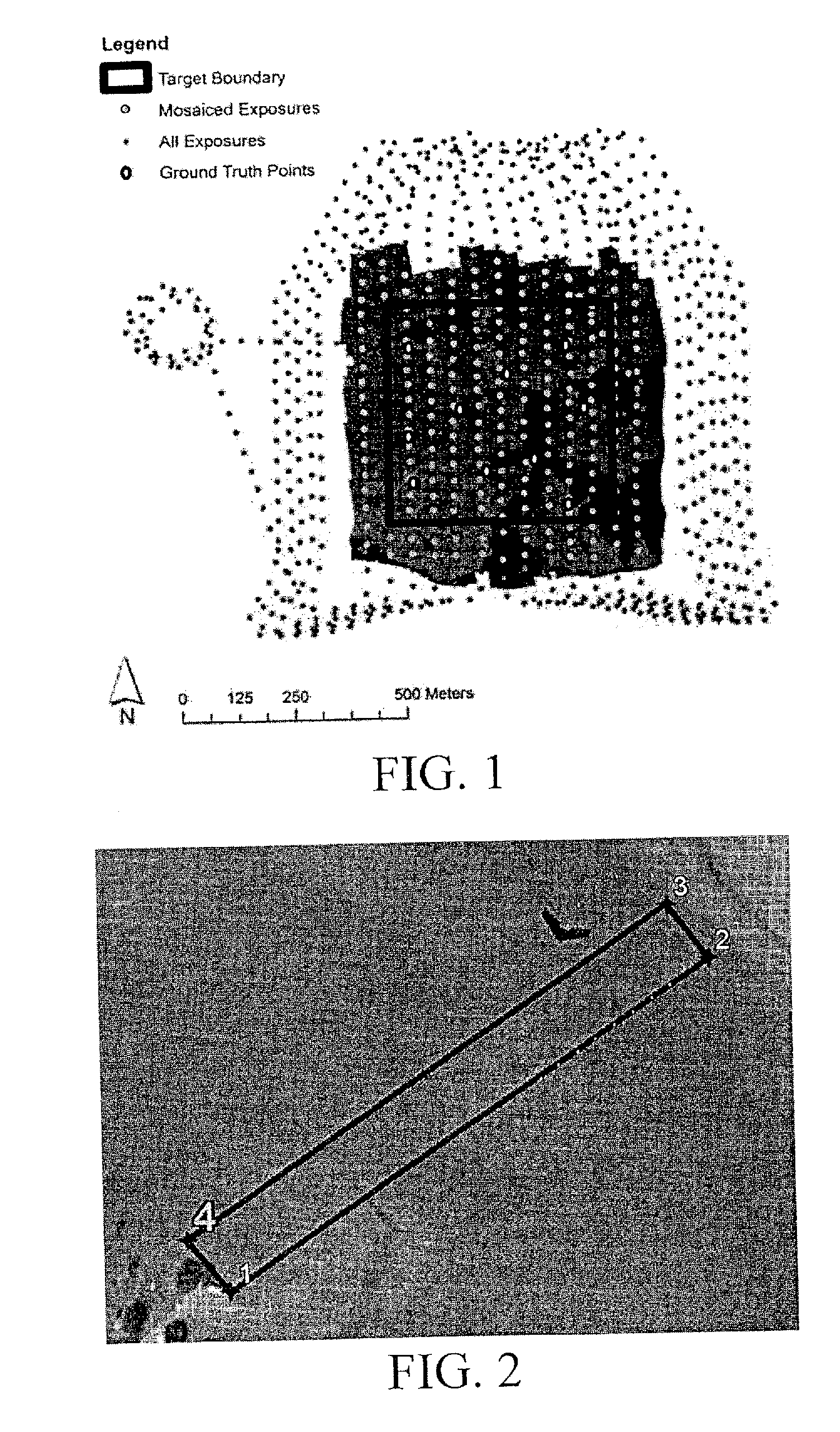
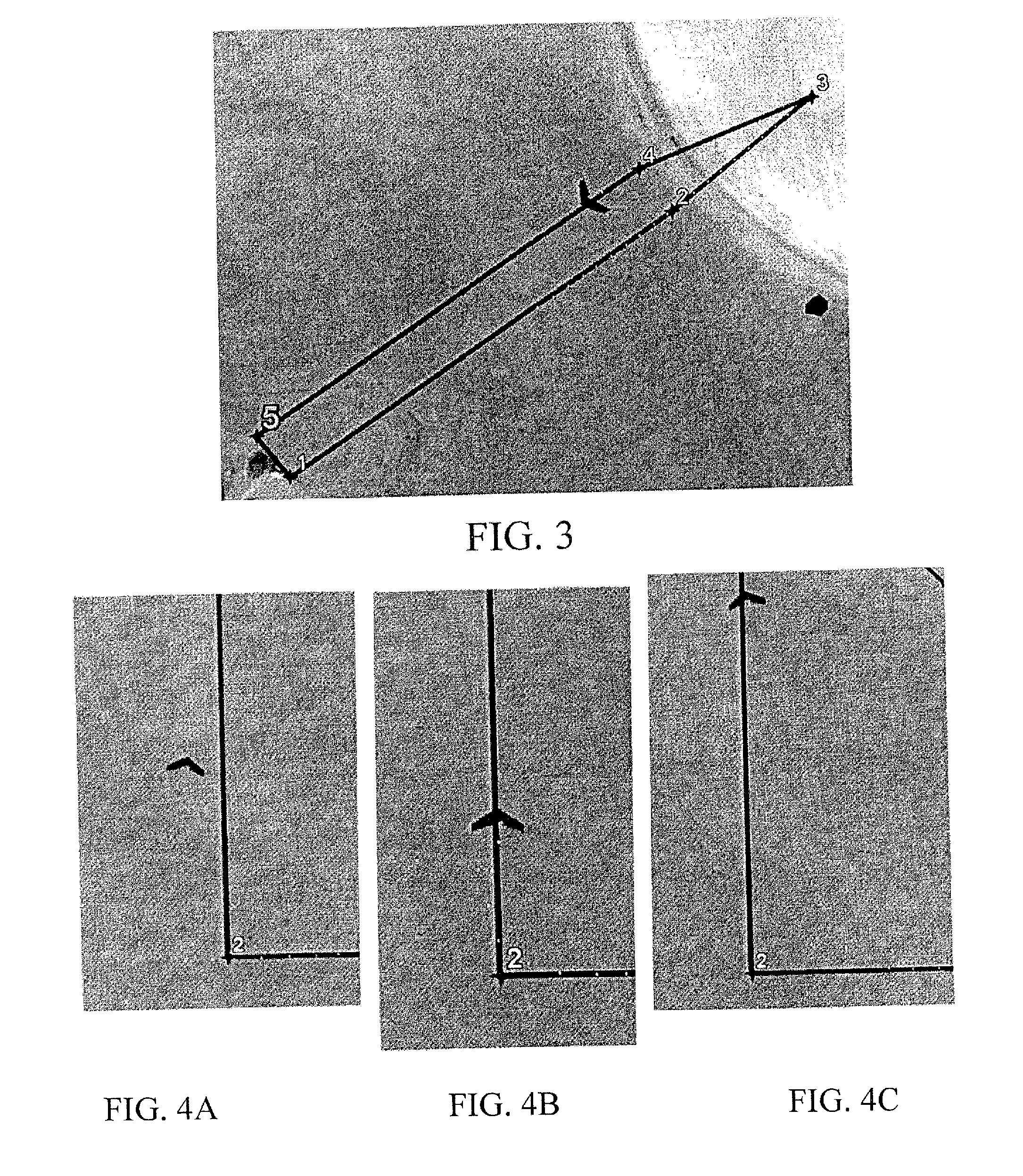
CROSS-REFERENCE TO RELATED APPLICATION[0001]The present application claims the benefit of U.S. Provisional Application Ser. No. 61 / 837,620, filed Jun. 20, 2013, which is hereby incorporated by reference herein in its entirety, including any figures, tables, or drawings.BACKGROUND OF INVENTION[0002]Remote sensing by aerial vehicles is a practice that has been around for several decades. Recent advancements in small Unmanned Aerial Systems (sUAS), paralleled with miniaturization of high quality cameras systems, has led to the development of a new platform for aerial photography and data collection. The unique flight profile of sUAS and their novelty leaves much work to be done in the area of controls research known as coverage planning. Currently the flight planning is manual and entirely dependent on an operator. Often the optimal path is counter-intuitive, either by selecting a direction for flight that is not obvious or by turning to the adjacent flightline by first turning away fr...
Claims
Login to View More Application Information
Patent Timeline
 IPC IPC(8): G01C23/00B64C39/02G01C21/10
CPCG01C23/005B64C2201/141B64C39/024G01C21/10G01C11/00G01C21/20G05D1/0005G05D1/0094G08G5/0034G08G5/0069G05D1/0202B64U2201/10
InventorRAMBO, THOMAS JEFFREY
OwnerUNIV OF FLORIDA RES FOUNDATION INC