

Method and system for crop type identification using satellite observation and weather data
a satellite observation and weather data technology, applied in the field of crop type identification, can solve the problems of crop type identification models that may have difficulty in accurately distinguishing crop types using satellite images alone, and the current approach to crop type identification using satellite images by themselves is not very accura
- Summary
- Abstract
- Description
- Claims
- Application Information
AI Technical Summary
Benefits of technology
Problems solved by technology
Method used
Image

Examples
Embodiment Construction
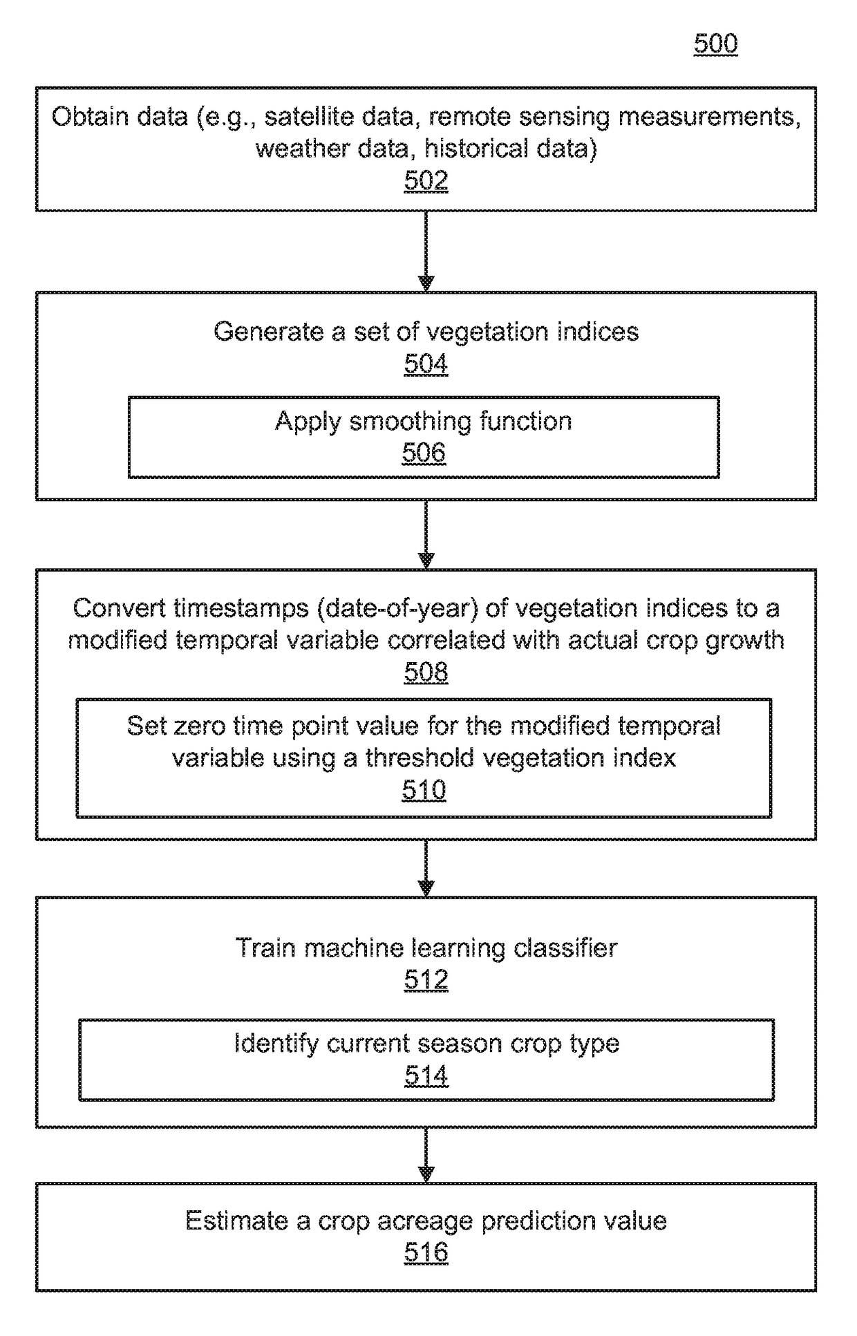
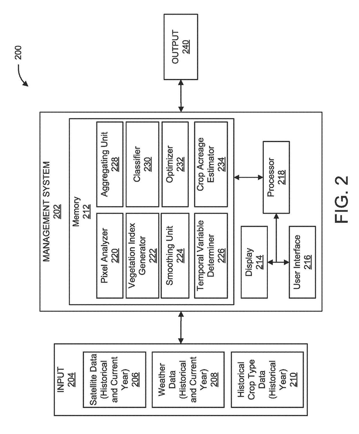
[0018]The present invention provides systems and methods for accurate crop type identification based on satellite observation (e.g., satellite imagery), weather data, and / or additional data relating to crop growth (such as soil information, irrigation, etc.) using machine learning. In some embodiments, the temporal axis of all satellite remote sensing measurements are reprojected onto a temporal variable that is more aligned with the actual crop growth compared to the calendar day-of-year. The temporal variable is determined using, for example, weather information. Thus, the satellite measured color variation of the same type of crop, as a function of the temporal variable in different years and locations, becomes more similar to each other, which simplifies the differentiation and identification of different crop types. In another embodiment, additional features beyond the satellite measure crop color variable are introduced to the machine learning based crop type classifier to imp...
PUM
 Abstract
Description
Claims
Application Information