Geodetic surveying

Active Publication Date: 2018-12-06
LEICA GEOSYSTEMS AG
View PDF0 Cites 11 Cited by
  • Summary
  • Abstract
  • Description
  • Claims
  • Application Information

AI Technical Summary

Benefits of technology

[0010]It's therefore an object of some embodiments of the present invention to improve a surveying instrument and a surveying measurement method, in particular to be less error-prone and to improve the accurac

Problems solved by technology

Such was burdensome as in general multiple iterations of leveling, vertical shifting, height measurement and re-checking are involved.
A technical problem which is not at all considered in above mentioned document is the fact that only in theory this one time stationing is fixed, but practically it can deviate during measurement.
For example, in many practical cases the surveying instrument—or more precisely the legs of the tripod (or the like) on which it is stationed—tends to sink into ground or to move slightly due to other influences during measurement such as heat, wind, etc.
Therefore, also the corrected surveying instrument center point from above is potential not valid throughout all of the measurements taken in this installation.
A re-verification of this corrected surv

Method used


Image

  • Geodetic surveying
  • Geodetic surveying
  • Geodetic surveying

Examples


Embodiment Construction

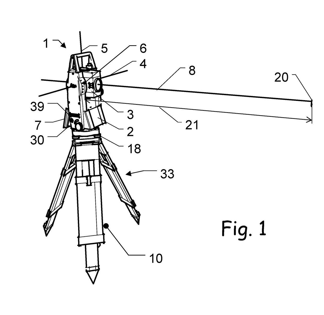
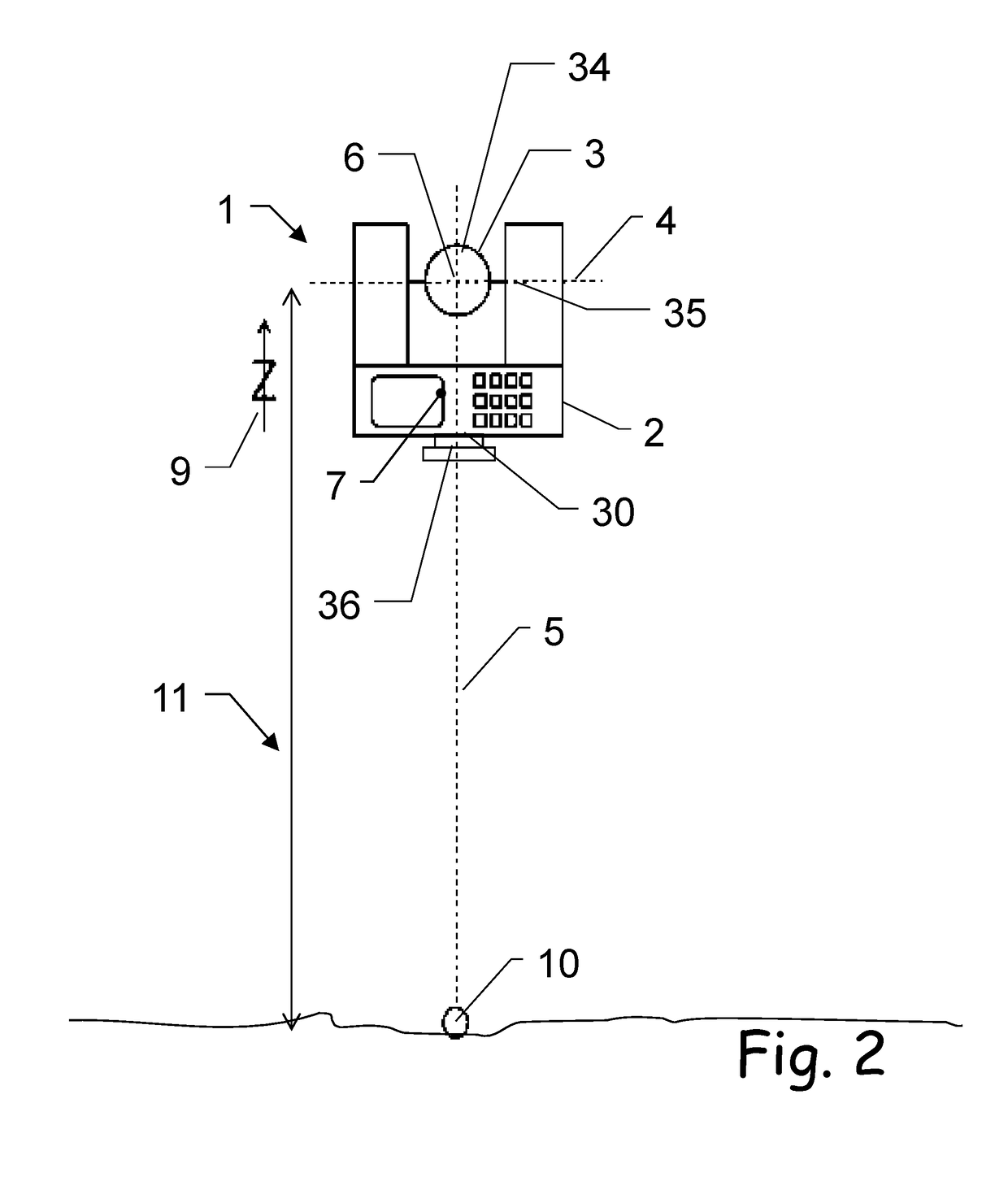
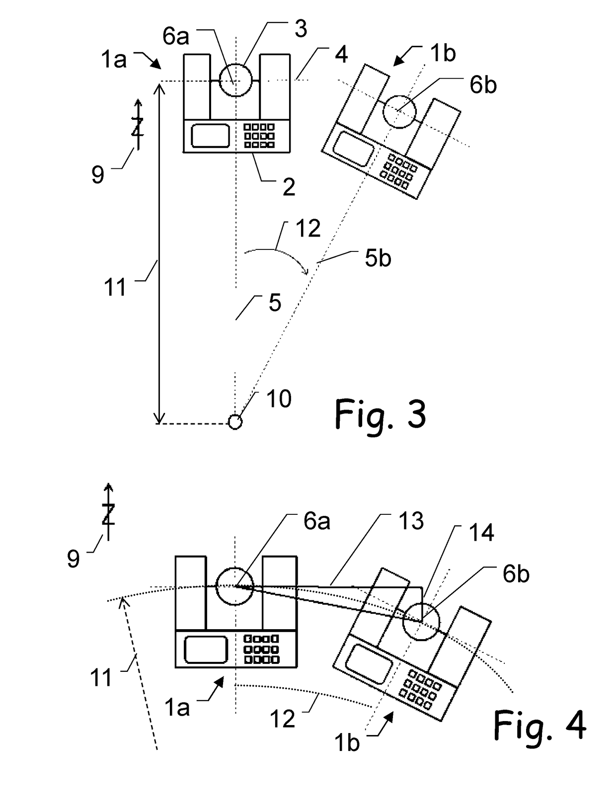
[0063]The diagrams of the figures should not be considered as being drawn to scale. Where appropriate, the same reference signs are used for the same features or for features with similar functionalities. Different indices to reference signs are used to differentiate between different embodiments of the same or an equivalent feature that is shown exemplary. The term “substantially” is herein used to describe the fact that a certain value, arrangement or feature does not necessarily need to be 100% exact, but can maybe slightly aberrate, while still being within scope. In other words, there can be some slight deviations, e.g. due to inaccuracies, unintentional, design considerations, tolerances, etc.—but there is a clear tendency towards the mentioned value or arrangement, in particular in view of the technical effect to be achieved therewith. Especially, it is not meant to be an obvious opposite. In any case, besides the meaning of “almost exactly” the term “substantially” can alway...


PUM


Abstract

A geodetic surveying instrument, such as a total station, stationed with instrument center coordinates at ground coordinates in a stationing height above ground. The instrument comprises a sighting unit for aiming a measurement target point, with an opto-electronic distance meter to determine a target distance and two axes for aiming the sighting unit, with goniometers to determine a target direction. It also comprises a tilt sensor to determine a tilt value of the instrument and a measurement-controller to derive measured coordinates of the measurement target point based on this target direction and target distance.

Description

CROSS-REFERENCE TO RELATED APPLICATIONS[0001]This application claims priority to European Patent Application No. 17173831 filed on May 31, 2017. The foregoing patent application are incorporated herein by reference.FIELD OF INVENTION[0002]The present invention relates generally to a surveying instrument and to a corresponding method of deriving target point coordinates.BACKGROUND[0003]In surveying, in particular land surveying, it is an object to determine geometrical properties of one or more target points, like coordinates, distances, and orientations. In most instances those properties have to be determined with respect to a known reference system, which can e.g. be defined by one or more known reference points, e.g. embodied by known and / or defined reference marks in vicinity. In many geodetic measurements for example, the surveying instrument is installed above a surface reference mark at ground or above an otherwise embodied, fixed reference—commonly by using a tripod supporti...

Claims


Application Information

Patent Timeline
IPC IPC(8): G01C15/00
CPCG01C15/008G01S17/08G01C15/00
Inventor KOTZUR, NORBERTKLEEMAIER, GERHARDMAAR, HANNESPATRI, GIAN-PHILIPP
Owner LEICA GEOSYSTEMS AG
Why Eureka
Try Eureka