Lane-centric road network model for navigation

a road network model and lane-centric technology, applied in the field of road network models, can solve the problems of segment-based models not being able to accurately describe intersections, and not being able to accurately describe complex roads with non-trivial lane level topologies

Active Publication Date: 2019-03-21
HERE GLOBAL BV
View PDF5 Cites 29 Cited by
  • Summary
  • Abstract
  • Description
  • Claims
  • Application Information

AI Technical Summary

Benefits of technology

[0005]According to an example embodiment, a memory of an apparatus stores a geographic database. The geographic database comprises a plurality of records corresponding to drivable surfaces of a road network. The plurality of records comprises a plurality of lane records, wherein each lane record corresponds to a particular lane of the road network drivable surface. Each first record of the plurality of records comprises a plurality of instances of adjacency information. Each instance of adjacency information/data (a) links the first record corresponding to a first drivable surface of the road network to a second record of the plurality of records corresponding to a second drivable surface of the road network. The first drivable surface is adjacent to the second drivable surface. Each instance of adjacency information/data indicates crossing parameters between the first drivable surface and the second drivable surface. A start location and a destination location are determined. Map data stored in the geographic database is accessed. A driving corridor is determined from the start location to the destination location by linking one or more data records of the plurality of data records based on the corresponding instances of adjacency information/data of the plurality of instances of adjacency information.
[0006]According to an aspect of the present invention, an apparatus is provided. In an example embodiment, the apparatus comprises at least one memory, the at least one memory storing a geographic database storing map data. The geographic database comprises a plurality of records corresponding to drivable surfaces of a road network. The plurality of records comprises a plurality of lane records, wherein each lane record corresponds to a particular lane of the road network. Each first record of the plurality of records comprises a plurality of instances of adjacency information. Each instance of adjacency information/data (a) links the first record corresponding to a first drivable surface of the road network to a second record of the plurality of records corresponding to a second drivable surface of the road network. The first drivable surface is adjacent to the second drivable surface. Each instance of adjacency information/data indicates crossing parameters between the first drivable surface and the second drivable surface. The apparatus further comprises at least one processor. The processor is configured to determine a start location and a destination location; access map data stored in the geographic database; and determine a driving corridor from the start location to the destination location by linking one or more lane records of the plurality of lane records and one or more open drivable surface records of the plurality of open drivable surface records based on the corresponding instances of adjacency information/data of the plurality of instances of adjacency information.
[0007]In an example embodiment, the apparatus further comprises a user interface and the processor is further configured to cause the user interface to display the driving corridor on a visualization of the one or more lane records and one or more open drivable surface records. In an example embodiment, the processor is further configured to control one or more mechanical systems of a vehicle to as the vehicle to traverses at least a portion of the route. In an example embodiment, the apparatus further comprises a user interface, the processor further configured to cause the user interface to provide an alert based on traffic information corresponding to at least one of the one or more lane records or one or more open drivable surface records. In an example embodiment, each lane record comprises one or more lateral boundary elements and one or more longitudinal boundary elements, wherein a lateral boundary element does not cross a flow of traffic along a corresponding lane of the road network and a longitudinal boundary element does cross the flow of traffic along the corresponding lane. In an example embodiment, the first drivable surface and the second drivable surface have a shared boundary element, the shared boundary element being at least one of (a) a lateral boundary element or (b) a longitudinal boundary element. In an example embodiment, the crossing parameters indicate whether the shared boundary element is not crossable, crossable in a first direction, crossable in a second direction that is opposite the first direction, or crossable in both the first direction and the second direction. In an example embodiment, (a) a first lateral boundary element of the one or more lateral boundary elements identifies a physical location of a lateral boundary of the corresponding lane and (b) a first longitudinal boundary element of the one or more longitudinal boundary elements identifies a physical location of a longitudinal boundary of the corresponding lane. In an example embodiment, the first record comprises one or more features corresponding to the first drivable surface. In an example embodiment, the one or more features comprises at least one of a lane identifier, a segment identifier, a segment name, an open drivable surface identifier, an intersection identifier, a speed limit, one or more traffic rules, or one or more traffic conditions corresponding to the first

Problems solved by technology

These road segment-based models lack the ability to accurately describe complex roads having non-trivial lane level topologies.
For example, the road segment-based mod

Method used


Image

  • Lane-centric road network model for navigation
  • Lane-centric road network model for navigation
  • Lane-centric road network model for navigation

Examples


Embodiment Construction

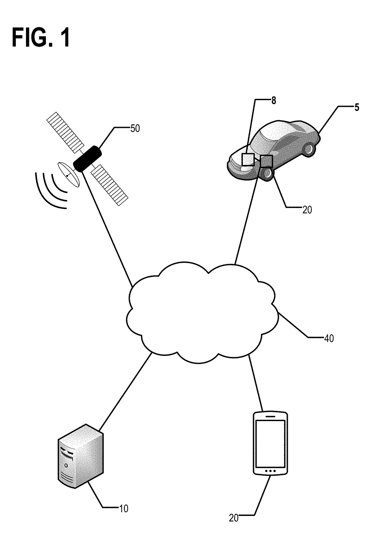
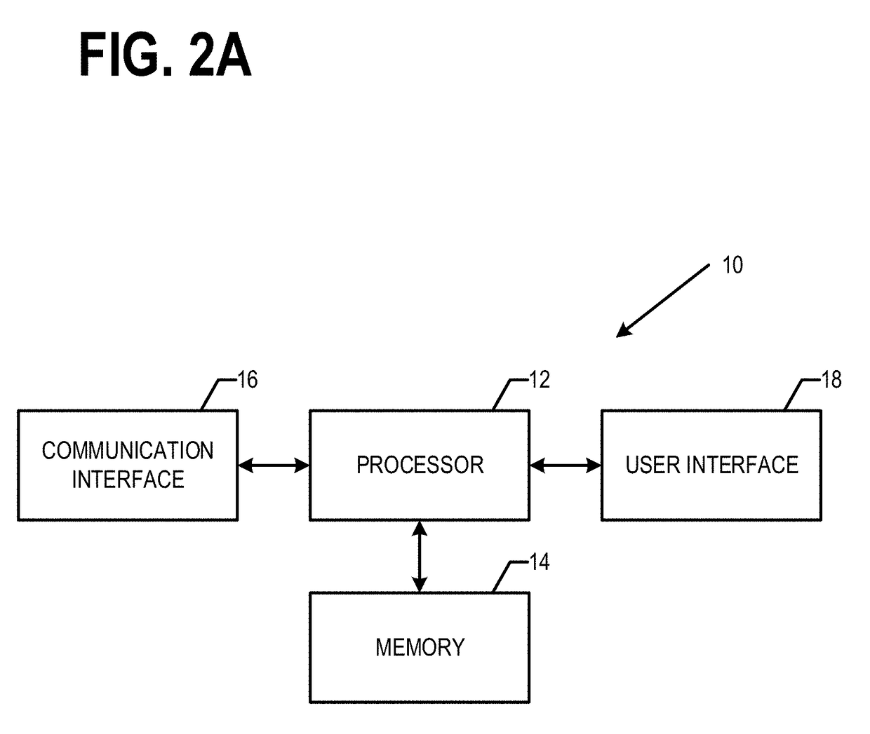
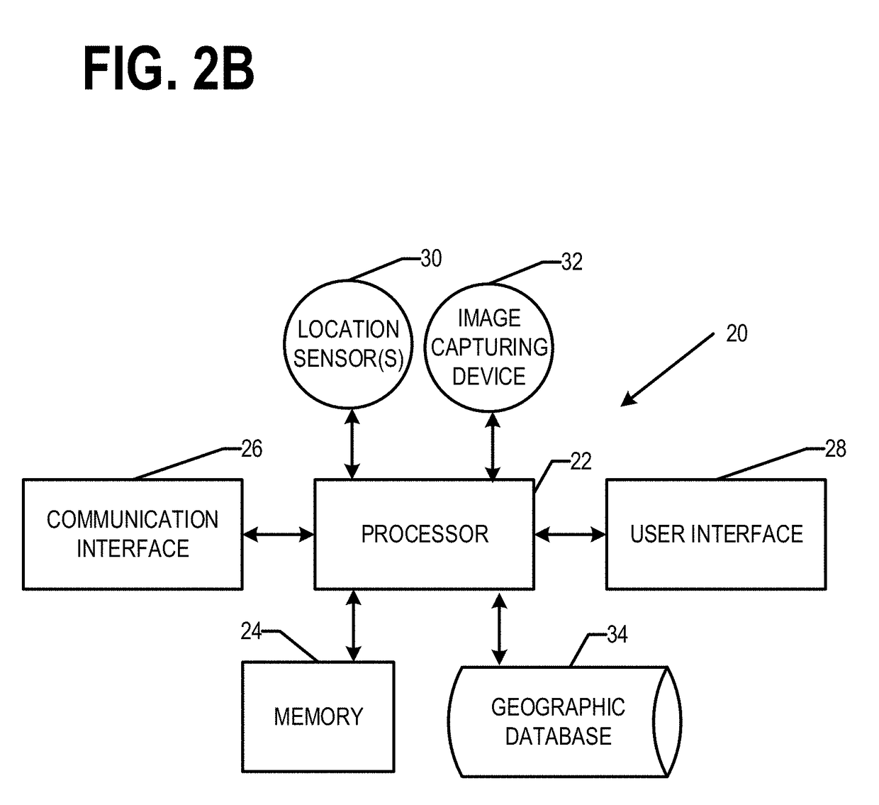
[0025]Some embodiments will now be described more fully hereinafter with reference to the accompanying drawings, in which some, but not all, embodiments of the invention are shown. Indeed, various embodiments of the invention may be embodied in many different forms and should not be construed as limited to the embodiments set forth herein; rather, these embodiments are provided so that this disclosure will satisfy applicable legal requirements. The term “or” (also denoted “ / ”) is used herein in both the alternative and conjunctive sense, unless otherwise indicated. The terms “illustrative” and “exemplary” are used to be examples with no indication of quality level. Like reference numerals refer to like elements throughout. As used herein, the terms “data,”“content,”“information,” and similar terms may be used interchangeably to refer to data capable of being transmitted, received and / or stored in accordance with embodiments of the present invention. Thus, use of any such terms shoul...


PUM


Abstract

A geographic database storing map data is provided. The geographic database is stored in a non-transitory computer readable medium. The geographic database comprises a plurality of records corresponding to drivable surfaces of a road network. The plurality of records comprise a plurality of lane records corresponding to particular lanes of the road network. Each first record of the plurality of records comprises a plurality of instances of adjacency information. Each instance of adjacency information/data (a) links the first record corresponding to a first drivable surface of the road network to a second record of the plurality of records corresponding to a second drivable surface of the road network. The first drivable surface is adjacent to the second drivable surface. Each instance of adjacency information/data indicates crossing parameters between the first drivable surface and the second drivable surface.

Description

TECHNOLOGICAL FIELD[0001]An example embodiment relates generally to a road network model for use in navigating the road network. In particular, an example embodiment generally relates to a lane-centric road network model and uses of the lane-centric road network model for navigation of the road network.BACKGROUND[0002]Generally road network models describe road segments as abstract objects. An abstract object may be assigned a collection of lanes. However, the collection of lanes are not described by the physical boundaries of the lanes. These road segment-based models lack the ability to accurately describe complex roads having non-trivial lane level topologies. For example, the road segment-based models cannot accurately describe intersections in which the stop line for a left turn lane is not aligned with the stop line for an adjacent forward or right turn lane.[0003]Autonomous driving requires high accuracy road network models that accurately describe lane topology. Continuing t...

Claims


Application Information

Patent Timeline
IPC IPC(8): G05D1/02G08G1/16G01C21/36G01C21/34
CPCG05D1/0214G05D1/0274G08G1/167G05D1/0231G01C21/3602G01C21/3492G05D2201/0213G05D1/0212G06F16/29G01C21/3867G01C21/3881
Inventor CHEN, BINDORIA, DAVIDSUTTON, HANKENDRES, IAN
Owner HERE GLOBAL BV
Why Eureka
Try Eureka