Precision aware drone-based object mapping based on spatial pattern recognition

a spatial pattern recognition and object mapping technology, applied in the field of computer and drones, and controlling drones, can solve the problems of reducing the battery time of the currently available drone models, requiring several pictures that cannot be taken, and producing photographs that are not suitable for cv algorithms

Active Publication Date: 2019-08-22
IBM CORP
View PDF0 Cites 12 Cited by
  • Summary
  • Abstract
  • Description
  • Claims
  • Application Information

AI Technical Summary

Benefits of technology

[0003]A method and system of controlling an unmanned aerial vehicle may be provided. The method, in one aspect, may include receiving an image of a region captured by the unmanned aerial vehicle flying at a current altitude. The method may also include executing a computer vision algorithm with the image as an input to the computer vision algorithm. The computer vision algorithm may compute an overall confidence score associated with detecting one or more candidate objects in the image. The method may also include, responsive to determining that the overall confidence score is below a predefined minimum threshold, controlling the unmanned aerial vehicle to reduce

Problems solved by technology

A limit to this process is the reduced battery time of the currently available models of drones.
Thus, when capturing aerial images, there is a tradeoff between the drone's autonomy and image quality.
However, the produced photograph m

Method used


Image

  • Precision aware drone-based object mapping based on spatial pattern recognition
  • Precision aware drone-based object mapping based on spatial pattern recognition
  • Precision aware drone-based object mapping based on spatial pattern recognition

Examples


Embodiment Construction

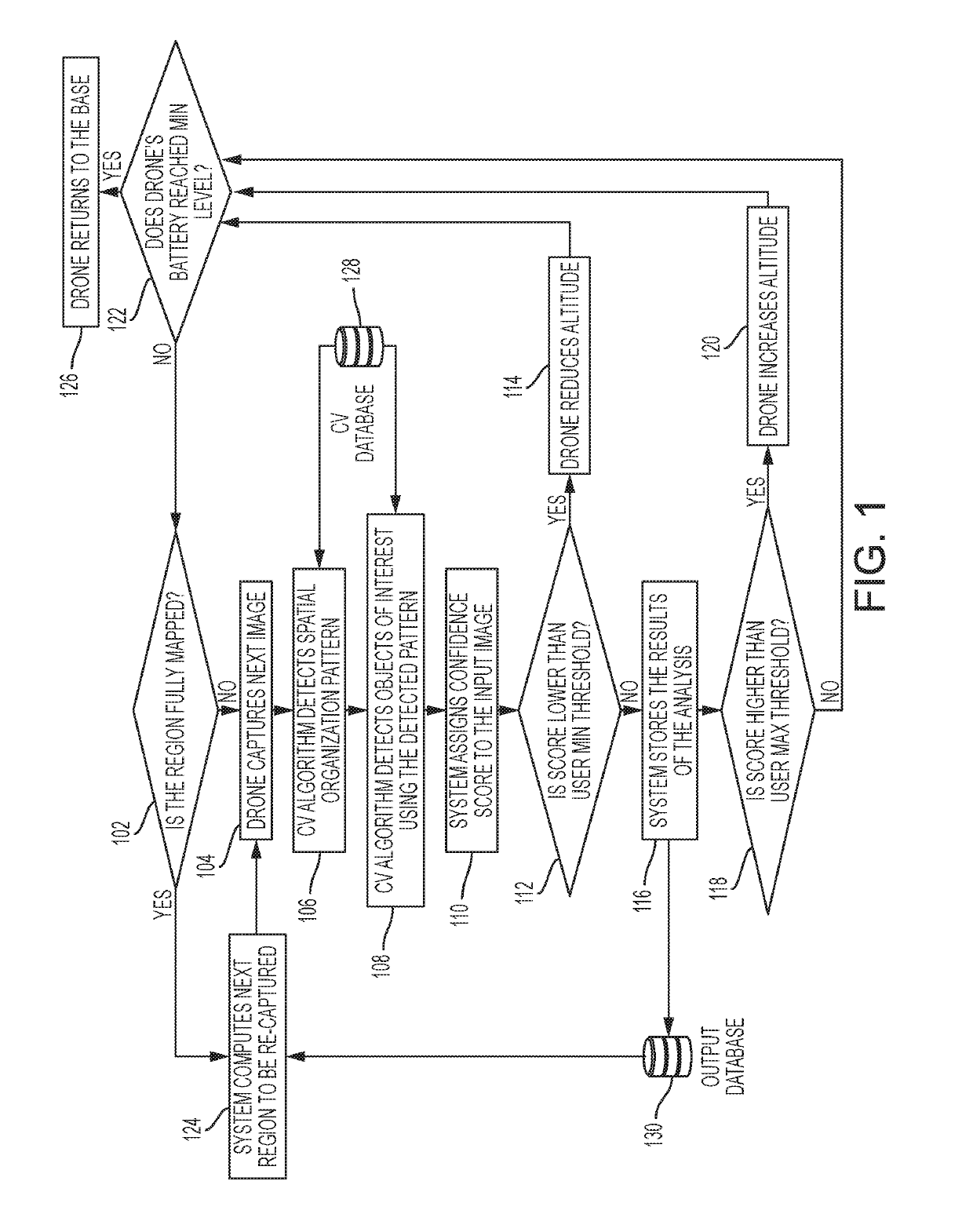
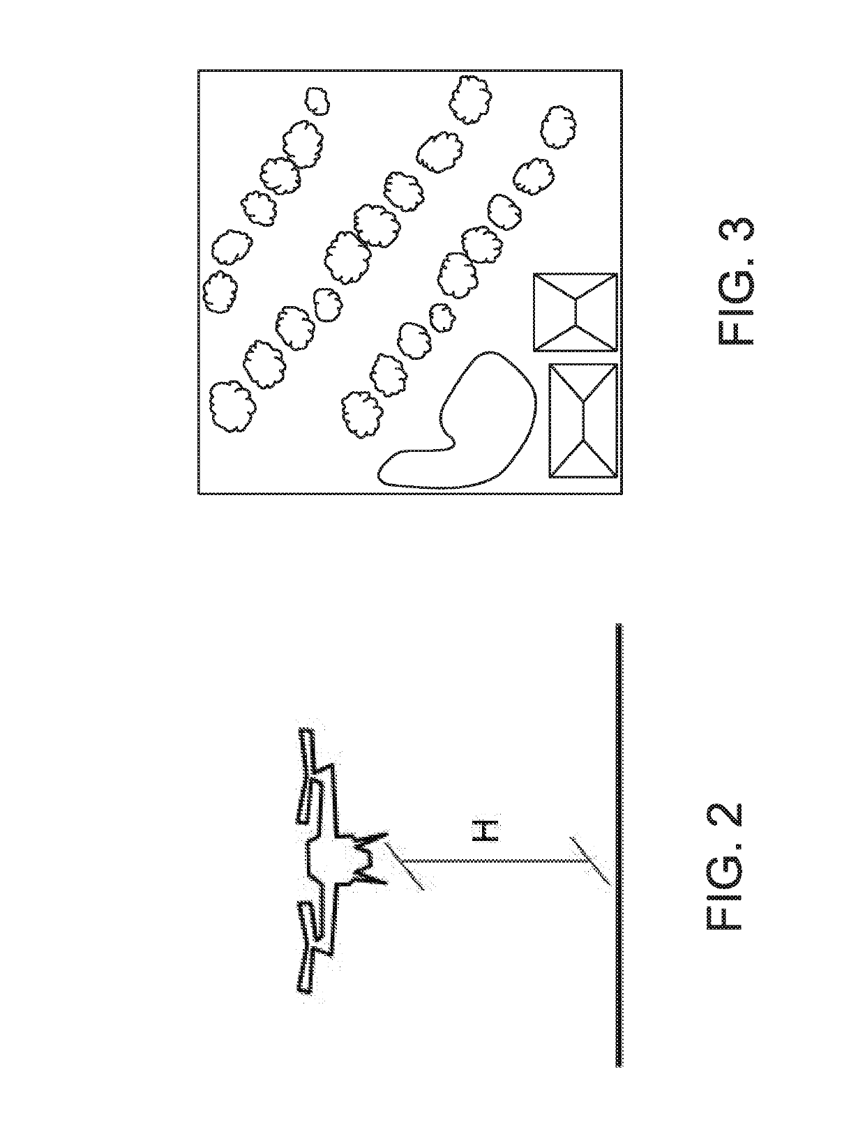
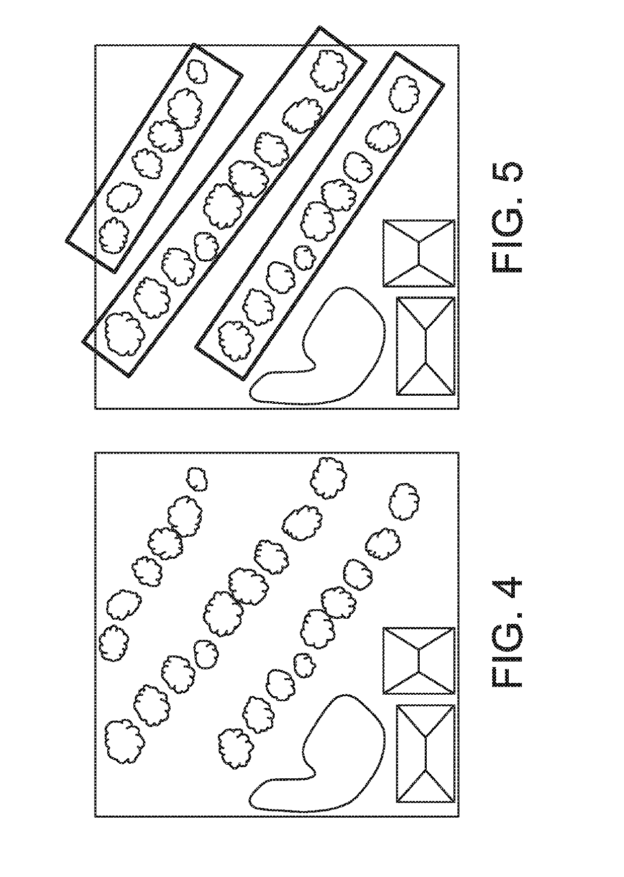
[0018]A system, method and techniques may be presented that optimize a process of taking aerial pictures of a region by an unmanned aerial vehicle (also referred to as a drone) by considering both the drone's autonomy and image quality. The system and method of the present disclosure may allow computer vision (CV) algorithms to be processed in real time, and based on the confidence scores of the algorithms adapt the drone's altitude, for example, for the next photos. To accelerate or speed up the image recognition process and make it suitable for real-time execution in drones, the system and / or method of the present disclosure in some embodiments explore the identification of spatial patterns followed by the objects of interest, e.g., explore the fact that all objects will be distributed in parallel lines. For instance, the system and / or method may compute optimal altitude and / or path for capturing the images. Confidence scores may be used for optimizing a process of recapturing pic...


PUM


Abstract

An image of a region captured by an unmanned aerial vehicle flying at an altitude may be received. A computer vision algorithm may be executed with the image as an input to compute an overall confidence score associated with detecting one or more candidate objects in the image. Responsive to determining that the confidence score is below a predefined minimum threshold or above a predefined maximum threshold, the unmanned aerial vehicle may be controlled to change its altitude and recapture the image of the region at a new position. Responsive to determining that the overall confidence score is not below the predefined minimum threshold, information associated with the image may be stored on a storage device.

Description

FIELD[0001]The present application relates generally to computers and drones, and controlling drones in image capturing.BACKGROUND[0002]There are several applications using drones or unmanned aerial vehicles (UAVs) for capturing images that are later processed by automatic Computer Vision (CV) algorithms. For example, in agriculture, drones can be used for taking photos of plantations, and these images can be subject to algorithms for counting and / or recognizing the detected vegetation. A limit to this process is the reduced battery time of the currently available models of drones. Thus, when capturing aerial images, there is a tradeoff between the drone's autonomy and image quality. For instance, if a user desires to capture a large region of a desired size, the fastest way of doing so may be to take a picture from a very high altitude that is able to capture the entire region. However, the produced photograph may not be suitable for CV algorithms, for example, due to its low spati...

Claims


Application Information

Patent Timeline
IPC IPC(8): G06K9/00G05D1/04B64C39/02G06K9/62G06V10/25G06V10/764G06V20/13G06V20/17
CPCG06K9/00993G05D1/042B64C39/024G06K9/00651G06K9/6215B64C2201/127G05D1/0094G06V20/13G06V10/993G06V10/25G06V20/17G06V10/764B64U2201/00B64U2101/30G06V10/96G06V20/182G06F18/22
Inventor BRITTO MATTOS LIMA, ANDREACARDONHA, CARLOS HENRIQUEVIANA, MATHEUS PALHARESZORTEA, MACIEL
Owner IBM CORP
Why Eureka
Try Eureka