Digital map compression and display method

Inactive Publication Date: 2001-01-23
RATEZE REMOTE MGMT LLC +1
View PDF18 Cites 68 Cited by
  • Summary
  • Abstract
  • Description
  • Claims
  • Application Information

AI Technical Summary

Problems solved by technology

Both of these systems require a very large amount of storage for terrain data.
Since addresses exist only at discrete locations, the truncation of address locations causes an unavoidable change in the map shapes as the aircraft changes heading.
Since addresses exist only at discrete locations, the truncation of address locations causes an unav

Method used


Image

  • Digital map compression and display method
  • Digital map compression and display method
  • Digital map compression and display method

Examples


Embodiment Construction

THE DIGITAL ELEVATION MODEL DATABASE

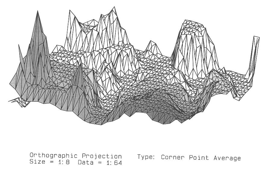
The U.S. Geological Survey (USGS) has available a digital elevation database called the Digital Elevation Model which consists of an array of regularly spaced terrain elevations. It can be purchased on 9 track tape or it can be downloaded from the USGS ftp site on the Internet. The data used as an example to illustrate the present invention is from the SEATTLE-E DEM file downloaded from the USGS ftp site. For the purposes of illustration the elevation values are exaggerated.

DATABASE COMPRESSION

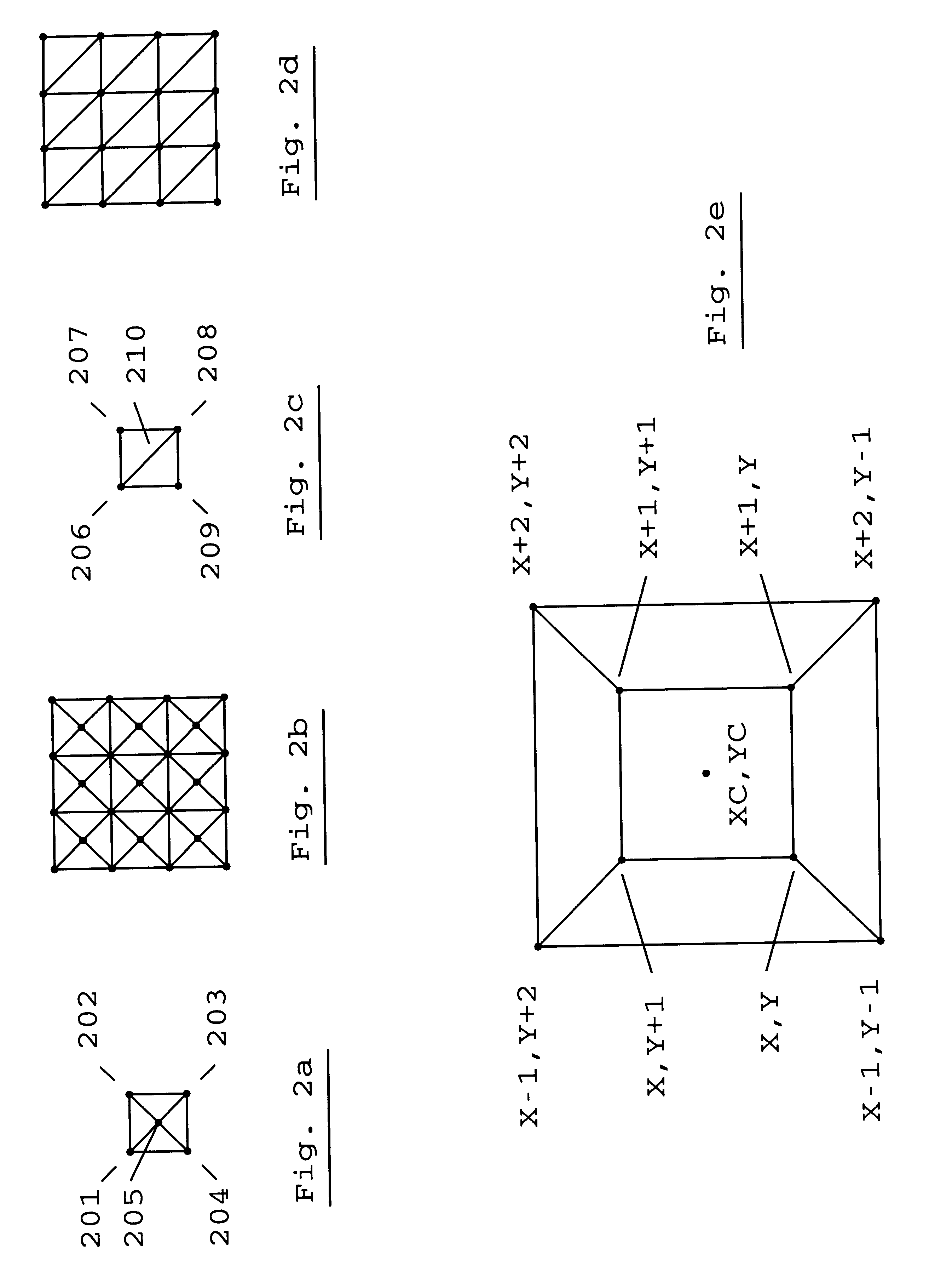
The present invention compresses the digital elevation database by taking every mth row and every nth column of the original database. This technique produces a compressed digital map database because there are now 1 / m the number of rows and 1 / n the number of columns so that the final database size is 1 / (m*n). FIG. la shows a grid of forty-nine points, representing seven rows and seven columns. In FIG. 1b, every second row and every second column have been s...


PUM


Abstract

A digital elevation database is compressed to create a compressed digital map database which is used by a digital computer system for displaying three-dimensional terrain data in the form of polygons. The compressed digital map database is produced from a database of elevation points by selecting every mth row and every nth column, thereby resulting in a reduction of database storage requirements. During program run-time the intersection of rows and columns forms cells with four corners. The elevation value of a center elevation point for each cell is formed by various methods, thereby creating a cell made up of four three-dimensional triangles. One method for creating the elevation of the center elevation point uses the elevations of the four corners of the cell. Another method uses extrapolated elevation values from the cell's extended diagonals. The three-dimensional triangles formed from the center elevation point are then transformed and projected using standard computer graphics methods on a digital computer to produce a three-dimensional projected display.

Description

1. Field of InventionThis invention relates to a method for compressing a digital elevation database for a system for displaying three-dimensional terrain data.2. Discussion of Prior ArtCopending patent application "Digital Map Generator and Display System", Ser. No. 08 / 944,366 filed Oct. 6, 1997 by the present inventor, describes a digital map system for displaying three-dimensional terrain data using terrain data in the form of polygons. The polygon database is produced from a database of elevation points which are divided into m.times.n cells which have an elevation point in the center of the cell. The center point forms four polygons with the corners of the cell. The elevation of the center point may be chosen to be the highest elevation point in the m.times.n cell, the average elevation of the elevation points in the m.times.n cell, or the elevation of the actual center point.Other systems using elevation data directly have been developed that present an apparent three-dimensio...

Claims


Application Information

Patent Timeline
IPC IPC(8): G06T9/00H04N7/30H04N7/26H04N7/50
CPCH04N19/172H04N19/196H04N19/137H04N19/154H04N19/27H04N19/60H04N19/39
Inventor MARGOLIN, JED
Owner RATEZE REMOTE MGMT LLC
Why Eureka
Try Eureka