System for automatically locating and directing a vehicle

a technology for automatically applied in the field of automatic locating and directing vehicles, can solve the problems of insufficient accuracy and reliability, too expensive gps to be used in economy vehicles, and limited capability

Inactive Publication Date: 2002-05-21
MA ERJIAN
View PDF19 Cites 43 Cited by
  • Summary
  • Abstract
  • Description
  • Claims
  • Application Information

AI Technical Summary

Problems solved by technology

But, GPS is too expensive to be used in the economy vehicle in the near future and its capability is limited.
But this is not accurate and reliable compared with the present inventions which solve the problem by setting signal emitters/carriers on the ground or on a fixed object by placing a Receiver in the vehicle to receive the information and determine the exact location.
Usually, a map is needed when one drives to a new place even if he finds a ...

Method used


Image

  • System for automatically locating and directing a vehicle
  • System for automatically locating and directing a vehicle
  • System for automatically locating and directing a vehicle

Examples


Embodiment Construction

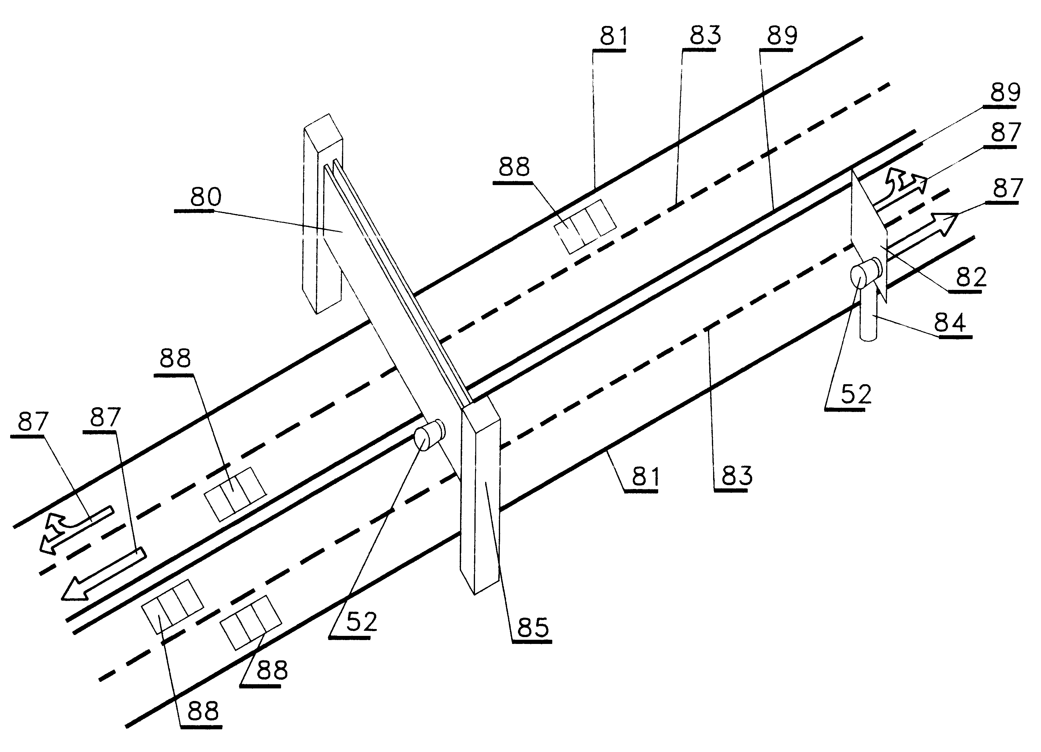
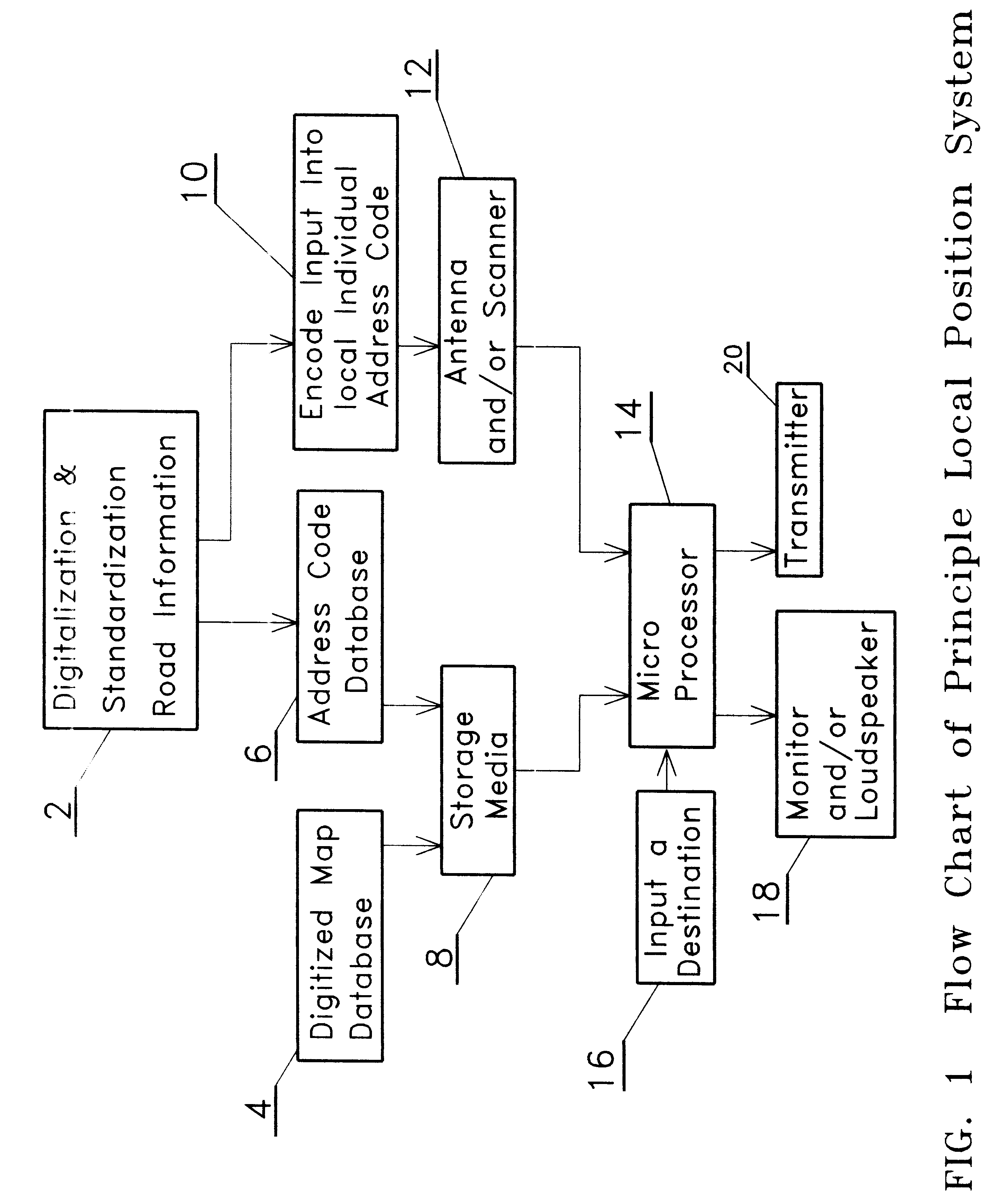
The present invented Local Positioning System comprises of three main development processes: building Address Code databases, which sets the Address Code near a path and developing the Receiver. The embodiment of the development processes is introduced as follows.

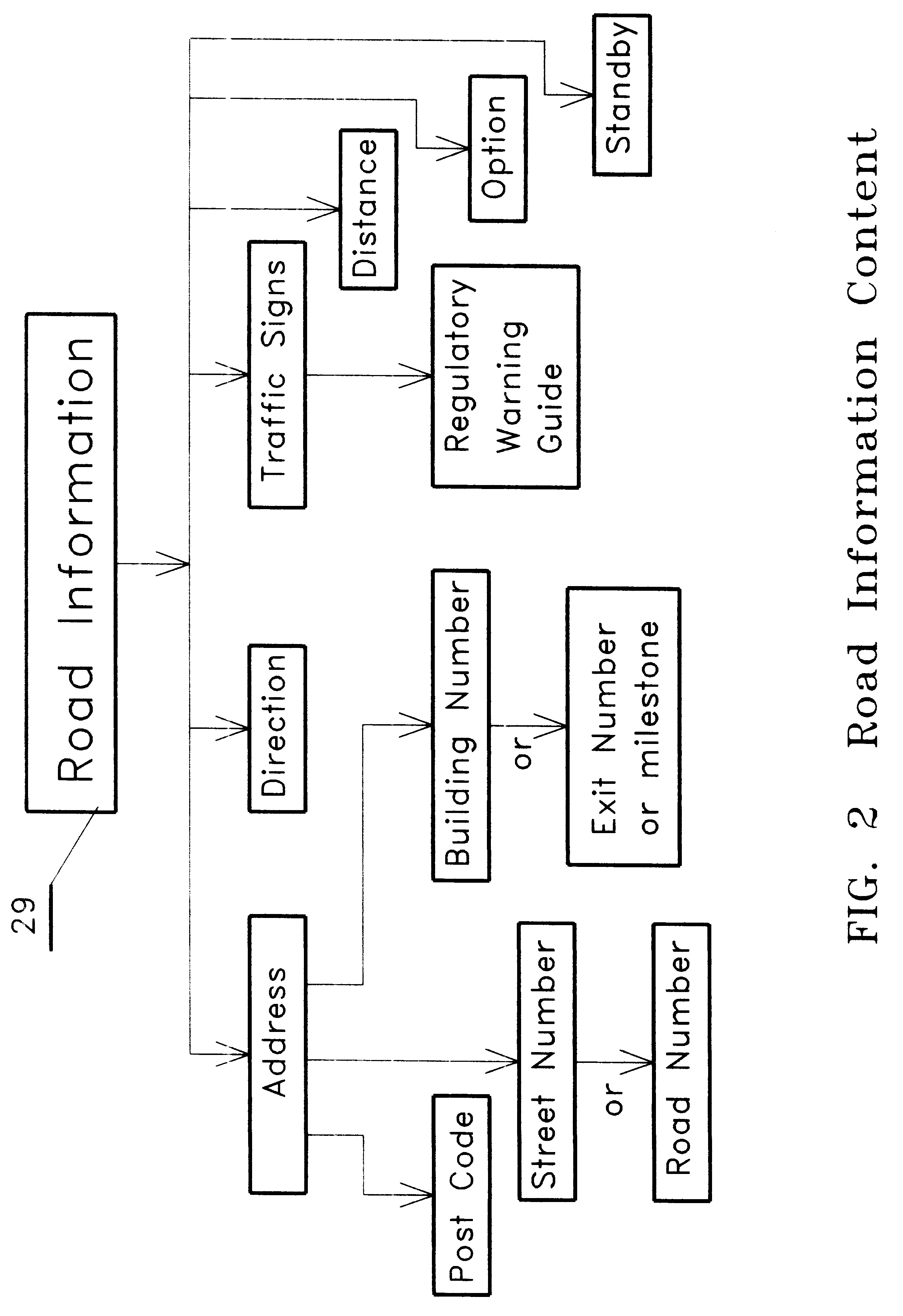
Database Establishment

The database comprises two types of databases: electronic map database and Address Code database. Electronic map database, which gives the present invention a reference, has been built a long time before. The digitized map is a combination of the electronic map and address code database, which has all advantages that the electronic map has. But the input method for search area is different. In the new database, a desired address can be searched by inputting a real address, postcode or an automatically received Address Code. Which means an Address Code can be a search key to find out its corresponding address, then a map of this area will be shown on the screen. As the vehicle is moving, new Address Cod...


PUM


Abstract

This is a method and apparatus for giving an accurate vehicle location and route from one location to a desired destination. This is done by catching signals from a fixed local information source through a receiver system placed in the vehicles. The present invention is called LPS (Local Position System) navigation system because it is based on a local information system instead of getting information from a satellite or city beacon. This system has two main units. The first of these units is the Address Code, this is an emitter or carrier which is placed on roads all over the nation. This unit can provide digitized and standardized road information. The second of these units is the Receiver, which can receive signals on the road and search them in a database. This database is set in the vehicle and tells the accurate location of the vehicle. It then can give precise directions to a location based on user's input. Therefore, a system user will know where he is and exactly how to get where he wants to go. The system user can transmit the received signal to his headquarters or to people with the same equipment.

Description

This invention relates to information digitization technology, general signal emitting and receiving method, data processing technology, and display techniques.BACKGROUND INFORMATIONSafety and efficiency in transportation are always public concerns, and as a result hundreds of patents are issued annually. This research tries to improve safety and efficiency in transportation in many ways, one of which is using location and navigation systems. The most current research works using navigation systems based on communication with a satellite. This is called GPS (Global Position System). But, GPS is too expensive to be used in the economy vehicle in the near future and its capability is limited.Some inventions determine vehicle's location by recording and calculating the distance and direction taken by the vehicle and then comparing them with map information. But this is not accurate and reliable compared with the present inventions which solve the problem by setting signal emitters / carr...

Claims


Application Information

Patent Timeline
IPC IPC(8): G01C21/30G01C21/28
CPCG01C21/30
Inventor MA, ERJIAN
Owner MA ERJIAN
Why Eureka
Try Eureka