

Navigation map creation system
a navigation map and map technology, applied in the field of mapping cartographic features, can solve the problems of large increase in the amount of data that must be stored to accurately represent features, high degree of accuracy, etc., and achieve the effect of increasing the memory storage requirements of the system, reducing the amount of memory required to store navigation map parameters, and increasing the accuracy of navigation map
- Summary
- Abstract
- Description
- Claims
- Application Information
AI Technical Summary
Benefits of technology
Problems solved by technology
Method used
Image

Examples
Embodiment Construction
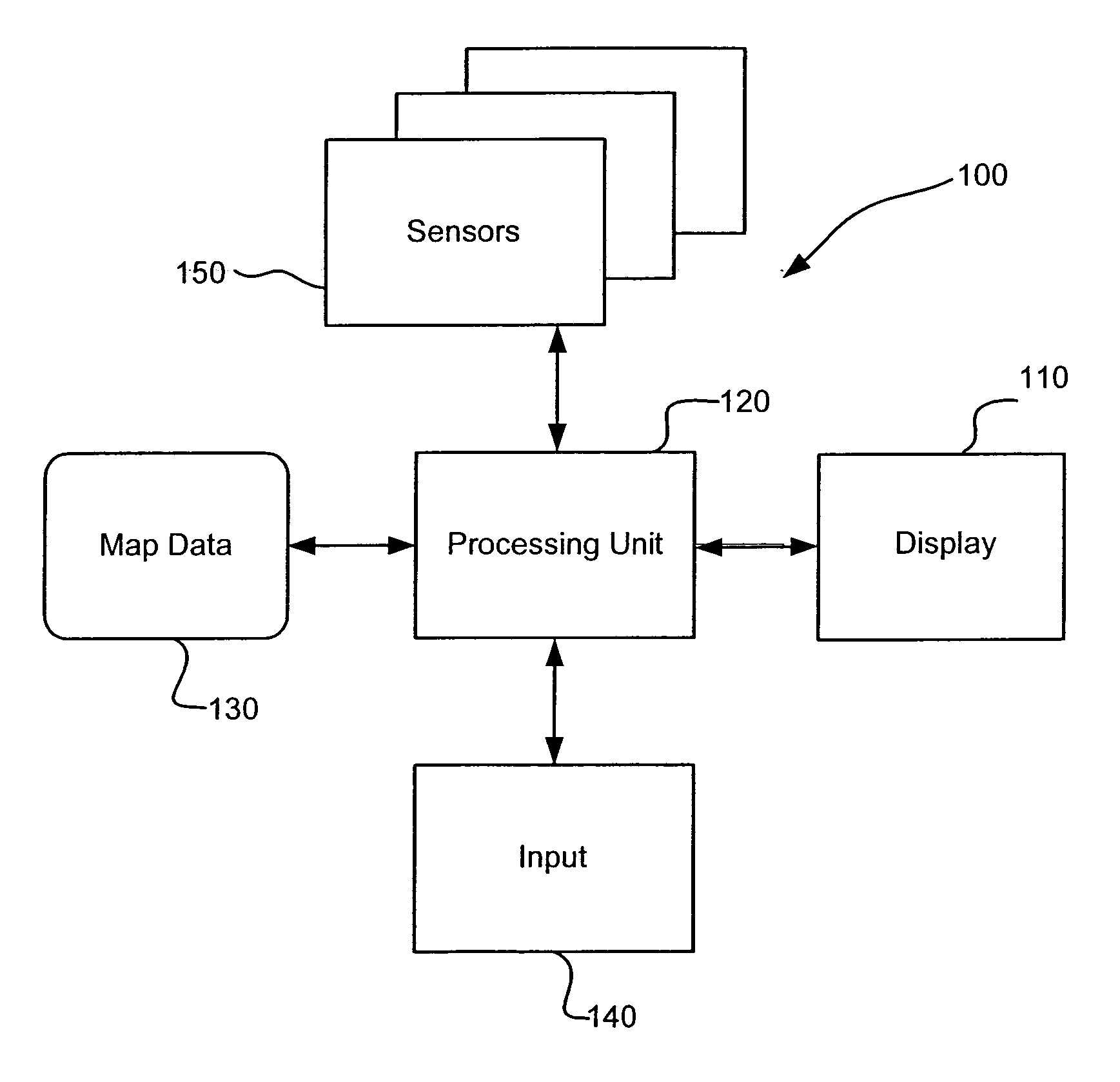
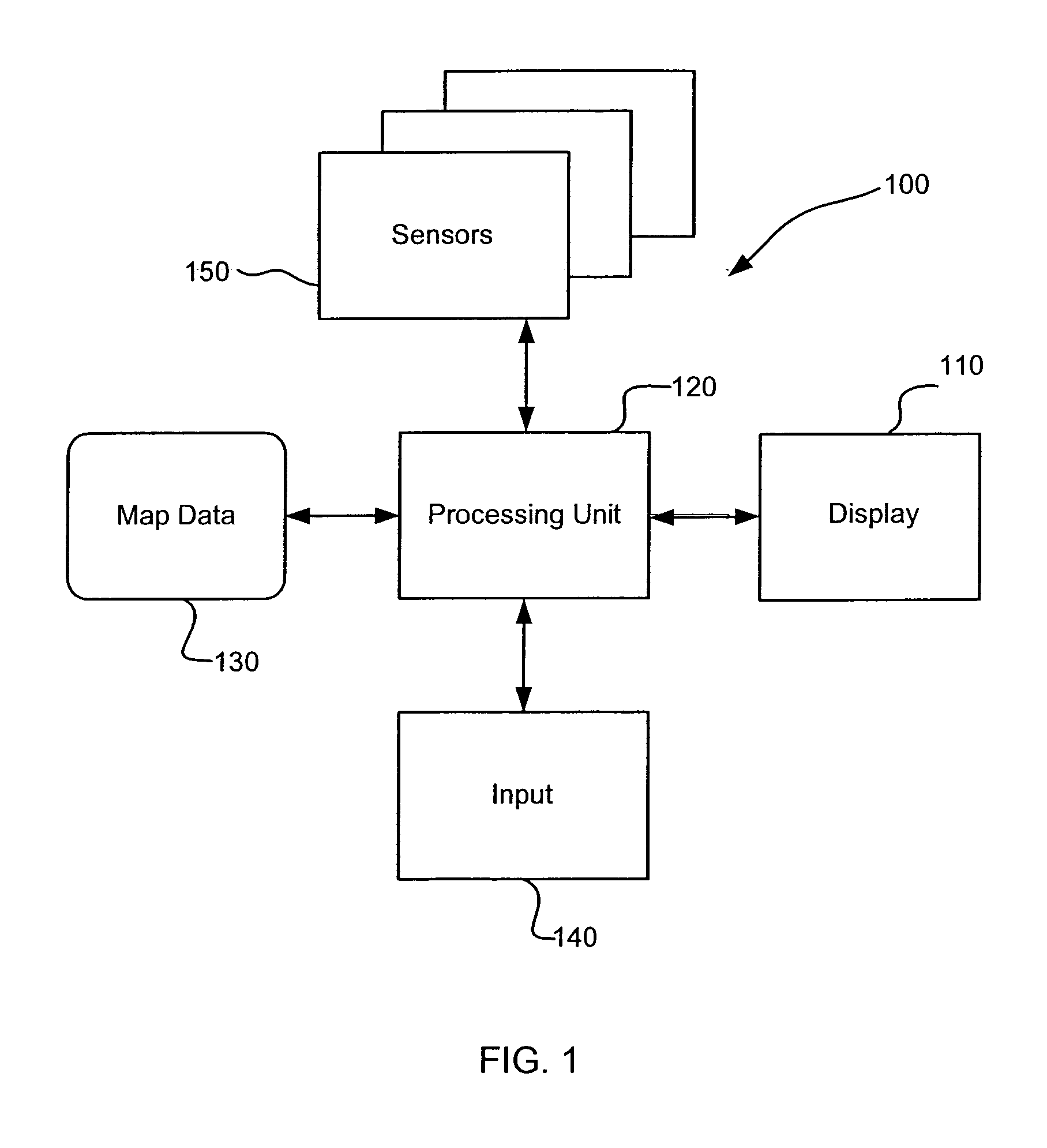
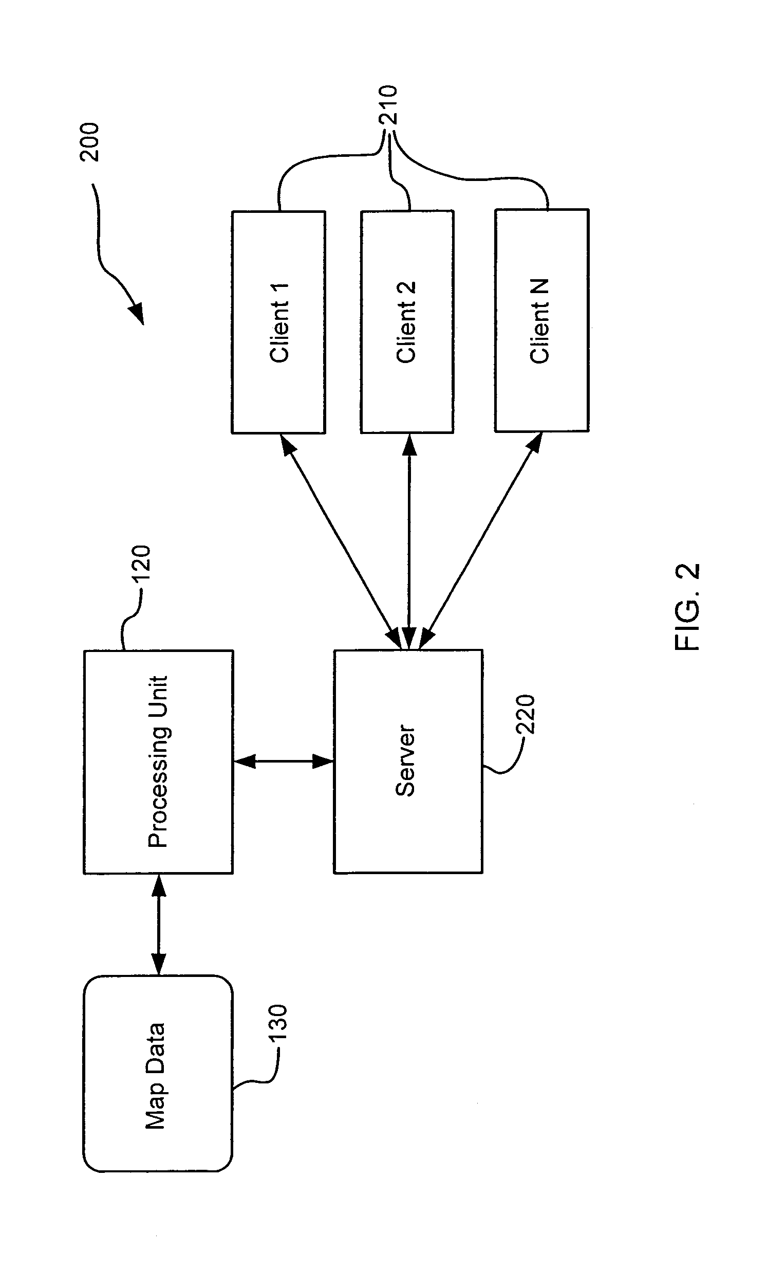
[0028]A geometric shape such as a clothoid (also known as cornu or Euler's spiral) may be used to represent cartographic features on an electronic map. The map may be used with navigation systems or other systems that use electronic maps, such as Personal Digital Assistants (PDAs) or home computers. Such maps may also be accessed via computer networks, such as wireless networks, wide area networks (WANS), local area networks (LANS), Intranets and the Internet. These navigation systems may be used in portable systems or on vehicles such as automobiles, trucks, farming equipment, mining equipment, golf carts and mobile robots. These navigation systems may also be used for plotting known waterways for ships, known flight paths for planes, or with the autopilot of an airplane or a spaceship. The term “cartographic features” or “map features” should be broadly construed to include any attributes that may be depicted in an electronic map, such as roads, railroad lines, parks, buildings, r...
PUM
 Abstract
Description
Claims
Application Information