Markup language for interactive geographic information system
a geographic information system and markup language technology, applied in the field of mapping systems, can solve the problems of performance degradation of gis that could readily display one, ten, or 100 fire hydrant markers, and performance declin
- Summary
- Abstract
- Description
- Claims
- Application Information
AI Technical Summary
Benefits of technology
Problems solved by technology
Method used
Image
Examples
Embodiment Construction
[0018]Geographic information systems (GIS) and techniques are disclosed that provide users with a greater degree of flexibility, utility, and information. The system may be a distributed geographic information system (DGIS) including multiple components that communicate with one another. For purposes of this disclosure, assume that “GIS” includes both GIS and DGIS configurations.
[0019]General Overview
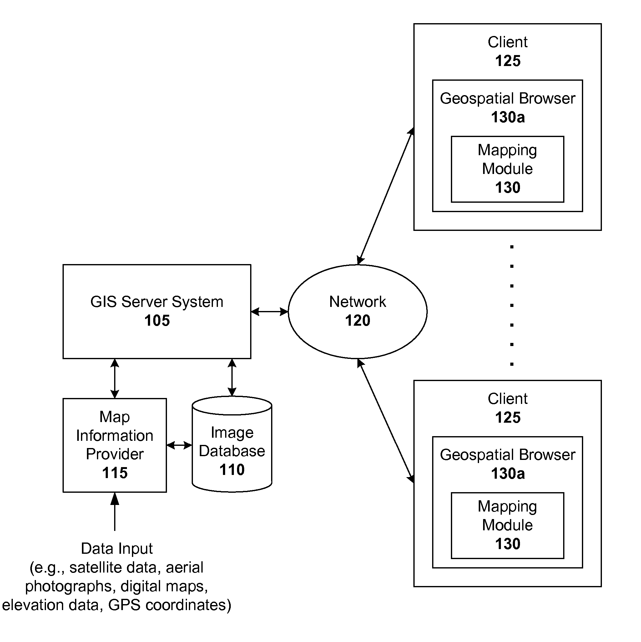
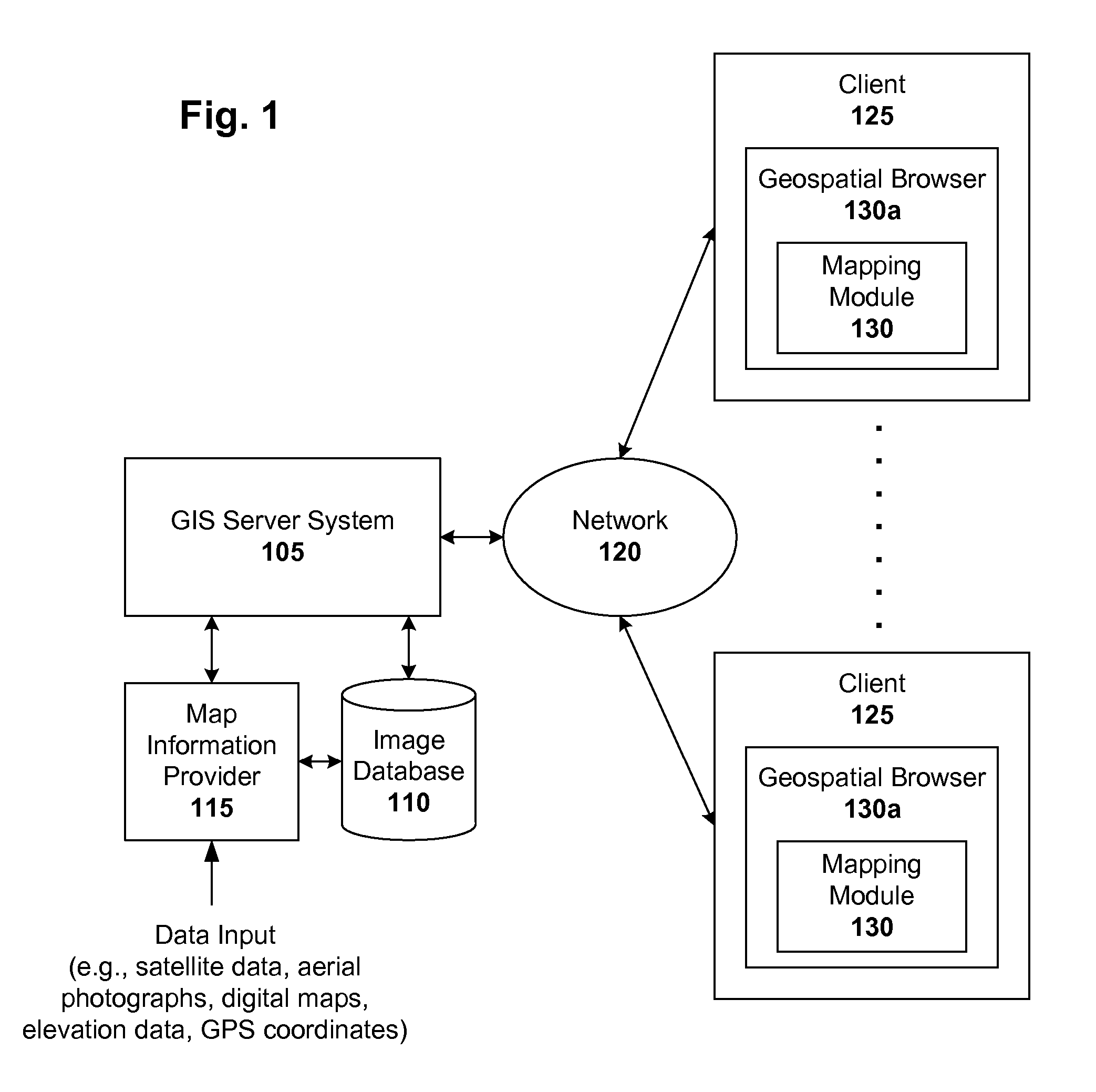
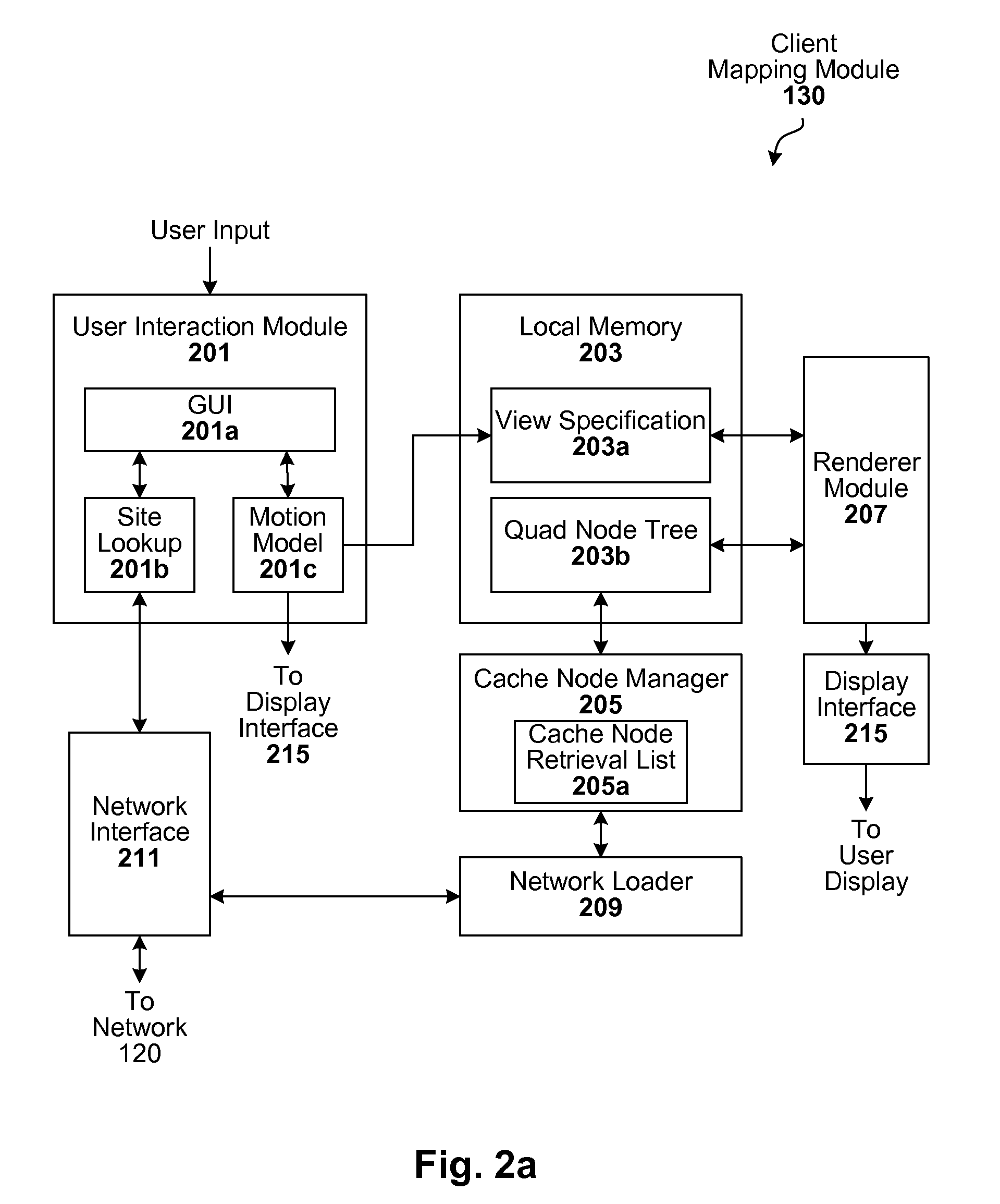
[0020]A GIS configured to carryout the techniques described herein can be implemented, for example, in a client-server architecture, though other configurations will be apparent in light of this disclosure. In this type of embodiment, client-side software operates (in conjunction with server-side software) to cause images of a planet and other geospatial information to a user's computer (or generally, client device) so they can be seen by the user or otherwise processed. In one example case, the client software is implemented using various software objects that are grouped in modules ac...
PUM
 Abstract
Description
Claims
Application Information
 - R&D
- Intellectual Property
- Life Sciences
- Materials
- Tech Scout
- Unparalleled Data Quality
- Higher Quality Content
- 60% Fewer Hallucinations
Browse by: Latest US Patents, China's latest patents, Technical Efficacy Thesaurus, Application Domain, Technology Topic, Popular Technical Reports.
© 2025 PatSnap. All rights reserved.Legal|Privacy policy|Modern Slavery Act Transparency Statement|Sitemap|About US| Contact US: help@patsnap.com


