
Supporting the use of a virtual reference station

a virtual reference station and reference station technology, applied in the field of positioning, can solve the problems of expensive and meant equipment for such applications

Active Publication Date: 2011-12-13
NOKIA TECH OY
View PDF17 Cites 29 Cited by
  • Summary
  • Abstract
  • Description
  • Claims
  • Application Information

AI Technical Summary

Benefits of technology

[0047]The invention can further be used for any kind of beacon signals, in particular, though not exclusively, for satellite signals. Such satellite signals may comprise satellite signals transmitted in a GNSS, like GPS, GLONASS, GALILEO, SBAS, QZSS, LAAS or a combination of these. LAAS makes use of pseudolites instead of true satellites, but these pseudolites are to be understood to be covered as well by the term satellite as used in this application. LAAS has the advantage that it enables a positioning under indoor conditions as well.

Problems solved by technology

The equipment required for such applications is expensive and meant, therefore, only for professional use.

Method used


Image

  • Supporting the use of a virtual reference station
  • Supporting the use of a virtual reference station
  • Supporting the use of a virtual reference station

Examples


Embodiment Construction

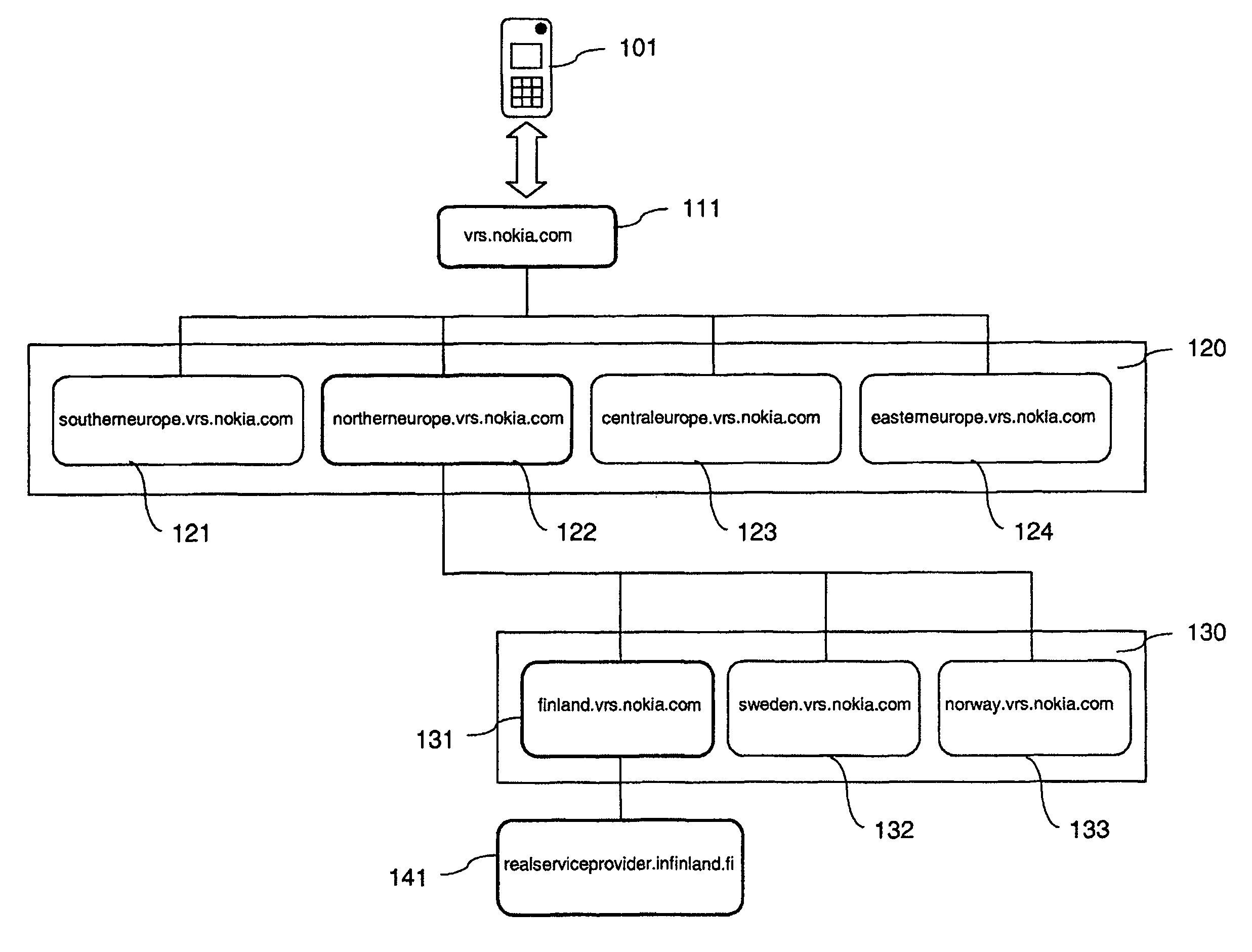
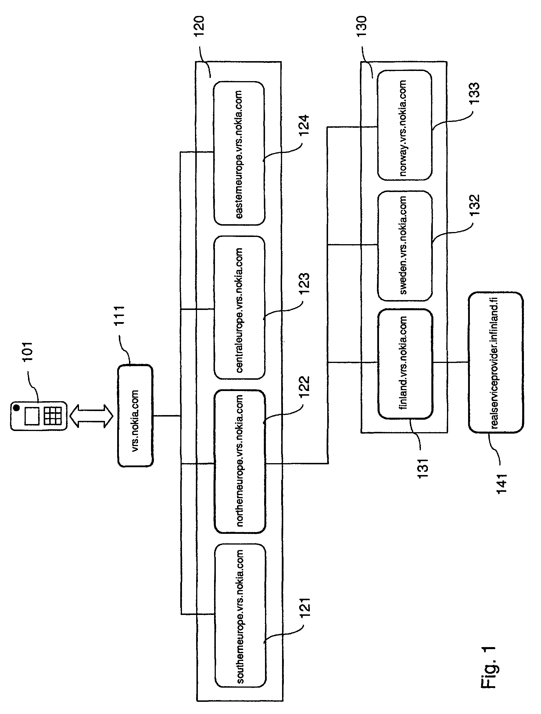
[0022]A method is described, which comprises receiving a request to provide virtual measurements on beacon signals that are valid for a virtual reference station, the request including an indication of a desired location of the virtual reference station. The method further comprises determining an entity that is associated to an area including the desired location. The method further comprises causing the request to be forwarded to the determined entity.

[0023]Moreover, an apparatus is described, which comprises a processor. The processor is configured to receive a request to provide virtual measurements on beacon signals that are valid for a virtual reference station, the request including an indication of a desired location of the virtual reference station. The processor is further configured to determine an entity that is associated to an area including the desired location. The processor is further configured to cause the request to be forwarded to the determined entity.

[0024]An ...


PUM


Abstract

For supporting the use of virtual reference stations, an apparatus may receive a request to provide virtual measurements on beacon signals that are valid for a virtual reference station, the request including an indication of a desired location of the virtual reference station. The apparatus may further determine an entity that is associated to an area including the desired location. The apparatus may further cause the request to be forwarded to the determined entity.

Description

FIELD OF THE INVENTION[0001]The invention relates to the field of positioning, and more specifically to a positioning which is based on measurements on signals that are determined for a virtual reference station.BACKGROUND OF THE INVENTION[0002]An absolute positioning of a device is supported by various Global Navigation Satellite Systems (GNSS). These include for example the American Global Positioning System (GPS), the Russian Global Navigation Satellite System (GLONASS), the future European system Galileo, the Space Based Augmentation Systems (SBAS), the Japanese GPS augmentation Quasi-Zenith Satellite System (QZSS), the Locals Area Augmentation Systems (LAAS), and hybrid systems. The satellites of these systems are also referred to as space vehicles (SV).[0003]The constellation in GPS, for example, consists of more than 20 satellites that orbit the earth. Each of the satellites transmits two carrier signals L1 and L2. One of these carrier signals L1 is employed for carrying a na...

Claims


Application Information

Patent Timeline
Patent Type & Authority Patents(United States)
IPC IPC(8): H04W24/00G01S19/32G01S19/44
CPCG01S19/04G01S19/43H04L67/18H04W4/021H04W4/02H04L67/52H04W4/029
Inventor WIROLA, LAURISYRJARINNE, JARI
Owner NOKIA TECH OY
Learn More