Method for detecting and mapping fires using features extracted from overhead imagery

a technology of overhead imagery and features, applied in the field of methods for detecting and mapping fires using features extracted from overhead imagery, can solve the problems of inability to accurately analyze all images on the timescale, process can be very time-consuming, and classification can only be completed by highly skilled analysts

Active Publication Date: 2013-02-05
THE UNITED STATES OF AMERICA AS REPRESENTED BY THE SECRETARY OF THE NAVY
View PDF11 Cites 24 Cited by
  • Summary
  • Abstract
  • Description
  • Claims
  • Application Information

AI Technical Summary

Benefits of technology

[0007]The present invention is related to a method for automatically detecting and mapping fires based on information extracted from commercial overhead EO / IR imagery, creating geo-referenced files which can be opened in most common geographic information system (GIS) software packages. The method creates a shapefile (*.shp & *.shx) and a Google Earth file (*.kmz) which contain the outlines of the areas from the image being processed with active fire in them, which types of files are typically very small compared to the size of the image file being processed. The method utilizes algorithms designed to process information contained in multi-spectral electro-optical imagery to classify pixels as ‘fire’ or ‘non-fire’. The method also has the ability to identify the approximate length, width, and area of the fires detected.

Problems solved by technology

This process can be very time consuming, especially for images which cover large areas of land that the image analyst must observe.
With this method, classification can only be completed by highly skilled analysts.
In emergency situations or when there are many images which need to be analyzed, an analyst may be unable to accurately analyze all of the images on the timescale that the mission requires.
The low resolutions of the current automated classification systems are disadvantageous because individual fires may be much smaller than one kilometer.
The current methods have the possibility of masking the extent of the fire because of their low resolution.
The fact that the NIR and SWIR bands are not true thermal bands makes the detection of fires much more difficult.
Some methods are limited by the size of the files that they create as an output of their mapping algorithm.
To transmit these files can require a significant amount of bandwidth and time.
The large file sizes can become especially restrictive when dealing with mobile wireless technologies such as those used by first responders.

Method used


Image

  • Method for detecting and mapping fires using features extracted from overhead imagery
  • Method for detecting and mapping fires using features extracted from overhead imagery
  • Method for detecting and mapping fires using features extracted from overhead imagery

Examples


Embodiment Construction

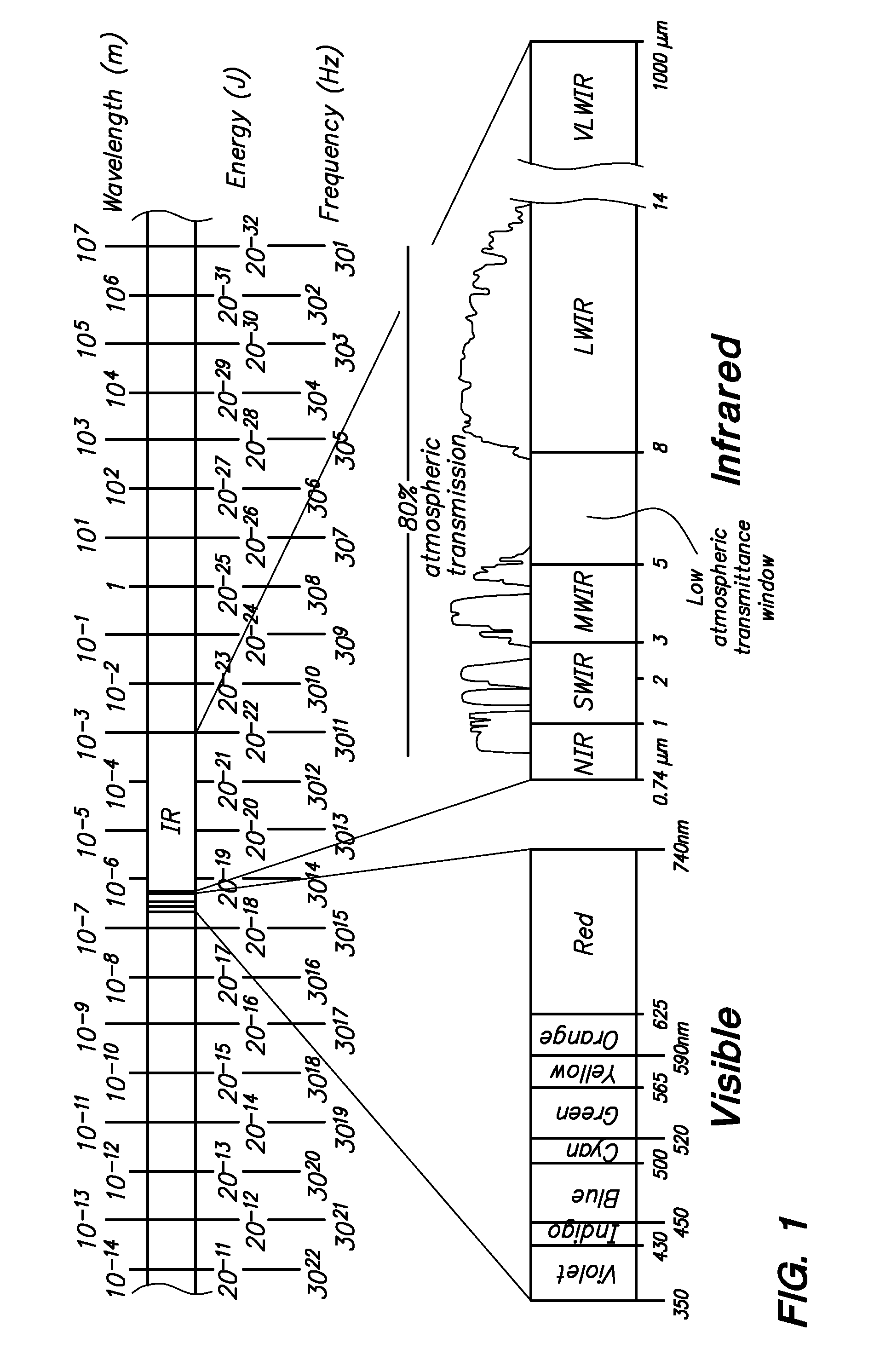
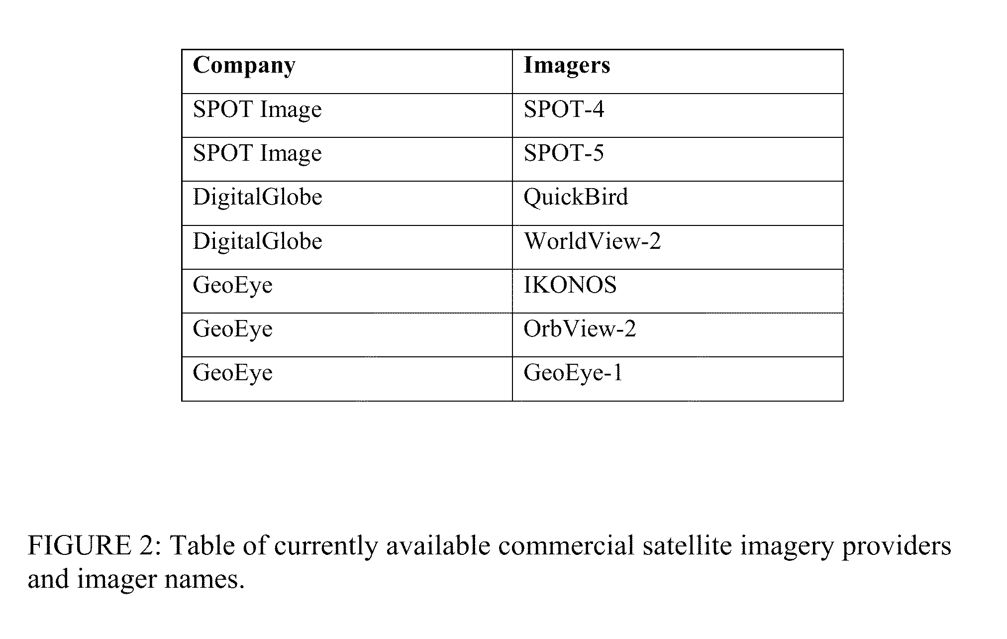
[0023]One purpose of the present invention is to automatically detect and map fires based on information extracted from commercial overhead EO / IR imagery. A table of commercial imagers and the companies that operate them can be found in FIG. 2. Suitable sets of high resolution images with multi-spectral imagery (MSI) are commercially available from various satellite companies shown in FIG. 2, as follows:

[0024]DigitalGlobe Quickbird, with 2.4 m resolution (color) with 4 bands MSI

[0025]DigitaGlobe WorldView-2 with 1.4 m resolution (color) with 8 bands MSI

[0026]SPOT Image SPOT-4 with 20 m resolution (color) with 4 bands MSI SPOT Image SPOT-5 with 5 m, 10 m resolution (color) with 4 bands MSI

[0027]GeoEye OrbView-2 with 1.65 m resolution (color) with 4 bands MSI

[0028]GeoEye GeoEye-1 with 1.65 m resolution (color) with 4 bands MSI

[0029]GeoEye IKONOS with 3.2 m resolution (color) with 4 bands MSI

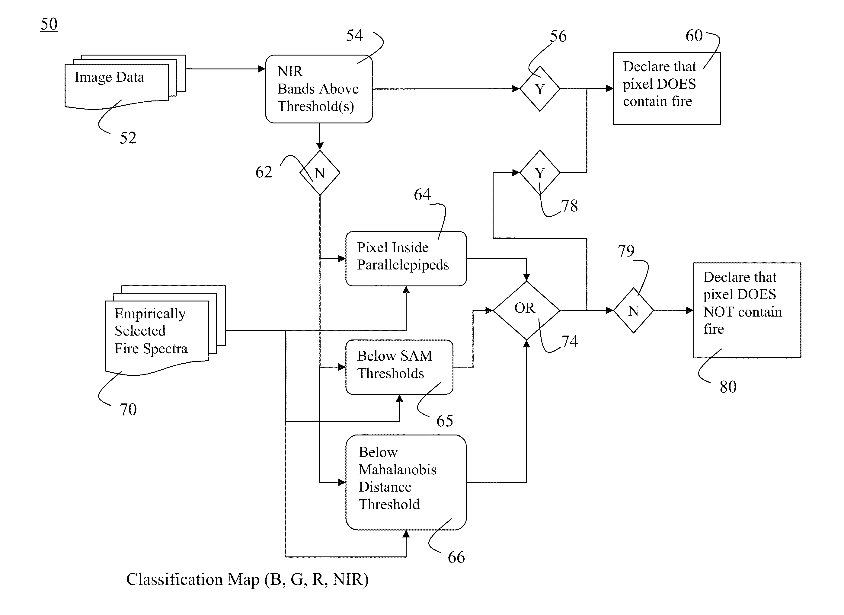
[0030]The invention has three methods of interacting with the high resolution imagery as set fo...


PUM


Abstract

A method for automatically detecting and mapping fires based on information extracted from commercial overhead EO/IR imagery, creating geo-referenced files which can be opened in most common geographic information system (GIS) software packages. The method creates a shapefile (*.shp & *.shx) and a Google Earth file (*.kmz) which contain the outlines of the areas from the image being processed with active fire in them, which types of files are typically very small compared to the size of the image file being processed. The method utilizes algorithms designed to process information contained in multi-spectral electro-optical imagery to classify pixels as ‘fire’ or ‘non-fire’. The method also has the ability to identify the approximate length, width, and area of the fires detected.

Description

FEDERALLY-SPONSORED RESEARCH AND DEVELOPMENT[0001]This invention (Navy Case No. 100162) is assigned to the United States Government and is available for licensing for commercial purposes. Licensing and technical inquiries may be directed to the Office of Research and Technical Applications, Space and Naval Warfare Systems Center, Pacific, Code 72120, San Diego, Calif., 92152; voice (619) 553-2778; email T2@spawar.navy.mil.CROSS-REFERENCE TO RELATED APPLICATIONS[0002]The present application is related to co-pending application entitled SHIP DETECTION SYSTEM AND METHOD FROM OVERHEAD IMAGES, Ser. No. 12 / 197,421, filed Aug. 25, 2008 (NC 099,165), assigned to the same assignee as the present application, and the details of which are hereby incorporated by reference.BACKGROUND OF THE INVENTION[0003]Currently, automated and manual systems for classifying and mapping fire from overhead imagery do exist. The mapping of fires at the resolution that this invention achieves is currently done ma...

Claims


Application Information

Patent Timeline
Patent Type & Authority Patents(United States)
IPC IPC(8): G06K9/00G06V20/13
CPCG06K9/0063G06K2009/00644G06V20/194G06V20/13
Inventor BUCK, HEIDIBAGNALL, BRYANSHARGHI, ELANSTASTNY, JOHN
Owner THE UNITED STATES OF AMERICA AS REPRESENTED BY THE SECRETARY OF THE NAVY
Why Eureka
Try Eureka