

Vector spatial data model conversion method from national standard model to military standard model
A technology of data model and vector space, which is applied in the field of geographic information, can solve problems such as edge processing without reference to the opposite side, many times of modification, inconsistent field names, etc., to achieve the effect of improving work efficiency and drawing efficiency, and realizing automation
- Summary
- Abstract
- Description
- Claims
- Application Information
AI Technical Summary
Problems solved by technology
Method used
Image

Examples
Embodiment Construction
[0048] In order to deepen the understanding of the present invention, the present invention will be described in further detail below in conjunction with the accompanying drawings and embodiments, which are only used to explain the present invention and do not limit the protection scope of the present invention.
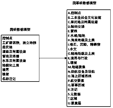
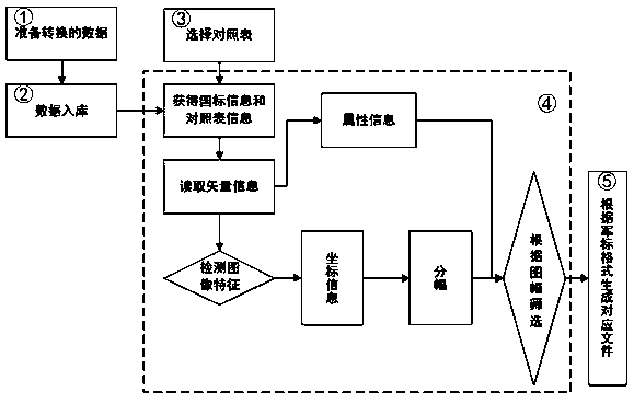
[0049] The national standard model of the embodiment of the present invention is to the vector space data model conversion method of military standard model, such as figure 2 , 7 and 8, including the following steps:
[0050] S1: Prepare vector data in Shapefile format;
[0051] S2: store the information contained in the vector data of the step S1 into the database (such as Figure 5 Shown), traverse the Shapefile files in the directory, and then stratify the data according to the file list;
[0052] Using the existing technology PostSQL+PostGIS can store Shapefile file data, provide a file directory containing Shapefile, the system will automatically traverse the ...
PUM
 Abstract
Description
Claims
Application Information