Global positioning system device and ionosphere error estimation method thereof

a global positioning system and error estimation technology, applied in measurement devices, satellite radio beaconing, instruments, etc., can solve the problems of difficult estimation of satellite signal interference, serious interference of signals propagating through the ionosphere, and errors in positioning, so as to improve flexibility in use of gps devices, reduce the cost of gps devices, and improve the accuracy of ionosphere error estimation

Inactive Publication Date: 2014-12-16
INSTITUTE FOR INFORMATION INDUSTRY
View PDF4 Cites 0 Cited by
  • Summary
  • Abstract
  • Description
  • Claims
  • Application Information

AI Technical Summary

Benefits of technology

[0014]According to the above descriptions, the GPS device and the ionosphere error estimation method thereof of the present invention can calculate a user ionosphere error through interpolation method by according to IPP coordinates and ionosphere errors of base stations directly and by using a single-band signal receiver. Thereby, the cost of the GPS device can be remarkably reduced, and the accuracy of the ionosphere error estimation and the flexibility in use of the GPS device can be improved.

Problems solved by technology

However, such a process of transmitting signals by satellites from the outer space to the earth tends to be interfered by various environmental factors, so errors may arise in the positioning result.
Further speaking, signals propagating through the ionosphere will be seriously interfered by large amount of free electrons existing in the ionosphere.
Even further, because free electrons distributed in the ionosphere are not in a regular or uniform way (actually in an irregular and time-varying way) and vary with the time and regions, which makes it difficult to estimate the interference on the satellite signals.
However, additional use of the dual-band receiver leads to a significantly increased cost, which hinders the widespread use of such signal receiving devices.
However, the Klobuchar model can only eliminate about 50% of the ionosphere errors, so the accuracy it provides is still low; and because the approaches of using constant ionosphere grid points to calculate errors in the Satellite-Based Augmentation System and the Wide Area Differential Global Navigation Satellite System lack flexibility, they are not adaptive to abrupt variations of ionospheres in low latitude regions, which indirectly causes differences in terms of the using effect in different regions.

Method used


Image

  • Global positioning system device and ionosphere error estimation method thereof
  • Global positioning system device and ionosphere error estimation method thereof
  • Global positioning system device and ionosphere error estimation method thereof

Examples


first embodiment

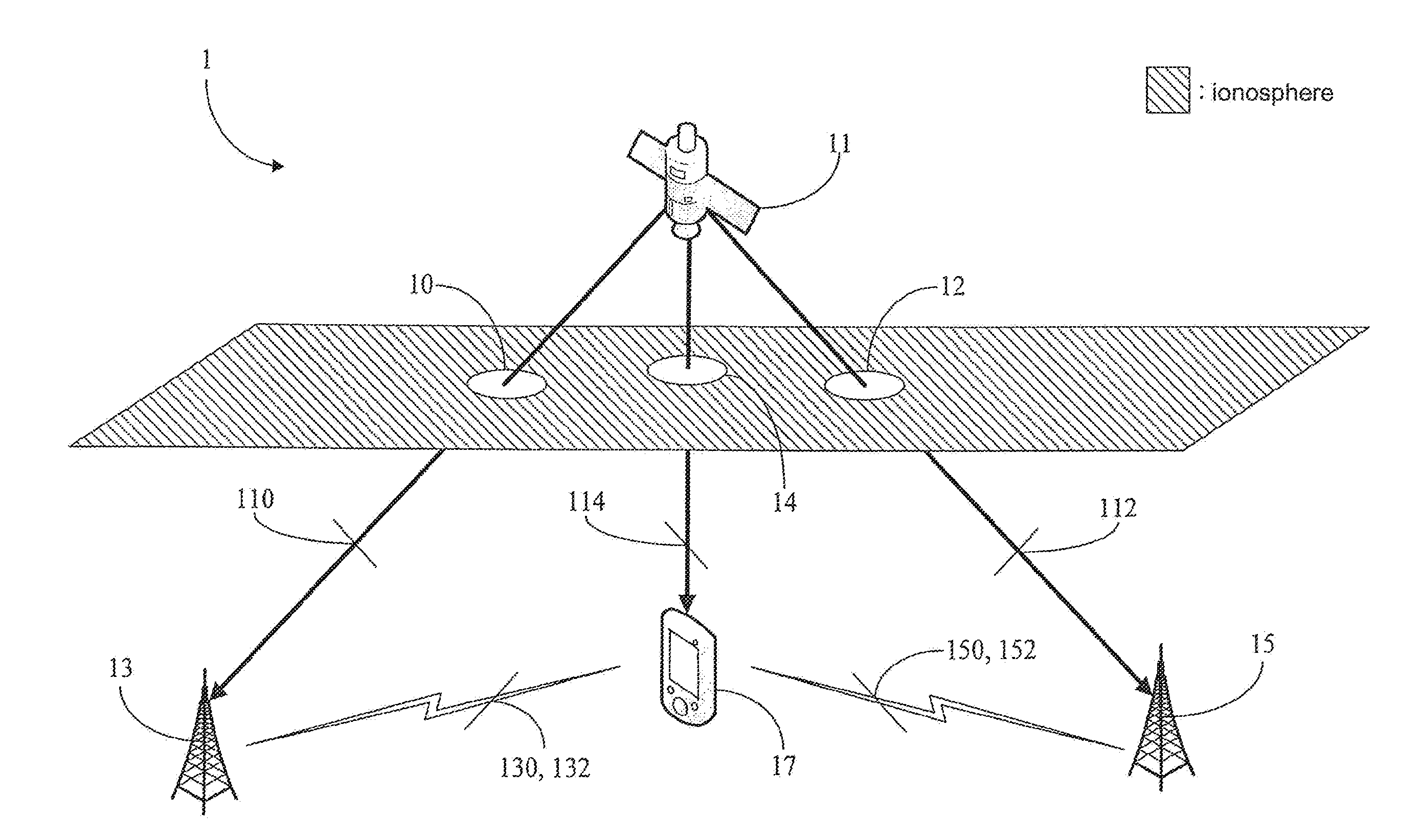
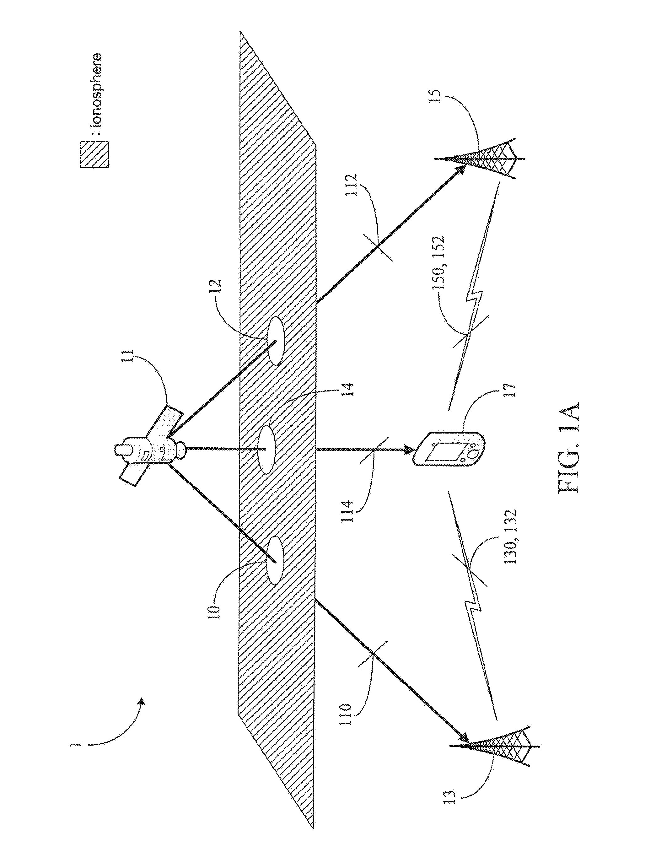
[0024]Referring to FIG. 1A, there is shown a schematic view of a global positioning system (GPS) network 1 of the present invention. The GPS network comprises a GPS satellite 11, a first dual-band base station 13, a second dual-band base station 15 and a GPS device 17. The GPS device 17 has network connections with the first dual-band base station 13 and the second dual-band base station 15.

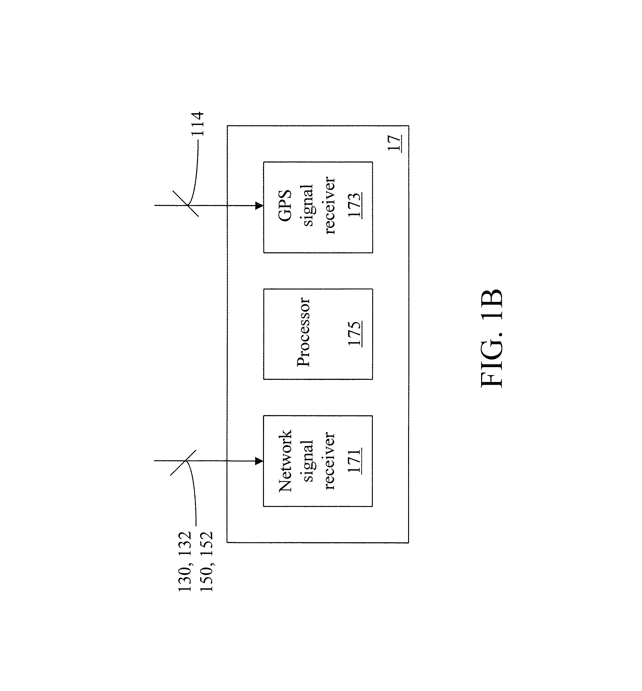
[0025]Referring to FIGS. 1B and 1C together, there is shown a schematic view of the GPS device 17 according to the first embodiment of the present invention. The GPS device 17 comprises a network signal receiver 171, a GPS signal receiver 173 and a processor 175. It shall be particularly appreciated that, the first dual-band base station 13 and the second dual-band base station 15 in the first embodiment are base stations each having a dual-band receiver, and are able to receive dual-band signals from different bands of the GPS satellite 11; and the GPS device 17 may be a mobile phone, a personal...

third embodiment

[0044]Referring to FIG. 3B, there is shown a detailed flowchart diagram of the ionosphere error estimation method according to the present invention. Specifically, step 306 may be further executed in the ionosphere error estimation method to enable the GPS device to magnify the user ionosphere error through trigonometric function operations according to the user angle. In other words, the user ionosphere error as the aspect of receiving the user positioning signal in a vertical angle is converted into an ionosphere error as the aspect of receiving the user positioning signal at the user angle. Thereby, errors possibly generated due to different angles at which the satellite signals are received by the individual base stations and the GPS device can be eliminated in the aforesaid way, thus making the user ionosphere error more accurate.

[0045]Referring to FIG. 4, there is shown a flowchart diagram of an ionosphere error estimation method according to a fourth embodiment of the present...


PUM


Abstract

A global positioning system device and an ionosphere error estimation method thereof are provided. The global positioning system device is connected to a plurality of dual-band base stations, and receives a plurality of ionosphere pierce point coordinates and a plurality of ionosphere errors from the dual-band base stations. The global positioning system device calculates a user ionosphere error by an interpolation method based on the ionosphere pierce point coordinates and the ionosphere errors of the dual-band base stations and a user ionosphere pierce point coordinate of the global positioning system device.

Description

[0001]This application claims priority to Taiwan Patent Application No. 100144957 filed on Dec. 7, 2011, which is hereby incorporated by reference in its entirety.CROSS-REFERENCES TO RELATED APPLICATIONS[0002]Not applicable.BACKGROUND OF THE INVENTION[0003]1. Field of the Invention[0004]The present invention relates to a global positioning system (GPS) device and an ionosphere error estimation method thereof. More particularly, the GPS device and the ionosphere error estimation method thereof of the present invention accomplish estimation of a user ionosphere error by directly using ionosphere pierce point coordinates and ionosphere errors of reference base stations (BSs).[0005]2. Descriptions of the Related Art[0006]The global positioning system (GPS) mainly operates in the following principal: positioning signals are transmitted by satellites located in the outer space, and then a signal receiving device located on the earth can determine a position where the signal receiving devi...

Claims


Application Information

Patent Timeline
Patent Type & Authority Patents(United States)
IPC IPC(8): G01S19/07G01S19/40
CPCG01S19/07
Inventor YANG, MINGJAN, SHAU-SHIUNTAO, AN-LINLI, CHIH-HUNGYANG, SHAN-YUAN
Owner INSTITUTE FOR INFORMATION INDUSTRY
Why Eureka
Try Eureka