

Multi-media analysis for implementing advanced flight following and generating of projected tracks
a technology of advanced flight following and projection, applied in traffic control systems, navigation instruments, instruments, etc., can solve the problems of inability to provide any automated alert, effort paid, and incredulous that a commercial airliner could simply disappear
- Summary
- Abstract
- Description
- Claims
- Application Information
AI Technical Summary
Benefits of technology
Problems solved by technology
Method used
Image

Examples
Embodiment Construction
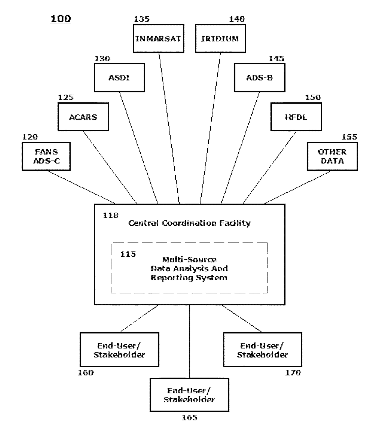
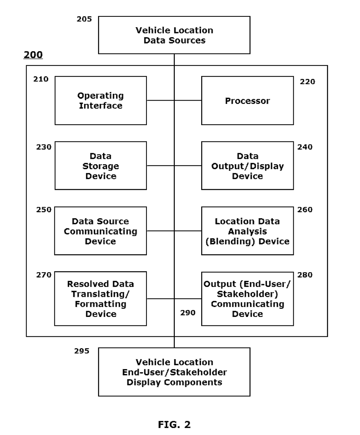
[0002]This disclosure relates to systems and methods for monitoring, collecting and aggregating position information from multiple independent data sources to localize a position of an aircraft operating worldwide and for providing the localized position information to one or more end-users or stakeholders in a format for direct integration into one or more mapping and / or situational awareness display applications operated by the end-user or stakeholder.
[0003]2. Related Art
[0004]Many individuals and entities, whether familiar with the vagaries of commercial and business aviation worldwide, watched in stunned amazement in March 2014 the news reports regarding the disappearance of Malaysia Airlines Flight 370. To the general public, and even those familiar with the details of sophisticated flight following worldwide, it seemed incredulous that a commercial airliner could simply disappear. Commercial news outlets clamored to find industry “experts” that could explain to the general pub...
PUM
 Abstract
Description
Claims
Application Information