National geologic maps data model system

A data model and geological map technology, applied in the direction of electrical digital data processing, special data processing applications, instruments, etc., can solve the problems affecting the common understanding of geological science data, limited data models, lack of consistent description of content, structure, behavior and semantics and other issues to achieve the effect of realizing personalized expansion, meeting application requirements, and solving maintenance and expansion problems

Inactive Publication Date: 2008-06-04
DEV RES CENT OF CHINA GEOLOGICAL SURVEY
View PDF5 Cites 1 Cited by
  • Summary
  • Abstract
  • Description
  • Claims
  • Application Information

AI Technical Summary

Problems solved by technology

As far as geological survey data is concerned, in the existing data models or modeling, due to the emphasis on the modeling of project requirements and the limitation of personal database technology, the data modeling in the field is based on the data (entity) itself, The connection between data (entities) and the formal description of the semantic constraint rules, the content, structure, behavior and semantics of the data model stipulated by the lack of consistent description, which to some extent affects the common understanding of geological science data. foundation, and the ability to enable data models to be designed to fit various data structures is also rather limited

Method used


Image

  • National geologic maps data model system
  • National geologic maps data model system
  • National geologic maps data model system

Examples


Embodiment Construction

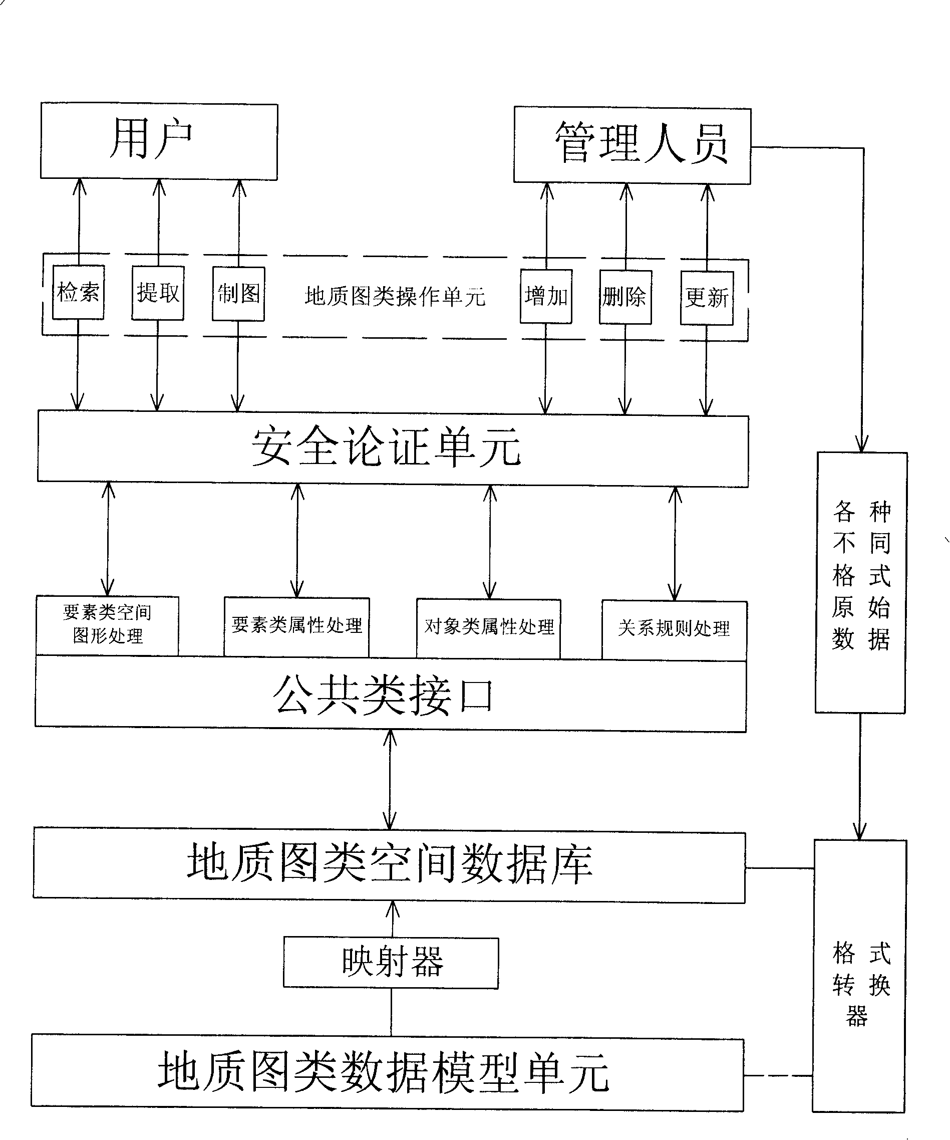
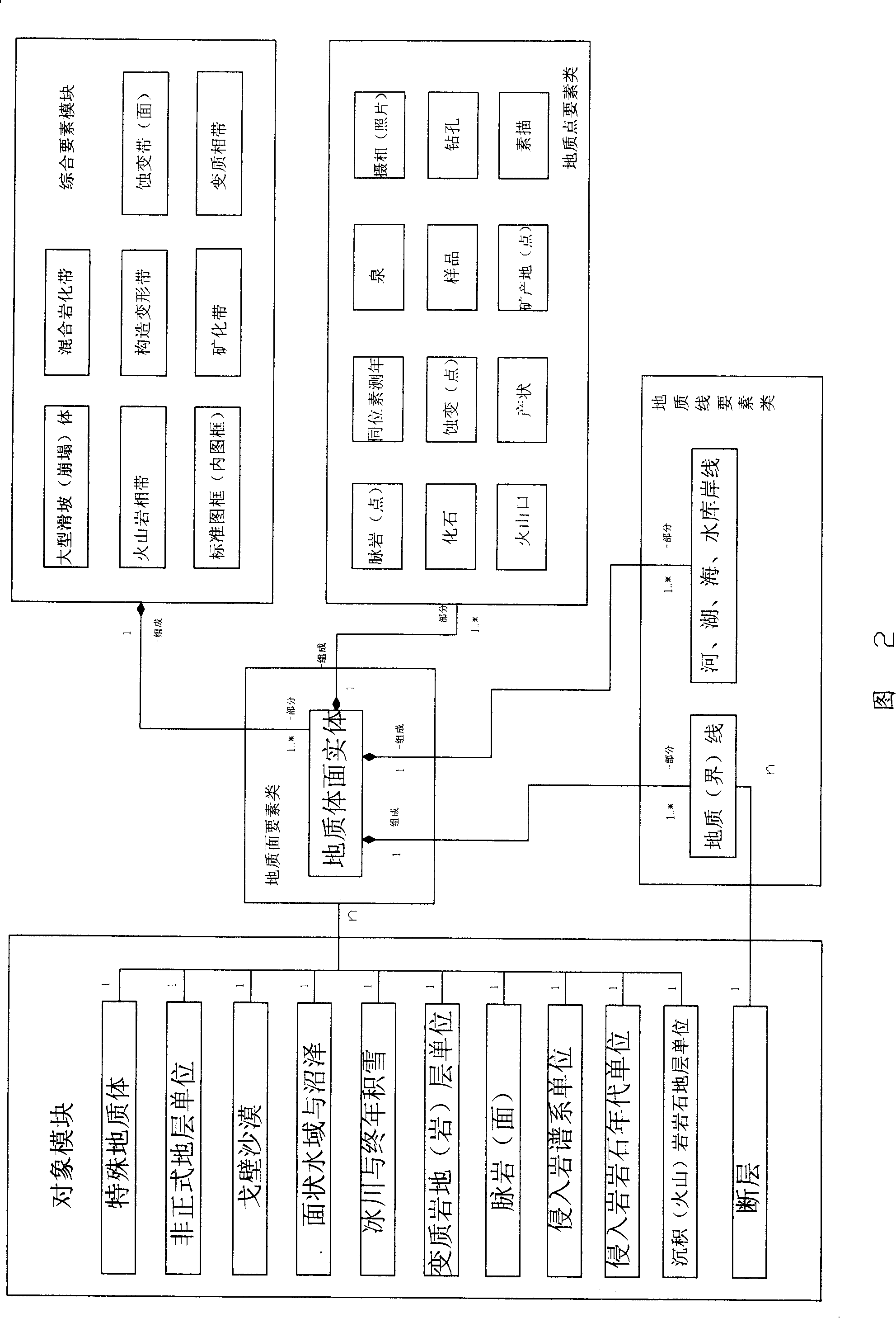
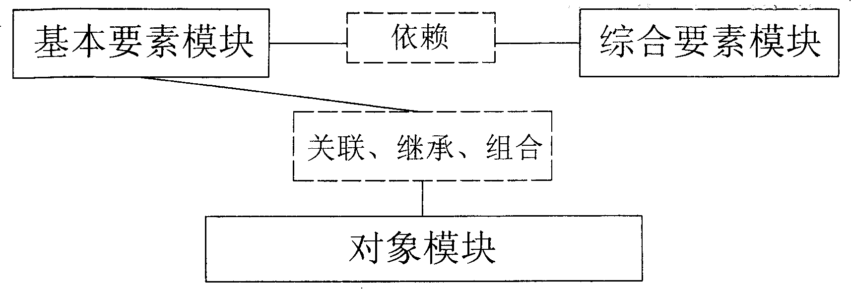
[0021] figure 1 The national geological map data model system shown includes: a geological map data model unit, a geological map spatial database, a mapper, a format converter, a public interface, a security demonstration unit, and a geological map operation unit. Among them, the geological map data model unit stores the geological data of the element type and the geological data of the object type, which are mainly divided into three parts: the basic element module, the comprehensive element module and the object module; Geological data is mapped to geological map data with consistent descriptions and stored in geological map spatial databases; through format converters, managers can convert geological raw data in various formats and import them into geological map data model units, In this way, the data in the geological map data model unit is continuously updated and improved; the public class interface performs feature class graphic processing, feature class attribute proc...


PUM


Abstract

Present invention relates to a nation geological map data model system. It contains geological map data model unit, geological map space data base, map unit, format converter, public interface, safety certification unit and geological map operating unit. Said system has following advantage 1, said data model field data model, thereby ensuring field data semantic specification consistency, 2, realizing geological map data model unrelated with scale,3, solving unreasonable topological relationship problem duo to past map layer, 4, solving non spatial entity data organization maintenance and expansion, 5, capable of organizing multi objective spatial database to different, requirement and different hierarchy, 6, user can realize personalized expansion to satisfy application requirement by adopting inherit.

Description

technical field [0001] The invention relates to the field of geological survey, in particular to a national geological map data model system. Background technique [0002] A data model is a formal description of the relationship between data (entities) and the rules of semantic constraints. In layman's terms, the data model specifies the content, structure, behavior and semantics of the data. Among them, what should be included in the content definition and what should not be included What; the structure describes the relationship between data; the behavior is expressed by executable operations; the semantics constrains the validity of the attribute domain, such as data type, value range (including code range) and default value. As far as geological survey data is concerned, in the existing data models or modeling, due to the emphasis on the modeling of project requirements and the limitation of personal database technology, the data modeling in the field is based on the dat...

Claims


Application Information

Patent Timeline
Patent Type & Authority Patents(China)
IPC IPC(8): G06F17/30
Inventor 李超岭姜作勤李丰丹叶天竺吕霞李景朝陈辉杨东来李浩川
Owner DEV RES CENT OF CHINA GEOLOGICAL SURVEY
Why Eureka
Try Eureka