Real-time three-dimensional geology modeling method based on GIS and virtual reality
A virtual reality, real-time 3D technology, applied in 3D modeling, image data processing, instruments, etc., can solve the problems of complex data processing, long modeling cycle, etc., to improve modeling efficiency, reduce manual intervention, and improve practicability Effect
- Summary
- Abstract
- Description
- Claims
- Application Information
AI Technical Summary
Problems solved by technology
Method used
Image
Examples
Embodiment Construction
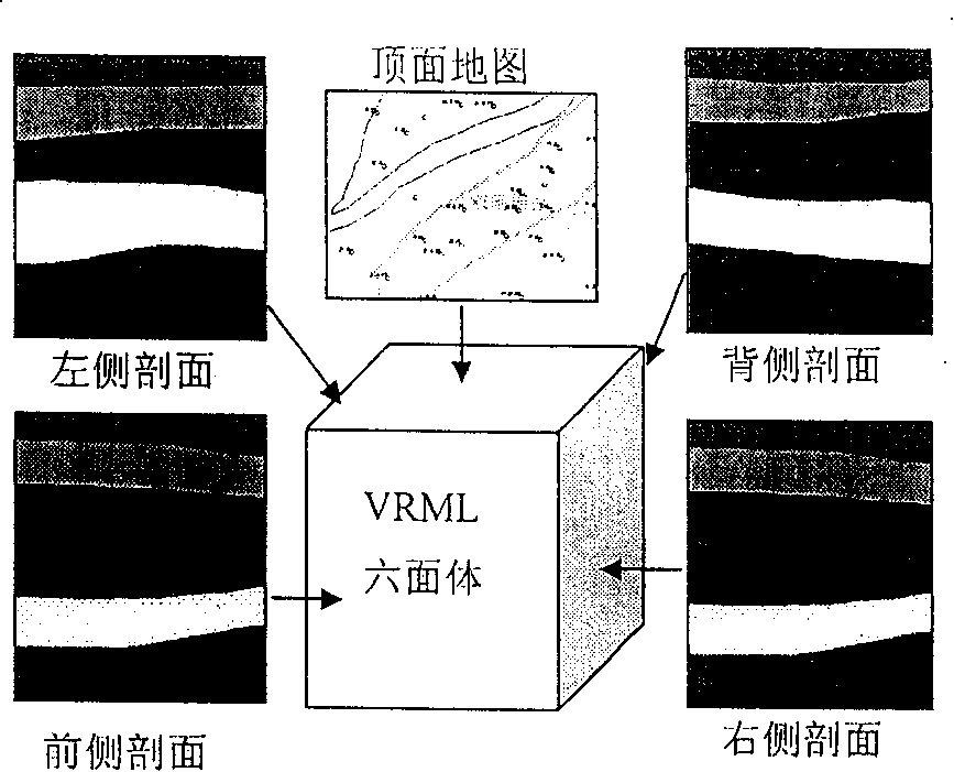
[0020] Such as figure 1 As shown, the basic idea of 3D geological modeling is to map on the surface of the hexahedron, especially the four sides and the top surface.
[0021] side map
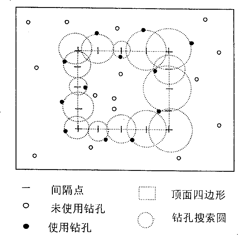
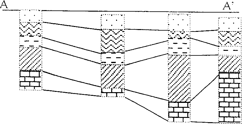
[0022] For efficiency in creating a section view, divide the four sides of the top quadrilateral equally (see figure 2 ), the specific number of equal divisions depends on the distribution density of the borehole data, so as to ensure that there is a borehole near each equal division point, and then perform spatial query in all the borehole data centered on the equal division point to find the distance, etc. Points to the nearest borehole. The data for that borehole is then "translated" to the bisection point. When the number and distribution of boreholes are permitted, the value at the equidistribution point can also be obtained through "interpolation". If there is information about the inclination and inclination angle of the rock formation in the drilling stratification data, the valu...
PUM
 Abstract
Description
Claims
Application Information
 - R&D
- Intellectual Property
- Life Sciences
- Materials
- Tech Scout
- Unparalleled Data Quality
- Higher Quality Content
- 60% Fewer Hallucinations
Browse by: Latest US Patents, China's latest patents, Technical Efficacy Thesaurus, Application Domain, Technology Topic, Popular Technical Reports.
© 2025 PatSnap. All rights reserved.Legal|Privacy policy|Modern Slavery Act Transparency Statement|Sitemap|About US| Contact US: help@patsnap.com


