Virtual computer for remote-sensing distributed image on rolling ground

A computer and ground technology used in remote sensing and geographic information systems

Inactive Publication Date: 2007-09-05
SHANGHAI UNIV
View PDF0 Cites 7 Cited by
  • Summary
  • Abstract
  • Description
  • Claims
  • Application Information

AI Technical Summary

Problems solved by technology

The existing satellite remote sensing digital image processing and

Method used


Image

  • Virtual computer for remote-sensing distributed image on rolling ground
  • Virtual computer for remote-sensing distributed image on rolling ground
  • Virtual computer for remote-sensing distributed image on rolling ground

Examples


Embodiment Construction

[0037] A preferred embodiment of the present invention is described in detail as follows in conjunction with accompanying drawing:

[0038] This example is a computer simulation of the 1:100,000 digital topographic map (1024×1024) in the Longyan area of ​​Fujian Province and the remote sensing distribution images on the undulating ground.

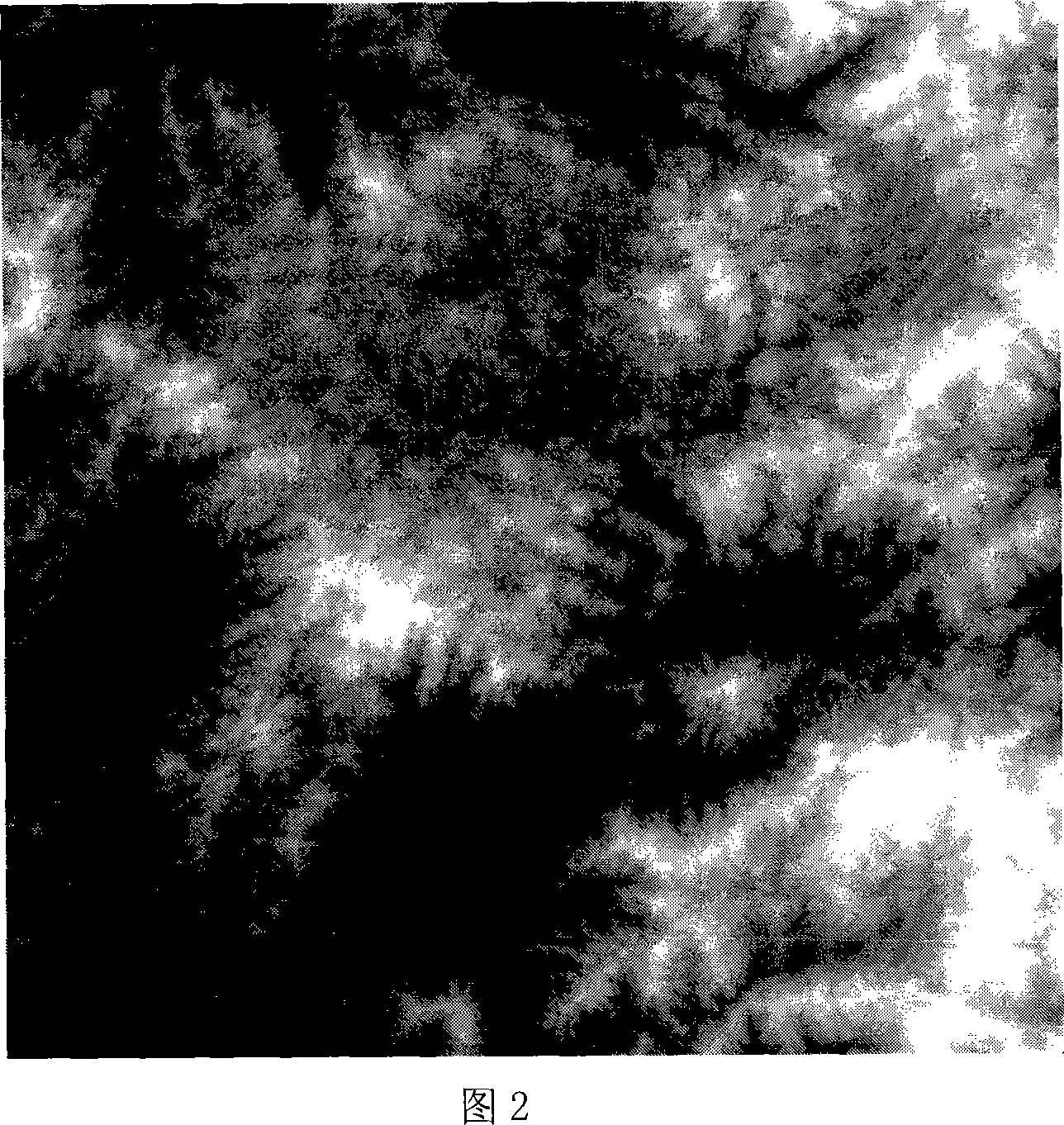
[0039] Referring to Fig. 2, it shows the area to be studied in this implementation, that is, the 1:100,000 digital topographic map (1024×1024) of Longyan, Fujian, China.

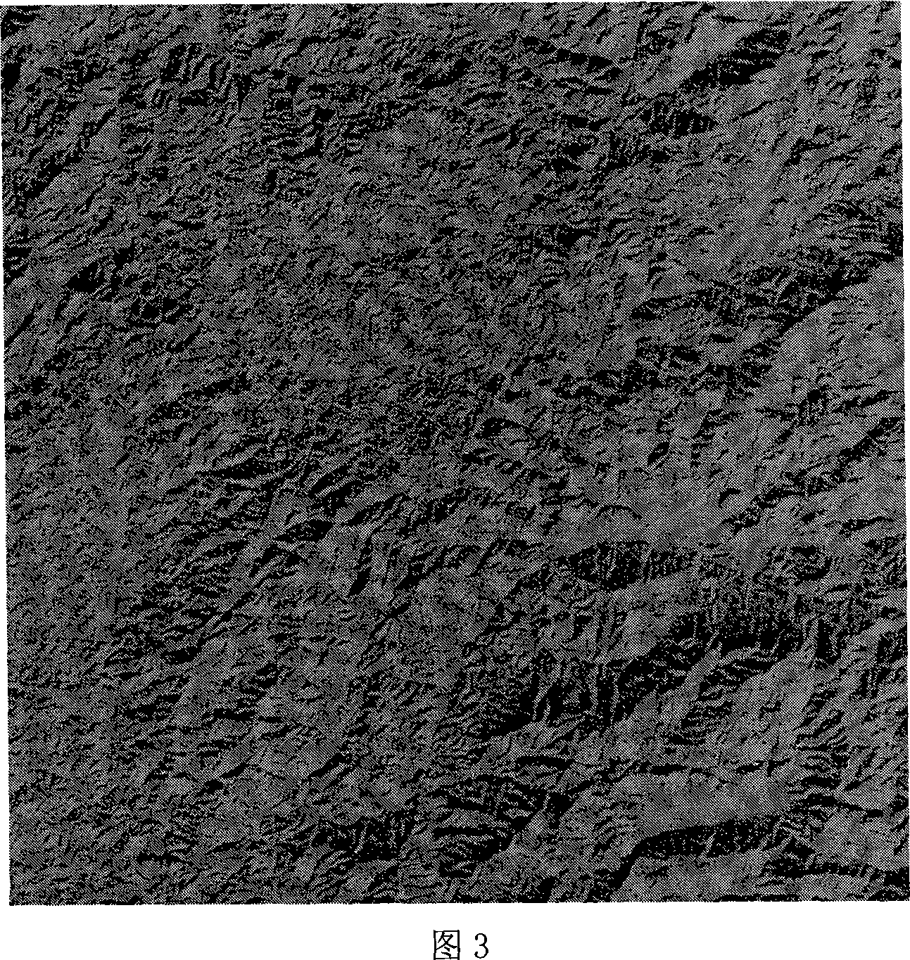
[0040] Referring to Fig. 3, it shows an image of topographic distribution of direct solar light in Longyan, Fujian, China (1024×1024, southeast direction of the sun).

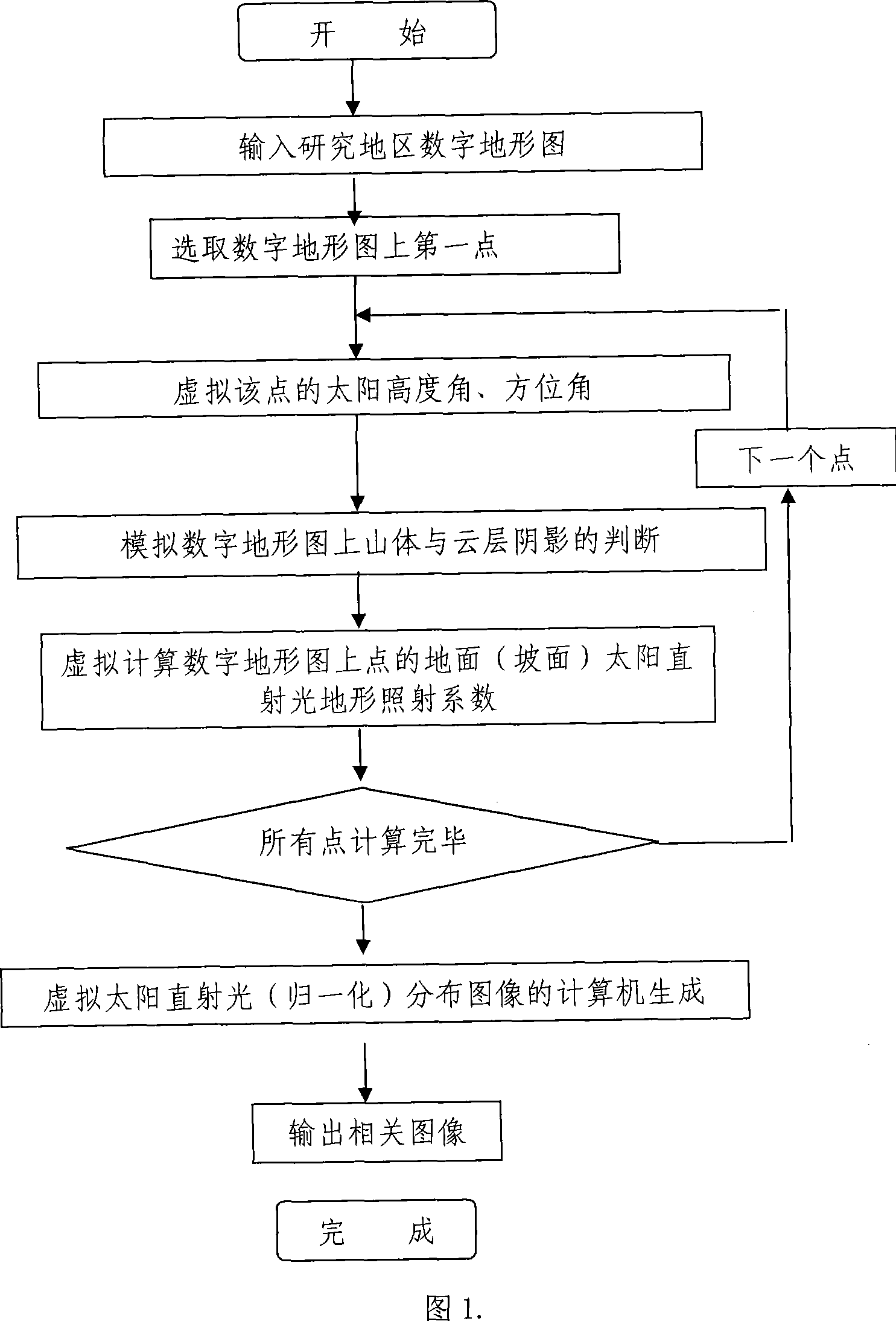
[0041] Please refer to Fig. 1, it is the computer virtual flowchart of the remote sensing distribution image on the undulating ground of the present invention, and in GIS, operating steps are as follows:

[0042] Step 1. Start, start the program, first follow the usual operation, input the digital topogra...


PUM


Abstract

A method of using computer to virtualize remote sending distributed image on rise and fall ground includes virtualizing parameters of different the sun position and utilizing digital landform map to obtain each point of virtual the sun straight light landform shining coefficient being converted to be virtual the sun straight light distribution drawing, setting up mathematical model of quantitative relation between satellite remote sensing information to landform and the sun straight light, analyzing satellite remote sensing image and removing off shadow of mountain and clouds on said image for finalizing computer virtualization.

Description

technical field [0001] The invention relates to a remote sensing and geographic information system technology, in particular to a computer virtual method for constructing remote sensing distribution images on undulating ground using computer virtual. Background technique [0002] Due to the shading and shielding of the direct sunlight by the terrain, compared with the broad level ground, the distribution of the direct solar irradiance on the natural surface will be affected by the terrain, which will change the remote sensing information of the ground object and affect the quality and quality of the remote sensing digital image. Quantitative research, applied precision. The influence of terrain on satellite remote sensing images and the elimination of mountain shadows and cloud shadows have always been difficult problems in the processing and application of satellite remote sensing digital images. The existing satellite remote sensing digital image processing and applicatio...

Claims


Application Information

Patent Timeline
IPC IPC(8): G06T11/00
Inventor 李先华师彪
Owner SHANGHAI UNIV
Why Eureka
Try Eureka