
GPS positioning information and electronic map charging section matching method

A GPS positioning and electronic map technology, applied in positioning, road network navigator, radio wave measurement system, etc., can solve the problem of wrong judgment of toll path, confusion of matching between two roads, and difficulty in distinguishing between uplink and downlink points with close distances and other issues, to achieve the effect of accurate charging, good effect and saving storage space

Active Publication Date: 2008-10-15
RES INST OF HIGHWAY MIN OF COMM
View PDF0 Cites 23 Cited by
  • Summary
  • Abstract
  • Description
  • Claims
  • Application Information

AI Technical Summary

Problems solved by technology

At present, the accuracy of GPS positioning is usually only in the range of 20 meters. It is difficult to distinguish between the uplink and downlink points that are close together by relying solely on GPS positioning. The matching of the two roads is confusing, and the judgment of the toll path is wrong.

Method used


Image

  • GPS positioning information and electronic map charging section matching method
  • GPS positioning information and electronic map charging section matching method
  • GPS positioning information and electronic map charging section matching method

Examples


Embodiment Construction

[0045] The simplification scheme of the charged electronic map of the present invention:

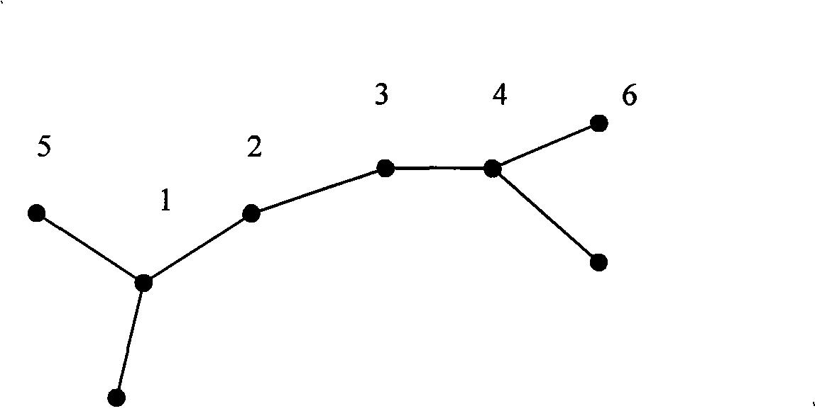
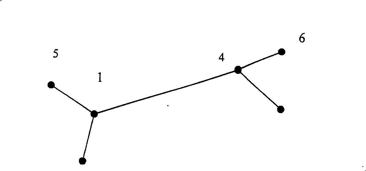
[0046] Electronic maps for charging play a central role in the entire GPS satellite charging system, and electronic maps of different specifications are often used for different navigation applications. Usually, an electronic map is composed of geographic data that records actual features, identification, attribute information and various additional information related to the actual features. Electronic maps are mainly composed of road shape data, background data, topology data and attribute data, and they are closely connected to provide services for vehicle navigation applications. Since the current charging is for the road, the shape data, topology data and attribute data related to the road are essential elements. In addition, the electronic map data must be as refined as possible without losing the accuracy of the map and the amount of charging information. At the same time, its da...


PUM


Abstract

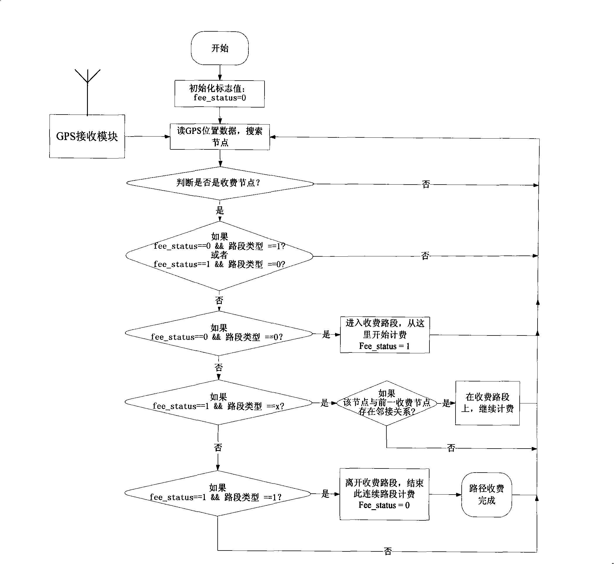
The invention discloses a method for matching GPS positioning information and charging roads of an electronic map, the method is as follows: the search range is initially determined; the GPS positioning information is received; the search range is determined according to the current driving speed of a vehicle; the GPS position point received currently is taken as the center, the search range is taken as the radius, the data of the roads are searched on a charging map, charging points and charging roads are judged; the map data is searched; when the vehicle does not drive on the charging road, which charging road the charging node pertains to is judged, and then whether the type of the charging road is an entrance or not is judged, the charging process is started or the previous step is carried out by return according to the judgment result; when the charging sign of the road is arranged on the charging road, whether the charging node exists in the search range or not is continually judged, whether the charging node and the previous charging node have the adjacent relationship or not is judged, and the charging or the finish of the charging is carried out according to the judgment result. The method can greatly save the storage space and improve the calculation efficiency.

Description

technical field [0001] The invention relates to a method for matching GPS positioning information and toll road sections of an electronic map. Background technique [0002] Electronic maps for charging play a central role in the entire GPS satellite charging system, and electronic maps of different specifications are often used for different navigation applications. Usually, an electronic map is composed of geographic data that records actual features, identification, attribute information and various additional information related to the actual features. Electronic maps are mainly composed of road shape data, background data, topology data and attribute data, and they are closely connected to provide services for vehicle navigation applications. Since the current charging is for the road, the shape data, topology data and attribute data related to the road are essential elements. In addition, the electronic map data must be as refined as possible without losing the accura...

Claims


Application Information

Patent Timeline
Patent Type & Authority Applications(China)
IPC IPC(8): G07B15/00G01C21/26G01C21/30G01C21/34G01S1/02G01S5/02G07B15/06
Inventor 王东柱朱书善李亚檬刘楠王笑京齐彤岩杨琪宋向辉谌仪
Owner RES INST OF HIGHWAY MIN OF COMM
Learn More