

Land consolidation linear ground object matching method based on mobile computing
A linear feature and land consolidation technology, applied in computing, image data processing, instruments, etc., can solve problems such as inaccurate and timely judgment of the number and location of construction projects, interpretation errors of linear features in the finishing area, etc., to achieve The effect of saving workload and time and improving work efficiency
- Summary
- Abstract
- Description
- Claims
- Application Information
AI Technical Summary
Problems solved by technology
Method used
Image

Examples
Embodiment Construction
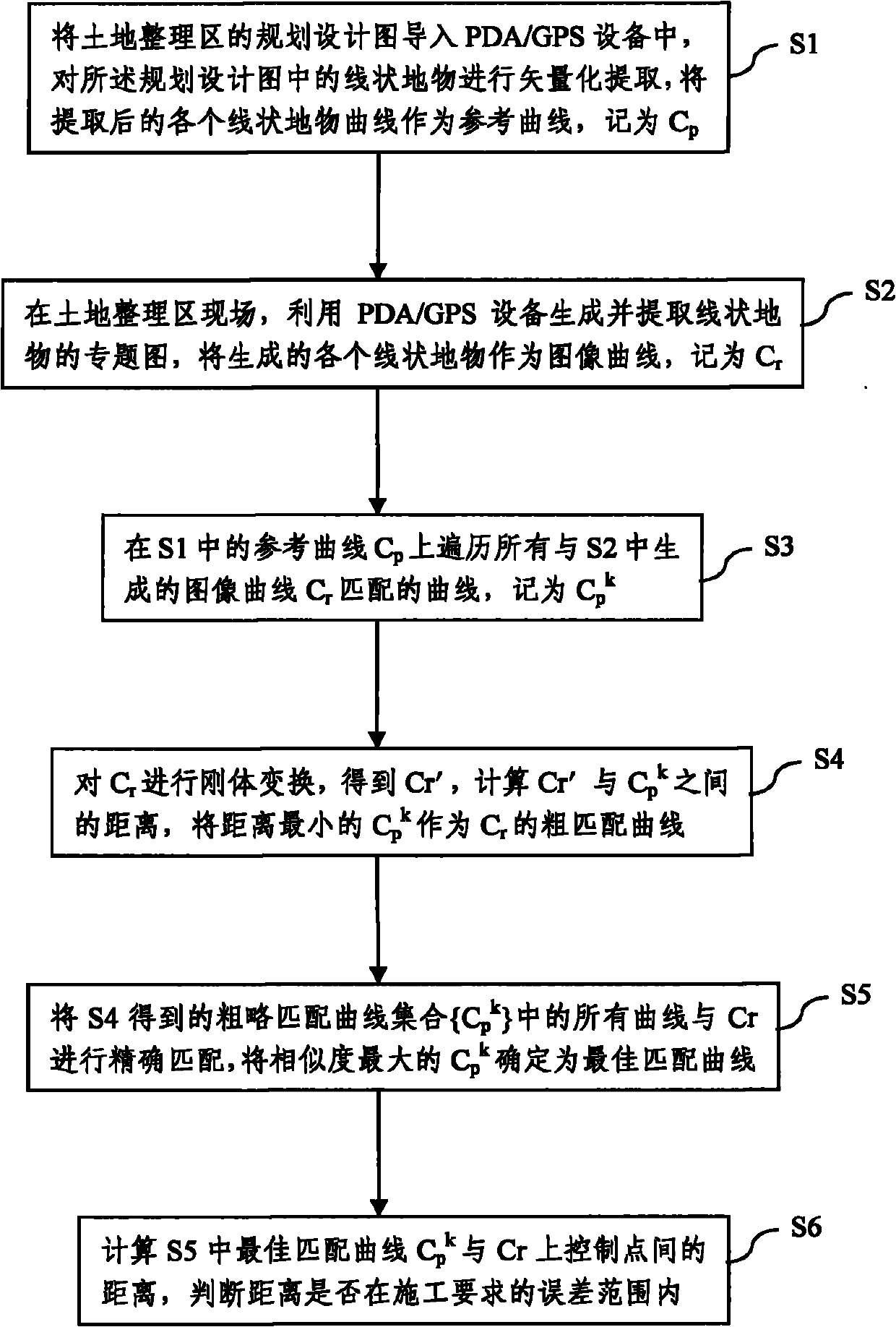
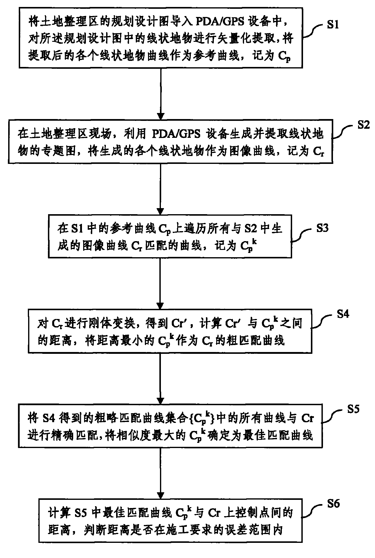
[0035] The mobile computing-based linear feature matching method for land consolidation proposed by the present invention is described as follows in conjunction with the accompanying drawings and embodiments.
[0036] Such as figure 1 As shown, in step S1, the planning and design drawing of the land consolidation area is imported into the PDA / GPS device, and the linear features in the planning and design drawing are vectorized and extracted, and the extracted linear feature curves are used as a reference curve, denoted as C p , where the linear features are generally roads, ditches, etc. in the land consolidation area.
[0037] Step S2, at the site of the land consolidation area, use PDA / GPS equipment to generate and extract thematic maps of linear features, and use the generated linear features as image curves, denoted as C r .
[0038] Step S3, the reference curve C in S1 p Iterate over all image curves generated in S2 with Cr The matching curve, denoted as C p k , th...
PUM
 Abstract
Description
Claims
Application Information