Infrared measurement based system and method thereof for determining relative state of inner satellite

A technology of outer satellite and positioning system, which is applied in the field of relative state determination system of inner satellite based on infrared measurement, to achieve the clear effect of locking and releasing phase

Inactive Publication Date: 2010-12-15
TSINGHUA UNIV
View PDF4 Cites 13 Cited by
  • Summary
  • Abstract
  • Description
  • Claims
  • Application Information

AI Technical Summary

Problems solved by technology

For example, for high-precision measurement of the earth's gravity field, it is required to be less than 1×10 -10 m / s 2 , which makes the interference introduced by any active measurement method non-negligible

Method used


Image

  • Infrared measurement based system and method thereof for determining relative state of inner satellite
  • Infrared measurement based system and method thereof for determining relative state of inner satellite
  • Infrared measurement based system and method thereof for determining relative state of inner satellite

Examples


Embodiment Construction

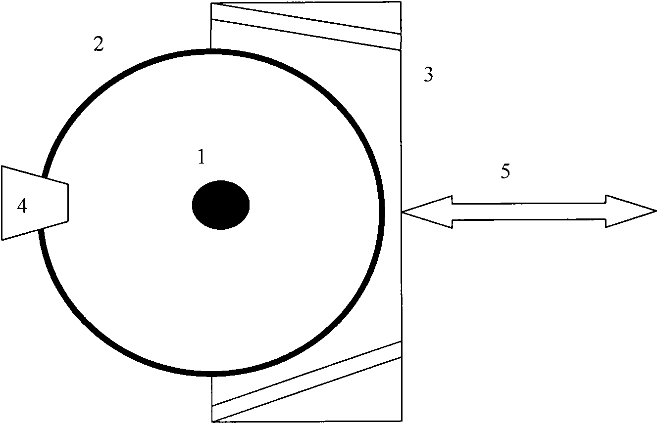
[0023] The infrared measurement-based internal satellite relative state determination system and method thereof of the present invention realize target rendezvous measurement through long-wave infrared imaging, and determine relative positions and speeds. Different surface treatments are carried out on the surface of the inner satellite and the inner surface of the inner cavity, so that under the condition of no light source irradiation, different infrared radiation characteristics can be generated due to the difference in surface emissivity, and the identification and measurement of the inner satellite can be realized. See attached figure 1 After the inner formation aircraft enters the sun-synchronous morning and evening orbit at an altitude of 300-350 km, the infrared positioning system 3 receives the command from the on-board computer to start up, and at the same time, the inner satellite locking and releasing mechanism 4 also releases the inner satellite according to the co...


PUM


Abstract

The invention discloses an infrared measurement based system and a method thereof for determining the relative state of an inner satellite, belonging to the technical field of spacecraft system technologies and measuring instruments. The state determining system comprises an inner satellite, an outer satellite cavity, an infrared positioning system and an inner satellite locking and releasing mechanism, wherein the inner satellite and the outer satellite cavity are subjected to surface processing, have different emission properties and can present images with different gray scales in the infrared positioning system under the condition of no illumination so as to achieve the function of acquiring the three-dimensional motion state of the inner satellite and finish a key measuring task of an inner formation under the condition of not generating disturbing force.

Description

technical field [0001] The invention relates to the technical fields of spacecraft systems and gravitational measurement, in particular to a system and method for determining the relative state of an inner satellite based on infrared measurement. Background technique [0002] Using the proof mass (PM) to conduct orbital flight along the geodesic line is a method for scientific tasks such as satellite gravitational field measurement and space gravitational detection. The inner satellite in the inner formation system flies freely in the cavity of the outer satellite, and the cavity of the outer satellite shields the inner satellite from non-gravitational interference such as atmospheric resistance and solar light pressure, so the inner satellite will follow a purely gravitational orbit under the action of gravity Flying plays a role in verifying the quality. When the inner formation system is working in orbit, the outer satellites measure the relative position and velocity of...

Claims


Application Information

Patent Timeline
Patent Type & Authority Applications(China)
IPC IPC(8): G01S17/50G01S17/66
Inventor 王兆魁张育林范丽韩大鹏刘昆项军华张峰谷振丰
Owner TSINGHUA UNIV
Why Eureka
Try Eureka