

Method for simplifying numerical map settlement place polygon by utilizing parametric design model
A technology for designing models and applying parameters, which is applied in the fields of cartography and geographic information engineering, and can solve problems such as inapplicability, inability to feedback and optimize graphics, low level of method adaptability and reusability, etc.
- Summary
- Abstract
- Description
- Claims
- Application Information
AI Technical Summary
Problems solved by technology
Method used
Image

Examples
Embodiment 1
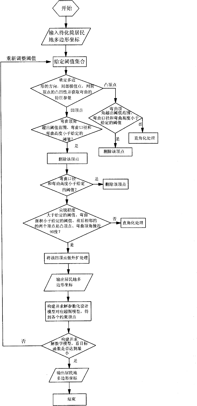
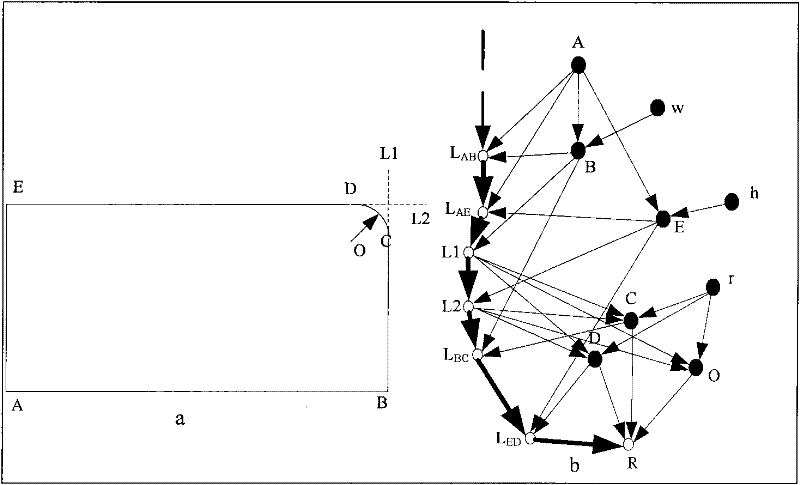
[0174] Embodiment 1: Taking the planar residential area data in the 1:250,000 map data as an example to synthesize the 1:500,000 data, the attached Figure 8 (a) is a planar residential area with a scale of 1:250,000.
[0175] Implementation process:
[0176] (1) According to the digital map production specification, the values or value ranges of the following parameters are given:
[0177] a.I i The value range of is shown in Table 1:
[0178] Table 1I i range of values
[0179]
[0180] b. Threshold value set D=(d 1 , d 2 ,...,d 9 ) T Partition of solution space and initial threshold According to the digital map production specification and experience, the decompression space is compressed as shown in Table 2:
[0181] The division of the solution space of Table 2-1D
[0182]
[0183] The division of the solution space of Table 2-2D
[0184]
[0185] initial threshold The value of is shown in Table 3:
[0186] Table 3 Threshold value of
[0187...
PUM
 Abstract
Description
Claims
Application Information