

Geological disaster monitoring system and method
A monitoring system, a technology for geological disasters, applied in signal transmission systems, measuring devices, mapping and navigation, etc., can solve problems such as wasting manpower and material resources, and achieve the effect of saving manpower and material resources
- Summary
- Abstract
- Description
- Claims
- Application Information
AI Technical Summary
Problems solved by technology
Method used
Image

Examples
Embodiment Construction
[0016] In order to make the objectives, technical solutions and advantages of the present invention clearer, the following further describes the present invention in detail with reference to the accompanying drawings and embodiments. It should be understood that the specific embodiments described herein are only used to explain the present invention, but not to limit the present invention.
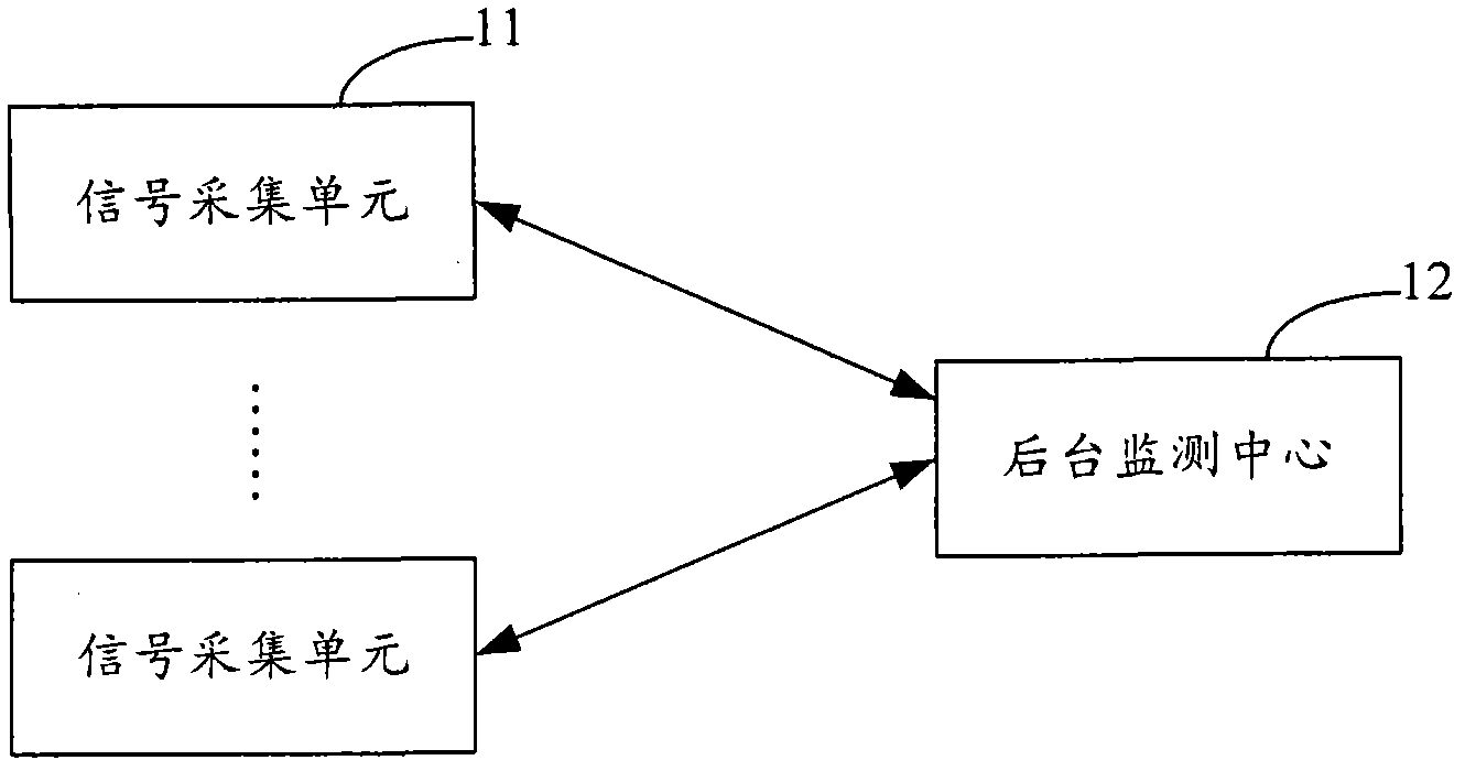
[0017] The geological disaster monitoring system provided by the embodiment of the present invention uses a signal acquisition unit to realize real-time automatic acquisition of on-site geological change signals, and displays the horizontal displacement and / or change of settlement displacement of the monitored site surface through the background monitoring center.
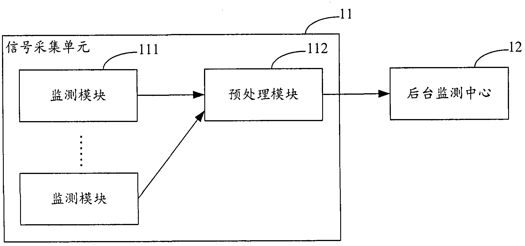
[0018] figure 1 It is the principle block diagram of the geological disaster monitoring system provided by the embodiment of the present invention. For ease of description, only the parts related to the embodiment of the present inve...
PUM
 Abstract
Description
Claims
Application Information